- Home
- :
- All Communities
- :
- Products
- :
- Data Management
- :
- Data Management Questions
- :
- Re: Layer File losing path
- Subscribe to RSS Feed
- Mark Topic as New
- Mark Topic as Read
- Float this Topic for Current User
- Bookmark
- Subscribe
- Mute
- Printer Friendly Page
Layer File losing path
- Mark as New
- Bookmark
- Subscribe
- Mute
- Subscribe to RSS Feed
- Permalink
Hi all,
I have a layer file that loses the path to the source on some files (in other words, you get the little red ! next to the layer in question). In the case this morning the source path was still there and correct. I just clicked on “Set Data Source” and clicked the feature class that it was already pointing to and it worked.
All of the other feature classes link up correctly – even ones that are in the same File GeoDatabase. This layer file was created yesterday.
I’m using ArcGIS 10.3.1 on a Windows 7 machine. Though this has happened sporadically back through at least 10.0 – it is just annoying enough now that I figured I’d put out a query.
Thanks,
Tycho
- Mark as New
- Bookmark
- Subscribe
- Mute
- Subscribe to RSS Feed
- Permalink
Can you provide a screenshot of the Properties of the lyr file in ArcCatalog of the Source tab?
- Mark as New
- Bookmark
- Subscribe
- Mute
- Subscribe to RSS Feed
- Permalink
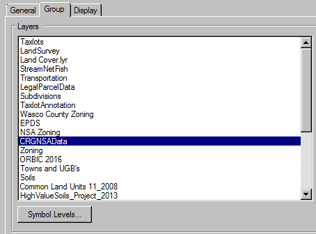
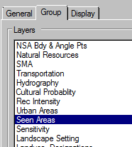
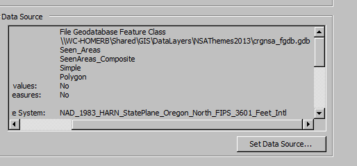
It's buried pretty deep, though this happens on simple (non-grouped) layer files as well. I clipped off the bottom portion of the projection parameters (it's not a custom one) -
- End of images
- Mark as New
- Bookmark
- Subscribe
- Mute
- Subscribe to RSS Feed
- Permalink
Have you tried adding this lyr file on a different and/or as a different person on the same machine as the security settings for this shared folder might be different for other users?
- Mark as New
- Bookmark
- Subscribe
- Mute
- Subscribe to RSS Feed
- Permalink
Make sure that you have the project set to use relative paths in the map/project properties section from the file menu.
Although I have never seen a migratory layer file, unless one is saving/using files off a network drive rather than a local drive (where possible)
- Mark as New
- Bookmark
- Subscribe
- Mute
- Subscribe to RSS Feed
- Permalink
Our data is on network drives (we don’t do backups of local drives, and people get upset when their hard drive crashes and all of their data is gone…).
I added this layer file to a map that I then copied over to another staff member’s template directory (the default C:\Program Files (x86)\ArcGIS\Desktop10.3\MapTemplates). I normally do use relative paths; for this one I changed it to absolute. I will change it back to relative and put it on a couple more people’s machines to test. I will let you guys know how it goes.
Thanks,
Tycho
- Mark as New
- Bookmark
- Subscribe
- Mute
- Subscribe to RSS Feed
- Permalink
Tycho ... moved to Managing Data rather than the generic community help pool to see if anyone has other ideas
- Mark as New
- Bookmark
- Subscribe
- Mute
- Subscribe to RSS Feed
- Permalink
Is the data stored on a NAS (network attached storage) If it is that's your problem. I've had a lot of problems keeping communication with my NAS drive.
- Mark as New
- Bookmark
- Subscribe
- Mute
- Subscribe to RSS Feed
- Permalink
Only our Lidar data is on a NAS. I don’t think too many users (I have 13 in total) are hitting it yet as it's a recent addition to our library. What I’ve done so far is –
Changed the path from absolute to relative
Changed the labeling from MapLex to the standard engine (there were just a few that needed that)
Changed the Lidar layerfile to 10.3 (I have a few users still using 10.2, they will have to keep using the old one). This template is just for a 10.3 user, so I’m not concerned about the change (I kept the old layerfile, of course)
I’m testing it on three different logins on different machines. At this point it appears to working, though I will bring it up once or twice a day on each machine for a few days before I call it good.
I will keep you posted…
- Mark as New
- Bookmark
- Subscribe
- Mute
- Subscribe to RSS Feed
- Permalink
Well, it has now worked for three days (being opened and closed multiple times) on two different machines with two different logins, so I’m going to call it good. I would love to have changed just one parameter at a time (from the reply above) to figure out exactly what the problem was. Unfortunately, now that it works I need to move on to the next project so it will always be a bit of a mystery.
Thanks for the help and suggestions,
Tycho