- Home
- :
- All Communities
- :
- Products
- :
- Data Management
- :
- Data Management Questions
- :
- Layer file and attribute table do not have matchin...
- Subscribe to RSS Feed
- Mark Topic as New
- Mark Topic as Read
- Float this Topic for Current User
- Bookmark
- Subscribe
- Mute
- Printer Friendly Page
Layer file and attribute table do not have matching fields
- Mark as New
- Bookmark
- Subscribe
- Mute
- Subscribe to RSS Feed
- Permalink
- Report Inappropriate Content
I downloaded some vegetation data and I have a layer file, a .tif and a separate attribute table. The attribute table has the information that I want to display (ie vegetation type), but I cannot join the attribute table to the layer file because there are no matching fields and I cannot add a field to the attribute table.
- Mark as New
- Bookmark
- Subscribe
- Mute
- Subscribe to RSS Feed
- Permalink
- Report Inappropriate Content
You can't join a table to a *.tif, nor the other way around
- Mark as New
- Bookmark
- Subscribe
- Mute
- Subscribe to RSS Feed
- Permalink
- Report Inappropriate Content
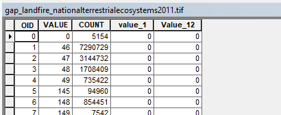
This is what I downloaded from Gap Landcover:
The .tif file doesn't appear to have any information that I need. The layer file displays the colors of the landcover types but nothing is available in the attribute table, Id, Count, and Value. The attribute table has all of the information I would like to attach to a file to display, but it doesn't appear that I can. Is there a way to do this?
- Mark as New
- Bookmark
- Subscribe
- Mute
- Subscribe to RSS Feed
- Permalink
- Report Inappropriate Content
There is no attachment.
The id, count and value field are those from the raster.
In order to attach the attribute table, then you need a common key or you would have to do it manually
Was there a link to to the data you have
- Mark as New
- Bookmark
- Subscribe
- Mute
- Subscribe to RSS Feed
- Permalink
- Report Inappropriate Content
Does the table has X , Y coordinates fields?
- Mark as New
- Bookmark
- Subscribe
- Mute
- Subscribe to RSS Feed
- Permalink
- Report Inappropriate Content
The data is from the USGS Gapland (Download Land Cover Data ) for the state of New Mexico. I feel like there should be an easier way to get the files to join but there are no matching fields for any of the data and I can't add a field to the attribute table.
- Mark as New
- Bookmark
- Subscribe
- Mute
- Subscribe to RSS Feed
- Permalink
- Report Inappropriate Content
It would probably help if you showed the tables to see what you are trying to do.
If one is a raster table and the other is some other type of table, and they have no matching key field, you will have to produce one
- Mark as New
- Bookmark
- Subscribe
- Mute
- Subscribe to RSS Feed
- Permalink
- Report Inappropriate Content