- Home
- :
- All Communities
- :
- Products
- :
- Data Management
- :
- Data Management Questions
- :
- Issue with data reprojection
- Subscribe to RSS Feed
- Mark Topic as New
- Mark Topic as Read
- Float this Topic for Current User
- Bookmark
- Subscribe
- Mute
- Printer Friendly Page
- Mark as New
- Bookmark
- Subscribe
- Mute
- Subscribe to RSS Feed
- Permalink
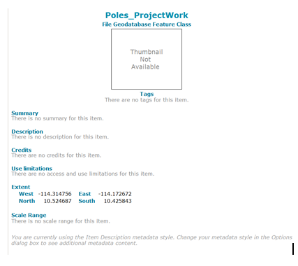
I have a set of data that was in the following projection (two images with the projection info followed by an image of the extent):
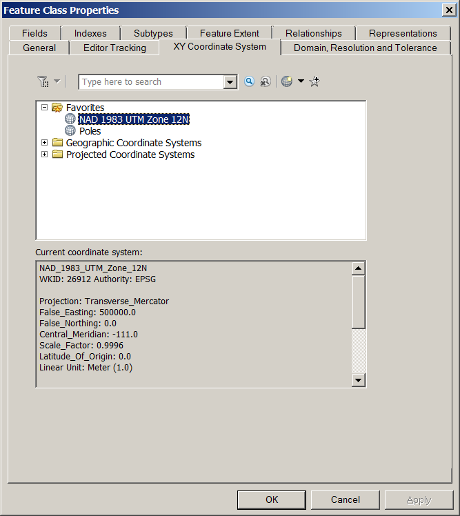
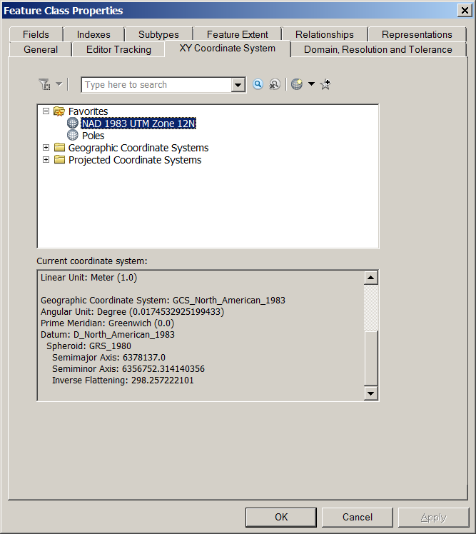
This projection was, for the most part correct, except that it is in meters and not foot which I needed it in to match the projection of the other feature classes supplied by my organization. So I projected it by using Data Management Tools\Projections and Transformations\Project. In the Project Window I used the Layers feature within the Spatial Reference Properties to select the same projection that was being used by the other feature classes. I ended up with the following:

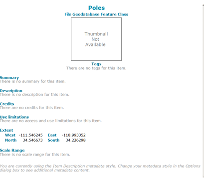
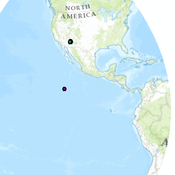
As you can see the extent in this final image above is off and my points are way off. See below (green dots are correct while the purple are way off).
I tried to project the dataset back to the original but still places them in the wrong area. I am at a loss of how to correct this and don't understand why there is an issue as I used the same projection used by the other layers in my map.
Any idea on 1) what I did wrong and 2) how do I get them back to the correct location using NAD 83 Zone 12 and in Foot_US for linear measurement?
TIA
Solved! Go to Solution.
Accepted Solutions
- Mark as New
- Bookmark
- Subscribe
- Mute
- Subscribe to RSS Feed
- Permalink
I'm sorry about the late reply.
To me, it looks like you defined the projection (projected coordinate system) to be a UTM zone. Is that correct?
If so, that's not right, you need to define it as a geographic coordinate system, probably NAD 1983 aka North American Datum 1983. It's in the geographic coordinate systems, North America folder.
Melita
- Mark as New
- Bookmark
- Subscribe
- Mute
- Subscribe to RSS Feed
- Permalink
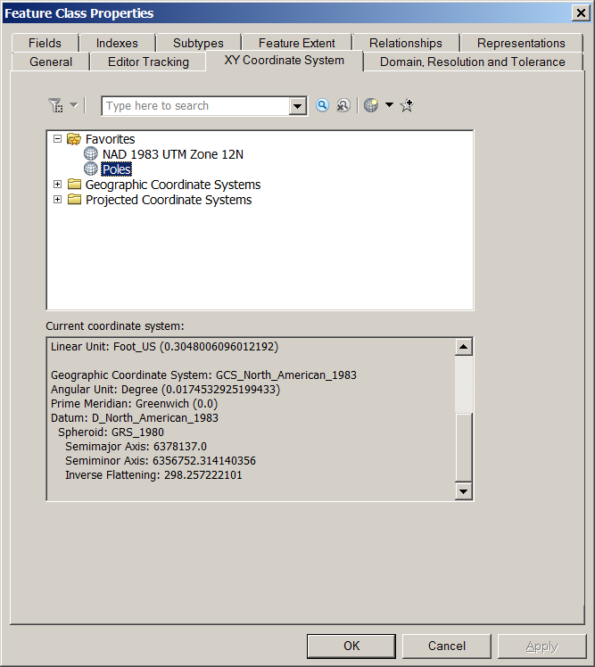
The Poles data is in latitude-longitude, decimal degrees. Redefine the coordinate system as NAD83 using the Define Projection tool or the data's property page in ArcCatalog.
Melita
- Mark as New
- Bookmark
- Subscribe
- Mute
- Subscribe to RSS Feed
- Permalink
Melita,
Thank you for the assistance! I did the Define but no change. Here's the results from the process (hopefully you can see enough of it):
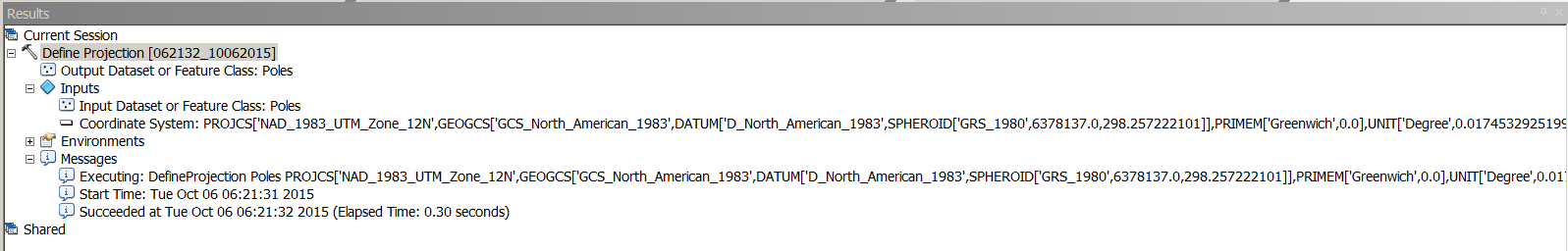
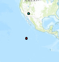
Here's a screen shot post-Define:
Any ideas?
- Mark as New
- Bookmark
- Subscribe
- Mute
- Subscribe to RSS Feed
- Permalink
i guess maybe its the coordinate system that is wrong.let me check then i'll get back to you
- Mark as New
- Bookmark
- Subscribe
- Mute
- Subscribe to RSS Feed
- Permalink
I'm sorry about the late reply.
To me, it looks like you defined the projection (projected coordinate system) to be a UTM zone. Is that correct?
If so, that's not right, you need to define it as a geographic coordinate system, probably NAD 1983 aka North American Datum 1983. It's in the geographic coordinate systems, North America folder.
Melita