Turn on suggestions
Auto-suggest helps you quickly narrow down your search results by suggesting possible matches as you type.
Cancel
- Home
- :
- All Communities
- :
- Products
- :
- Data Management
- :
- Data Management Questions
- :
- Re: IDRISI 2.0 raster to ArcGIS 10
Options
- Subscribe to RSS Feed
- Mark Topic as New
- Mark Topic as Read
- Float this Topic for Current User
- Bookmark
- Subscribe
- Mute
- Printer Friendly Page
IDRISI 2.0 raster to ArcGIS 10
Subscribe
7695
7
02-10-2014 02:32 AM
02-10-2014
02:32 AM
- Mark as New
- Bookmark
- Subscribe
- Mute
- Subscribe to RSS Feed
- Permalink
Hi,
I used earlier IDRISI 2.0. Now I started with ArcGIS 10. I would like to use some raster data from IDRISI 2.0 (pair of files - *.img and *.doc - an example in attachment) in ArcGIS 10.
How to convert old IDRISI data?
Please, let me know.
Peter
I used earlier IDRISI 2.0. Now I started with ArcGIS 10. I would like to use some raster data from IDRISI 2.0 (pair of files - *.img and *.doc - an example in attachment) in ArcGIS 10.
How to convert old IDRISI data?
Please, let me know.
Peter
7 Replies
02-11-2014
06:38 AM
- Mark as New
- Bookmark
- Subscribe
- Mute
- Subscribe to RSS Feed
- Permalink
To open this legacy format in ArcGIS 10, make following changes.
1. Change extension .IMG to .rst
2. Change .DOC extension to .RDC
3. Open RDC file within Notepad or Notepad++,
add "file format : Idrisi Raster A.1" at the first line,
add "display min : 0" at line 18, and "display max : 215" at line 19
(notice: display min and display max have the same values as min. value and max. value)
4. Save your changes, then you can open the rst file with ArcGIS 10
Attached is the updated data of your sample data.
02-13-2014
05:44 AM
- Mark as New
- Bookmark
- Subscribe
- Mute
- Subscribe to RSS Feed
- Permalink
Hi,
I tried to add files from attachtment (NewIdriri.zip) to new map document. It does not work.
I receive this message: Invalid raster dataset. Failed to create raster layer. Next message: Could not add the specified data object to the map. Failed to open raster dataset
I use ArcGIS 10 Desktop.
Peter
I tried to add files from attachtment (NewIdriri.zip) to new map document. It does not work.
I receive this message: Invalid raster dataset. Failed to create raster layer. Next message: Could not add the specified data object to the map. Failed to open raster dataset
I use ArcGIS 10 Desktop.
Peter
02-13-2014
01:36 PM
- Mark as New
- Bookmark
- Subscribe
- Mute
- Subscribe to RSS Feed
- Permalink
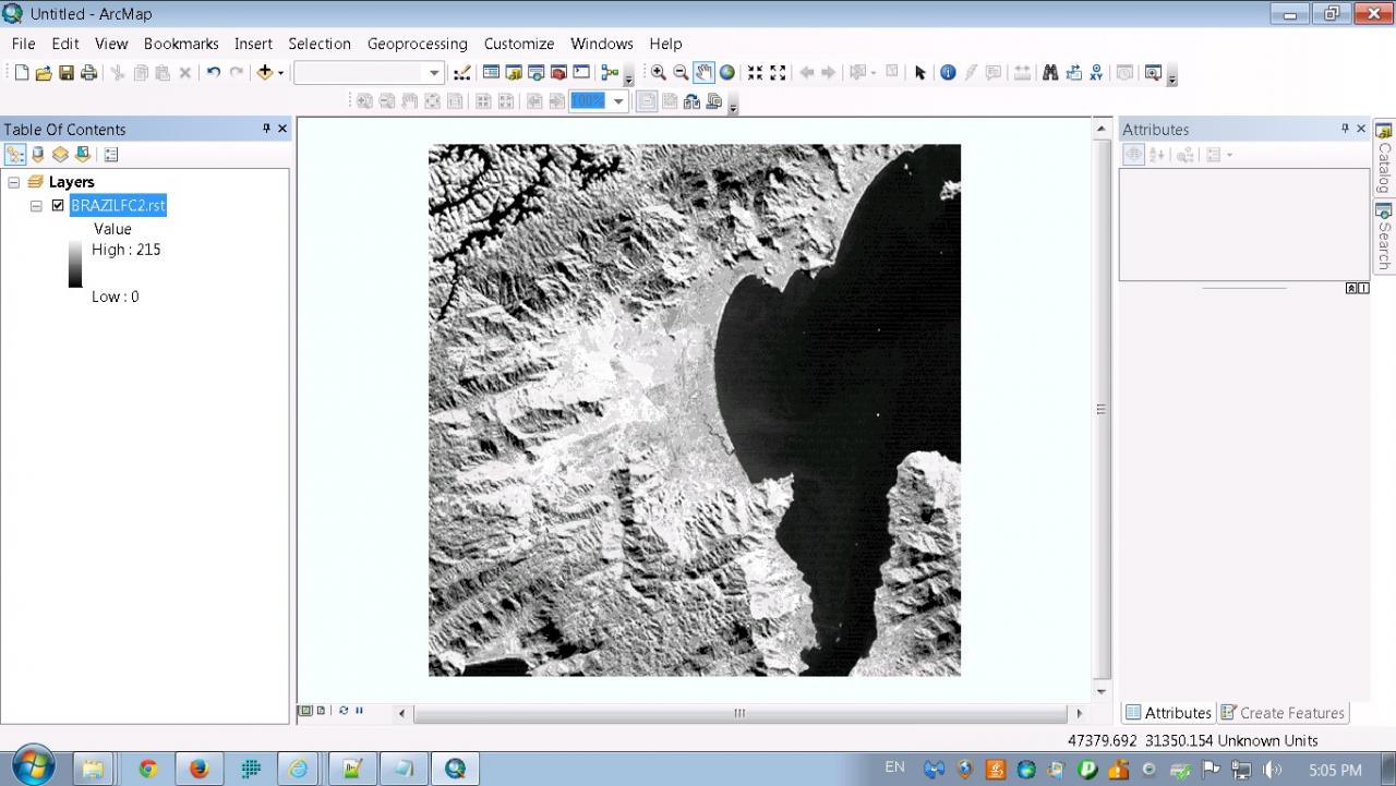
I open the file in ArcGIS 10.2. The only message I get is about "missing spatial reference system, and cannot be projected...", but still works quite well. Attached is the screenshot.
I believe Idrisi RST file is also supported by ArcGIS 10.0. You can do two things to see what will happen.
1. In ArcMap, go to Customize>ArcMap Option>Raster>File Formats, make sure IDRISI rst in the list is checked;
2. Use Copy Raster tool to convert the rst file into other formats, such as esri grid, or tif. If the conversion succeeds, you can open the result in ArcMap.
Hope these help.
May
02-18-2014
11:58 PM
- Mark as New
- Bookmark
- Subscribe
- Mute
- Subscribe to RSS Feed
- Permalink
Hi,
I found that my path to the file in disk is too long and too complicated, using diacritics (accents) in folder names.
I tried to put files directly to C: and IDRISI folder - it works.
Thanks for assistance.
Peter
I found that my path to the file in disk is too long and too complicated, using diacritics (accents) in folder names.
I tried to put files directly to C: and IDRISI folder - it works.
Thanks for assistance.
Peter
07-03-2014
06:07 AM
- Mark as New
- Bookmark
- Subscribe
- Mute
- Subscribe to RSS Feed
- Permalink
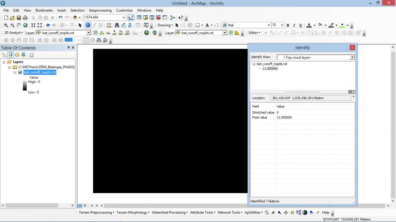
Hi, I really need som help. I am currently using IDRISI Selva. I generated DEM to come up with a runoff data using IDRISI then produced a batangas_runoff_nopits.rst file. When I tried to open the batangas_runoff_nopits.rst file in ArcMap 10 it appears that the image is all black. The value for High and Low is 0. But when i tried to identify the raster its pixel has a value. How can I view the runoff data in ArcGIS? and convert this .rst file into polyline? I would really appreciate your reply. Thanks you. please email me if possible tglicera@gmail.com
Thanks.
Grace
Thanks.
Grace
07-03-2014
08:47 AM
- Mark as New
- Bookmark
- Subscribe
- Mute
- Subscribe to RSS Feed
- Permalink
This was a bug. It's fixed in ArcGIS 10.1.
You can convert the rst file into tif or img file, then open it in ArcMap 10.
To convert, go to File->Import->GDALIDRISI, in tab gdal_translate, input is the rst file, provide output, and for output format, choose GTiff or HFA. After done, you can open the output file in ArcMap 10.
You can convert the rst file into tif or img file, then open it in ArcMap 10.
To convert, go to File->Import->GDALIDRISI, in tab gdal_translate, input is the rst file, provide output, and for output format, choose GTiff or HFA. After done, you can open the output file in ArcMap 10.
07-03-2014
09:24 AM
- Mark as New
- Bookmark
- Subscribe
- Mute
- Subscribe to RSS Feed
- Permalink
This was a bug. It's fixed in ArcGIS 10.1.
You can convert the rst file into tif or img file, then open it in ArcMap 10.
To convert, go to File->Import->GDALIDRISI, in tab gdal_translate, input is the rst file, provide output, and for output format, choose GTiff or HFA. After done, you can open the output file in ArcMap 10.
Are there any options aside from using arcgis 10.1? 😞