- Home
- :
- All Communities
- :
- Products
- :
- Data Management
- :
- Data Management Questions
- :
- How to Point Cluster when only having a layer?
- Subscribe to RSS Feed
- Mark Topic as New
- Mark Topic as Read
- Float this Topic for Current User
- Bookmark
- Subscribe
- Mute
- Printer Friendly Page
How to Point Cluster when only having a layer?
- Mark as New
- Bookmark
- Subscribe
- Mute
- Subscribe to RSS Feed
- Permalink
Hello everyone,
I am neither sure if what I am trying to do is super obvious or actually impossible. And since I am very desperate because I cant seem so be able to move it along. Here I go:
I have Layer (.lyr) file from Oak Ridge National Library Landscape (attached below) which contains data points and a corresponding scale for density. I want to cluster around the Nile River in Sudan in order to see how urbanization and overall population density changed from one specific year to the next.
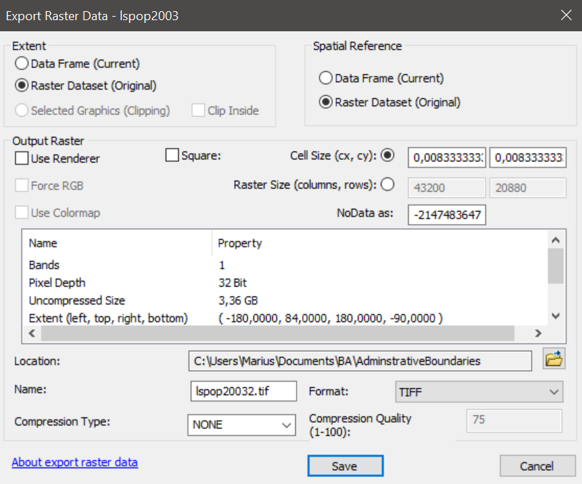
However, I am unable to convert the layer file to a shape file as it gives me this window when I try to export it:
Do you guys have any idea how I could be able to cluster such a file as in this case?
Thank you in advance,
All the best,
Marius
- Mark as New
- Bookmark
- Subscribe
- Mute
- Subscribe to RSS Feed
- Permalink
What would also help tremendously if you could tell me how I convert this file to a format for which I can use a Optimized Hot Spot Analysis.
Thank you!
- Mark as New
- Bookmark
- Subscribe
- Mute
- Subscribe to RSS Feed
- Permalink
Hi Marius,
It looks like you have a .lyr file of raster imagery. You would need to get the raw imagery (i.e. TIF, IMG). You could then convert this to a polygon or point feature class using the Raster to Polygon or Raster to Point tools.
Once you have a polygon/point feature class, you can execute the Optimized Hot Spot tool.