Turn on suggestions
Auto-suggest helps you quickly narrow down your search results by suggesting possible matches as you type.
Cancel
- Home
- :
- All Communities
- :
- Products
- :
- Data Management
- :
- Data Management Questions
- :
- Re: how to make an address locator for township-ra...
Options
- Subscribe to RSS Feed
- Mark Topic as New
- Mark Topic as Read
- Float this Topic for Current User
- Bookmark
- Subscribe
- Mute
- Printer Friendly Page
how to make an address locator for township-range-section polygons
Subscribe
01-22-2014
07:49 AM
- Mark as New
- Bookmark
- Subscribe
- Mute
- Subscribe to RSS Feed
- Permalink
- Report Inappropriate Content
Hello all,
As stated im having troubles making an address locator to show land ownership
1 company owns 4000+++ peices of land which i have on an excell spreadsheet broken town to Township Range Section
i have the state sections breakdown date
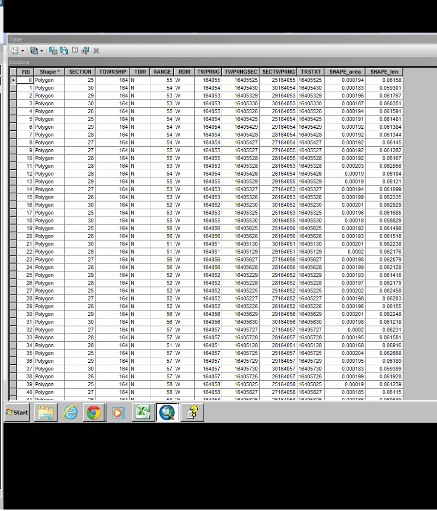
the table looks like this
but im stuck at this.
Im guessing i need to add an alia refrence data of my collected data from my spreadsheets but im unsure how to arrange that and if i can just add a excel file
As stated im having troubles making an address locator to show land ownership
1 company owns 4000+++ peices of land which i have on an excell spreadsheet broken town to Township Range Section
i have the state sections breakdown date
the table looks like this
but im stuck at this.
Im guessing i need to add an alia refrence data of my collected data from my spreadsheets but im unsure how to arrange that and if i can just add a excel file
Solved! Go to Solution.
21 Replies
01-25-2014
05:44 AM
- Mark as New
- Bookmark
- Subscribe
- Mute
- Subscribe to RSS Feed
- Permalink
- Report Inappropriate Content
01-25-2014
07:48 AM
- Mark as New
- Bookmark
- Subscribe
- Mute
- Subscribe to RSS Feed
- Permalink
- Report Inappropriate Content
Thanks for helping me out so much i finally got it how i needed it, when i copied the section layer and unchecked null values from the symbol tab everything showed up?
I learned a ton doing all of this. I really appreciate you walking me through most of this.
I am glad it is working. I noticed you are still in Source tab view in the Table of Contents. Switch to Display view for most of the time. It is the only view that lets you change layer order. Also, Source tab view slows performance, because the hard disk is queried for the source directory information every time the map refreshes. That query can be very slow, especially if you ever use SDE geodatabases someday. Source tab is only valuable if you need to see the source of the data, change SDE versions, or see the list of standalone tables in the map or remove them.
- « Previous
- Next »
- « Previous
- Next »