- Home
- :
- All Communities
- :
- Products
- :
- Data Management
- :
- Data Management Questions
- :
- Geotagging photos to an existing point shapefile
- Subscribe to RSS Feed
- Mark Topic as New
- Mark Topic as Read
- Float this Topic for Current User
- Bookmark
- Subscribe
- Mute
- Printer Friendly Page
Geotagging photos to an existing point shapefile
- Mark as New
- Bookmark
- Subscribe
- Mute
- Subscribe to RSS Feed
- Permalink
Hello all,
I want to geotag photos to an existing shapefile but I am not sure how. I have a point shapefile of memorial plaques, and I have a folder of pictures of all of these plaques. The photos have no spatial information as I took them with a small pocket camera. I tried using the "geotagged photos to point" tool, but my pictures don't show up because they don't have any spatial reference and it also generates a new shapefile, which I don't want. I want to tag them to a pre existing shapefile as this shapefile has all of the attribute information stored in it. Any ideas of suggestions would be helpful.
AB
- Mark as New
- Bookmark
- Subscribe
- Mute
- Subscribe to RSS Feed
- Permalink
AB,
Looking at your question I am thinking about it in two ways.
1. You have all of the XY information as points, how do you update the photos with that information?
2. The other is, how do I add the pictures to the shapefile?
I think to get what you want, you will do both.. well actually you will create a new feature class that contains all of the information.
For 1 there are a number of manual ways to do this.. One that I am familiar with is to use ArcGIS Explorer Desktop. ArcGIS Explorer | Download
Click Add Geotag Photo
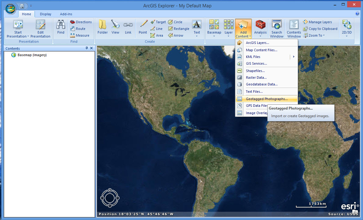
Browse to your folder of pictures and select one or more.
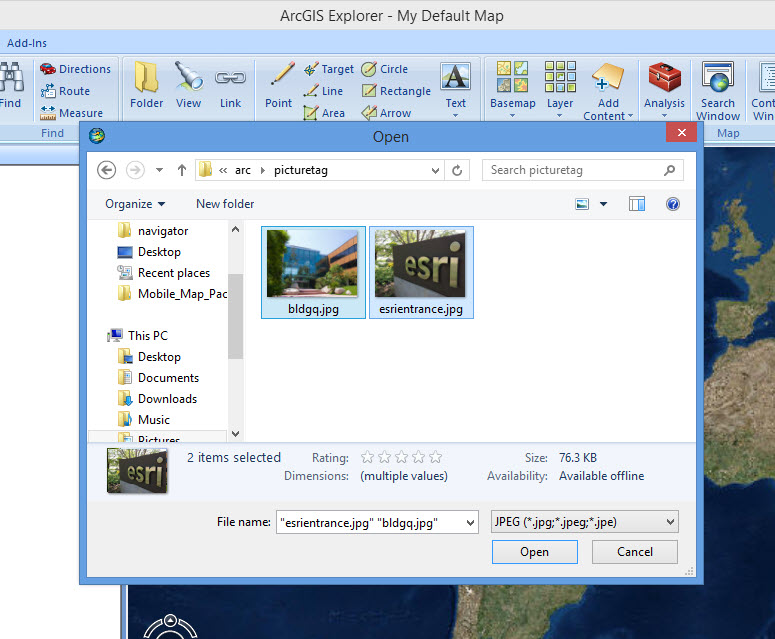
Explorer will ask you if you want to manually add Geotag information.
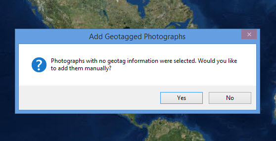
Click yes, and then zoom the map to update each photo with geotag information.
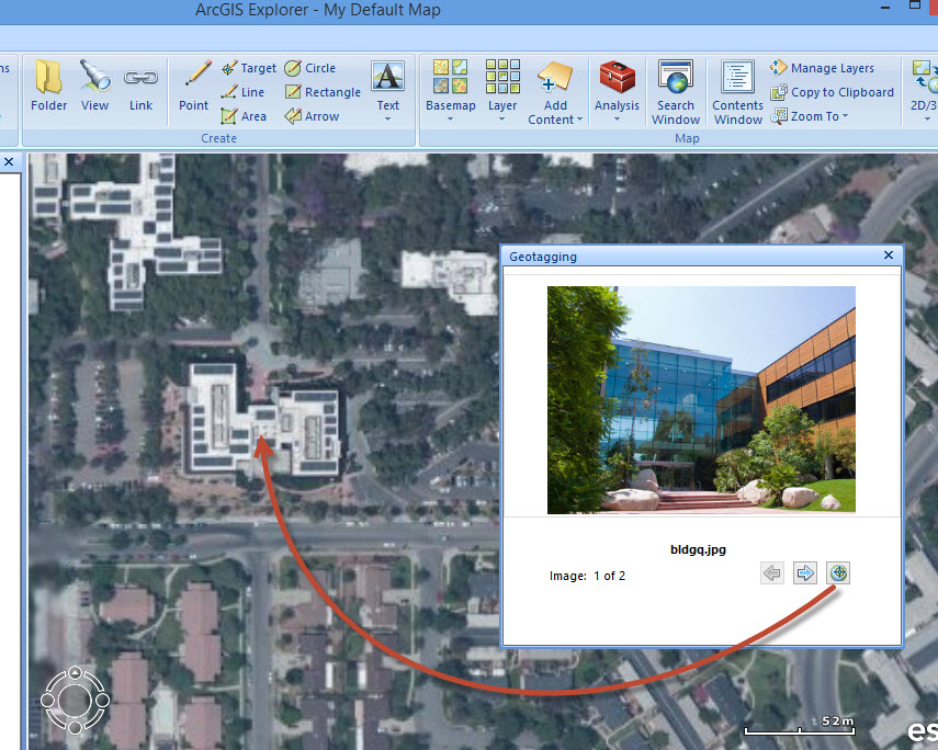
and continue...
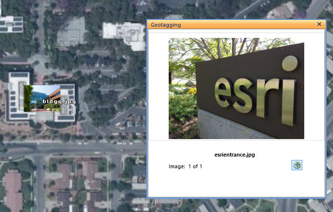
Once you have all of the photos updated you could use Geotag photo to point to create a feature class with a reference to the photos on Disk, as well as Attachment if desired.
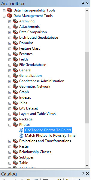
With geotag photo you just browse to a folder and it creates the Features from all of the photos using the Geotag information.
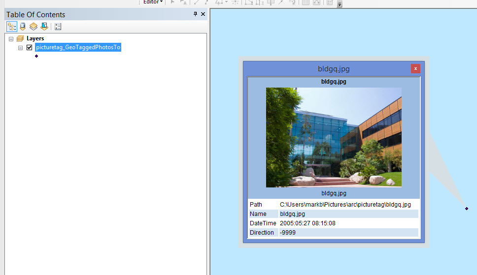
Once you have done this, You can use a spatial join to your original points to transfer the attribute information you have to the new feature class. This is Step 2. Create a feature class that contains the Photo as well as the attribute information from the shapefile.
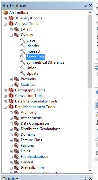
Spatial Join allows you to specify a radius, so the manually tagged photos do not need to exactly match your shapefile points. In ArcGIS Explorer Desktop you could add your shapefile to help with tagging the photos as closely as possible to the desired position.
Mark
- Mark as New
- Bookmark
- Subscribe
- Mute
- Subscribe to RSS Feed
- Permalink
You can add a field to your attribute table and then populate with the links to the photos. Then check "Support hyperlinks using field" on the Display tab of Properties for your layer and you can use the lightning bolt to jump to your photo (ArcGIS Help (10.2, 10.2.1, and 10.2.2). Be sure and put the photos on a shared drive, at a permanent internet link, or use relative paths if you intend to share with other people.