- Home
- :
- All Communities
- :
- Products
- :
- Data Management
- :
- Data Management Questions
- :
- CSV File ArcMap Geocoding
- Subscribe to RSS Feed
- Mark Topic as New
- Mark Topic as Read
- Float this Topic for Current User
- Bookmark
- Subscribe
- Mute
- Printer Friendly Page
CSV File ArcMap Geocoding
- Mark as New
- Bookmark
- Subscribe
- Mute
- Subscribe to RSS Feed
- Permalink
Newbie here trying to figure out how to work with excel data in arcmap. I am currently using ArcMap. Before my online ArcGis Online subscription ran out I managed to add a layer of excel real estate data and the coordinates were as I intended. This was due to the address geocoding feature I suppose. After displaying x y data, I would geocode adress and it would work fine. However, the online free trail ran out I have not been able to geocode addresses inside of Arc
map and my data is halfway across the world. Guess my question is why is not working in the first place? My lat long coordinates are correct in my excel file. Should I format the addresses is in a different way? There is a column for each of the following in the csv. file.
| House Number | Street Name | City | State/Province | County | Postal Code |
Should I make the combine the above address columns a single field? Also, if there are any good beginner tutorials on how to work with the data after it is mapped, a link would be greatly appreciated. If I upgrade most of what I do would be csv to shp type of stuff. Thanks!
- Mark as New
- Bookmark
- Subscribe
- Mute
- Subscribe to RSS Feed
- Permalink
There are two situations:
1. you have the Lat Long fields instead of street, state, zip columns in ur csv file.
-- Easiest solution is to use the Make XY Event Layer in arctool box to create a new point feature layer based on x and y coordinates defined in the csv file.
2. You need to geocode based on the address info (street, state, zip, etc.) to acquire the x y coordinates.
Three ways are available:
a. Buy additional arcgis online credits to geocode so that you can geocode in ArcMap, which I think is the way you mentioned above. You don't need to combine all the fields in the same field. Working with the ArcGIS Online World Geocoding Service—Help | ArcGIS for Desktop
b. Write a python script to import google geocode service to do the geocoding to acquire the lat & long for the csv. You can geocode 2500-3000 records per day for free I guess. The related link is: geocoder 1.19.0 : Python Package Index or you can just google python geocode.
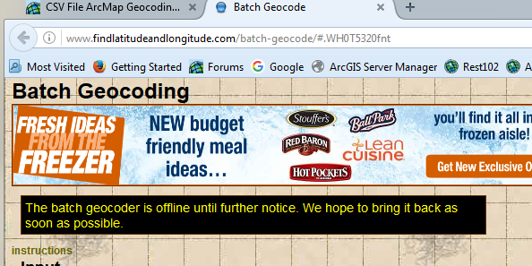
c. Use a Batch Geocode website developed by Datvid B. Zwiefelhofer. Put all of your records in the website and get lat long. It's free for unlimited records. But it's kind of slow when the total number is large.Here is the link: Batch Geocode
Hope it helps.
- Mark as New
- Bookmark
- Subscribe
- Mute
- Subscribe to RSS Feed
- Permalink
That website appears to be off line....