- Home
- :
- All Communities
- :
- Products
- :
- Data Management
- :
- Data Management Questions
- :
- Re: Bing Base Imagery not accurately georeferenced...
- Subscribe to RSS Feed
- Mark Topic as New
- Mark Topic as Read
- Float this Topic for Current User
- Bookmark
- Subscribe
- Mute
- Printer Friendly Page
Bing Base Imagery not accurately georeferenced in ArcMap?
- Mark as New
- Bookmark
- Subscribe
- Mute
- Subscribe to RSS Feed
- Permalink
Hello everyone,
I've been experiencing this problem for over a year now, but it's become extremely bothersome now that I'm working on the "heads-up digitizing" of large extent areas. It seems that compared to accurately verified survey points and USGS image tiles, ESRI's base imagery simply does not align with the same accuracy. Through many projects, I have verified the proper projections of both survey data and georeferenced imagery downloaded from the USGS (both of which align perfectly ontop of each other), but turning on the Bing base imagery shows it can be mis-aligned as much as 10 feet in some instances - even when the data frame is projected in the same coordinate system as the survey data and georeferenced imager tile.
For small projects, this does not matter for me - since one or two USGS image tiles give the accuracy I need. With larger projects, however, extending hundreds of miles - I simply don't have the time or physical disk space to download accurate USGS imagery. Instead, I must rely on Bing base imagery to trace my features (in this case, railroad tracks).
The attached picture shows a new MXD, with simply the USGS image tile imported. This ensures ArcMap imported the projection of the image tile since it was the first feature added to the map. Then, I turned on Bing base imagery:
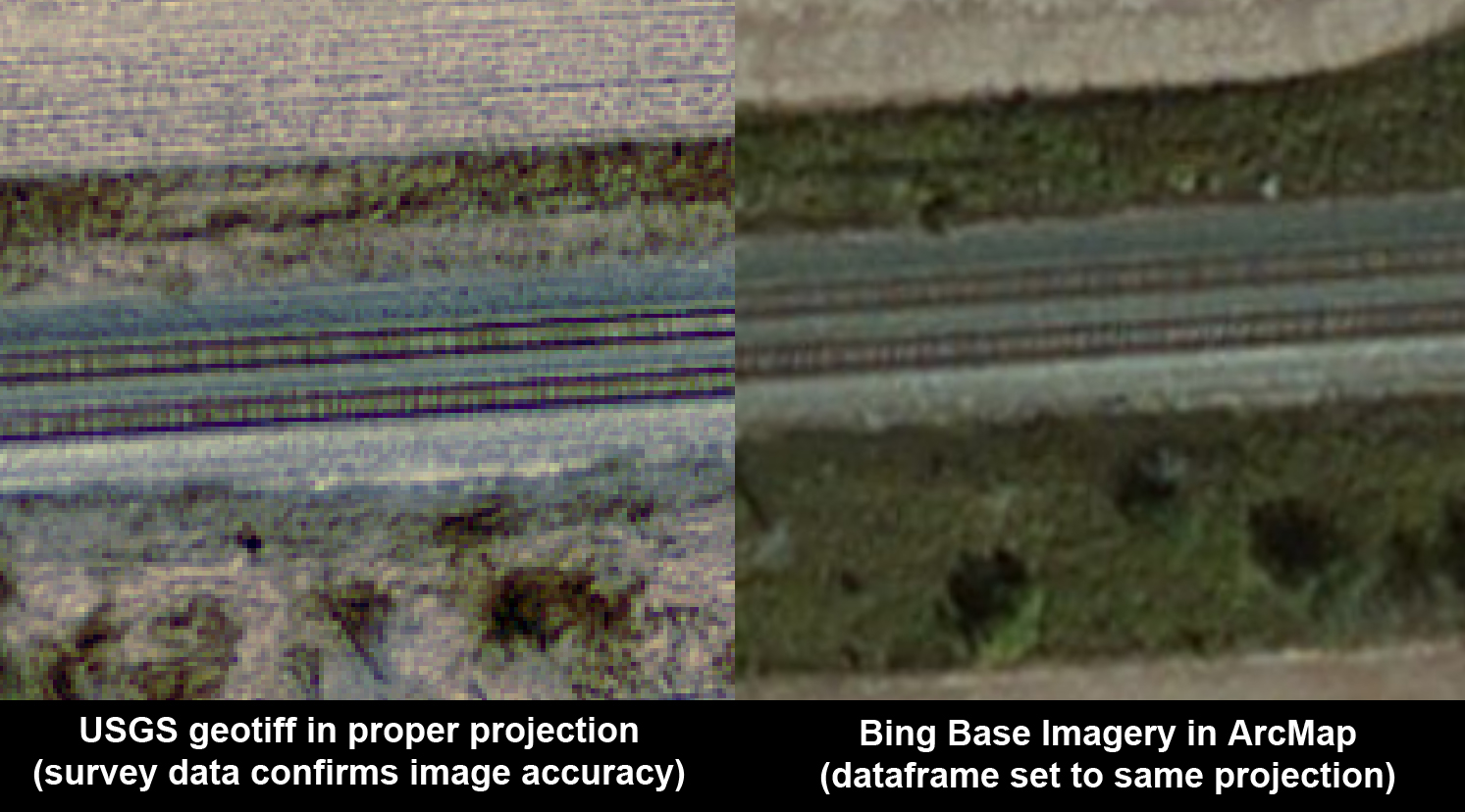
The image above shows the edge of a USGS image tile, shown over the background of Bing imagery in ArcMap. As you can see, the features don't line up - the railroad tracks, the right-of-way, the vegetation zones, etc. While this example is just east of Sidney, Ohio, USA - this seems to be a problem in all parts of the continental United States. I have rarely, if ever, seen the Bing imagery "spot on" with properly referenced imagery or survey data.
What am I doing wrong, if anything?
Suppose I created a complex network of features that were traced using the Bing base imagery. Is there a tool to reproject these features to a more accurate spatial location?
Thanks for any and all help!
- Mark as New
- Bookmark
- Subscribe
- Mute
- Subscribe to RSS Feed
- Permalink
You're not doing anything wrong, except possibly expecting a better accuracy than Bing (or any other bulk web imagery provider, like Google) is going to provide. You trade convenience and disk space by using imagery that isn't necessarily accurate to within your project specifications.
Good luck finding reported accuracies for these services, as well. For "real" projects, you need to use more rigorously collected and documented imagery, like USGS (I'm guessing), that provide their accuracy and other metadata, which you can then use to report your own digitizing accuracy.
- Mark as New
- Bookmark
- Subscribe
- Mute
- Subscribe to RSS Feed
- Permalink
I know this is December and you post your question last July and I am reading all of the post here on GeoNet. So, from what I understand your situation. ESRI's Basemap are basically not projection. and it is based on http://www.esri.com/events/seminars/bettermaps/~/media/files/pdfs/events/seminars/bettermaps/materia...
but you would need to find out for Bing Base Imagery on what their coordinate system are using.. I am assuming the same coordinate system as ESRI's .
So you will always have different alignments especially imagery and vector datasets.
The best way to do is when you open ArcMap, bring your known projection system datasets first and then bring your basemap later, so that way you have the projection system in place especailly when you want to export to a new dataset so you will have the same projection system
Good luck.