- Home
- :
- All Communities
- :
- Products
- :
- Data Management
- :
- Data Management Questions
- :
- Re: Adding an adjacent fabric feature causes the e...
- Subscribe to RSS Feed
- Mark Topic as New
- Mark Topic as Read
- Float this Topic for Current User
- Bookmark
- Subscribe
- Mute
- Printer Friendly Page
Adding an adjacent fabric feature causes the existing adjacent feature to be duplicated,
- Mark as New
- Bookmark
- Subscribe
- Mute
- Subscribe to RSS Feed
- Permalink
Adding an adjacent fabric feature causes the existing adjacent feature to be duplicated,
I couldn’t figure out why adding an adjacent fabric feature causes the existing feature to be duplicated,
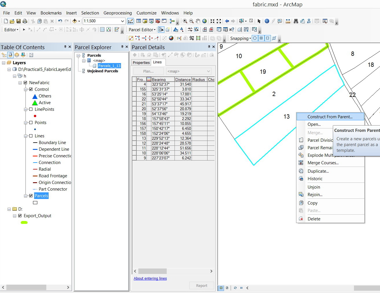
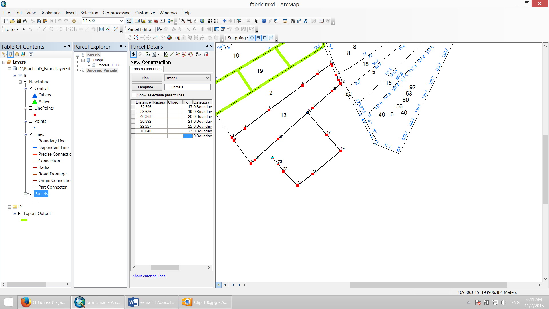
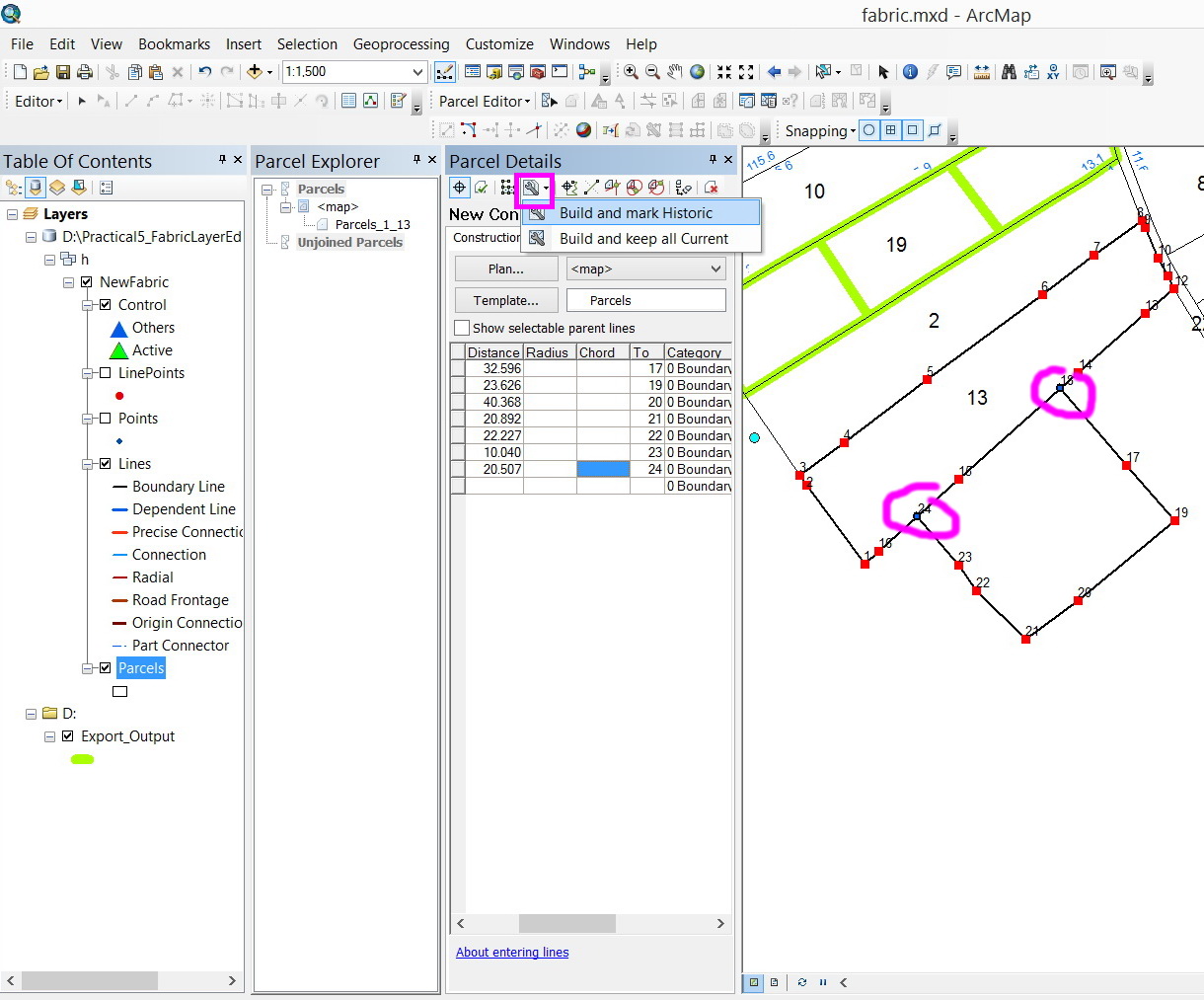
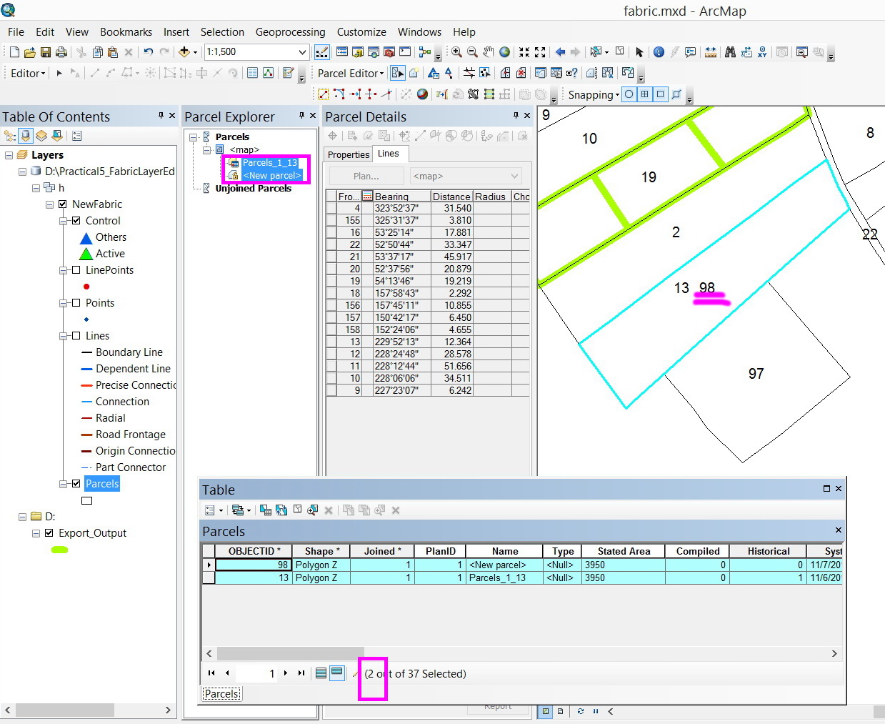
For example, in the screenshots below, it is needed to add a parcel adjacent to parcel#13. As the new parcel is digitized and saved, it is observed that parcel#13 is duplicated.
What might be the issue here?
Thank you
Best
Jamal
Jamal Numan
Geomolg Geoportal for Spatial Information
Ramallah, West Bank, Palestine
Solved! Go to Solution.
Accepted Solutions
- Mark as New
- Bookmark
- Subscribe
- Mute
- Subscribe to RSS Feed
- Permalink
When you enter a parcel in the parcel fabric, you must enter the WHOLE COMPLETE traverse loop. Even if the parcel shares a boundary, you still must enter the whole parcel traverse, close it and then join it.
See more in this tutorial
Tutorial: Create new parcels in the parcel fabric—Help | ArcGIS for Desktop
- Mark as New
- Bookmark
- Subscribe
- Mute
- Subscribe to RSS Feed
- Permalink
Thanks Christine,
This will add much of work that we need to digitize the shared boundary! And how to make sure that they will be identical? What if one point is missed and thus gap\overlap\new polygons are created?
Jamal Numan
Geomolg Geoportal for Spatial Information
Ramallah, West Bank, Palestine
- Mark as New
- Bookmark
- Subscribe
- Mute
- Subscribe to RSS Feed
- Permalink
The idea is that you are entering a parcel from the legal recorded document (that has boundary dimensions on it) - not digitizing. If you are digitizing, then the parcel fabric might not be the best or most efficient tool for you.
The idea of the parcel fabric is accountability, and accuracy. The parcel fabric is used to get your data accurate to the legal record and spatially accurate to survey control
The parcel misclose lets you know if there is a blunder in your data entry.
- Mark as New
- Bookmark
- Subscribe
- Mute
- Subscribe to RSS Feed
- Permalink
Practically, there is no why to have the new data surveyed from the field (by total station or GPS device with 2cm accuracy) to be 100% identical to the data already stored in the fabric. At the end, the shared boundaries between the data stored in the fabric layer and the new added one needs to be manually modified (reshaped) so that the common boundary gets identical.
Jamal Numan
Geomolg Geoportal for Spatial Information
Ramallah, West Bank, Palestine
- Mark as New
- Bookmark
- Subscribe
- Mute
- Subscribe to RSS Feed
- Permalink
You are correct. Thats why we have the joining process. If you look through the doc here you will see that lines can bend and flex to misaligned boundaries... YOu can use two join options - move the new data to the existing boundaries OR move/bend the existing boundaries to the new data being joined.
About joining parcels—Help | ArcGIS for Desktop
If you run a least squares adjustment, you can use accuracy levels to weight down the good data so that the less accurate data adjusts around it and the good data maintains its shape.
- Mark as New
- Bookmark
- Subscribe
- Mute
- Subscribe to RSS Feed
- Permalink
Thank you for the input Christine. This is very helpful.
Jamal Numan
Geomolg Geoportal for Spatial Information
Ramallah, West Bank, Palestine
- Mark as New
- Bookmark
- Subscribe
- Mute
- Subscribe to RSS Feed
- Permalink
moving to Managing Data