- Home
- :
- All Communities
- :
- Products
- :
- Data Management
- :
- Data Management Questions
- :
- 9 Digit X and Y Coordinates?
- Subscribe to RSS Feed
- Mark Topic as New
- Mark Topic as Read
- Float this Topic for Current User
- Bookmark
- Subscribe
- Mute
- Printer Friendly Page
- Mark as New
- Bookmark
- Subscribe
- Mute
- Subscribe to RSS Feed
- Permalink
Hello,
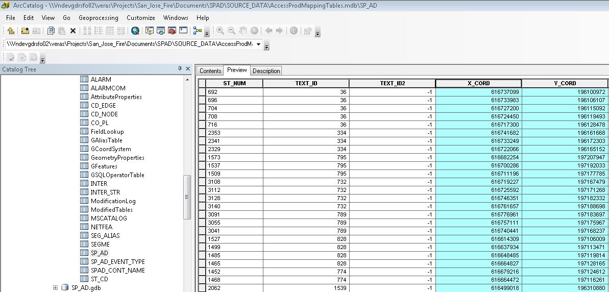
I am dealing with a .MDB file from a client, and need to figure out what coordinate system it is in. However, the coordinates listed in the table for X and Y are 9 digits long, no decimals, and I can't figure out what type of coordinate system that would be (see screenshot below). Can anyone give me a clue?
Thanks in advance!
Solved! Go to Solution.
Accepted Solutions
- Mark as New
- Bookmark
- Subscribe
- Mute
- Subscribe to RSS Feed
- Permalink
I figured it out! Thanks for all your ideas. I needed to add a decimal point 7 digits over, which put it in NAD_1983_StatePlane_California_III_FIPS_0403_Feet.
- Mark as New
- Bookmark
- Subscribe
- Mute
- Subscribe to RSS Feed
- Permalink
The data are projected...or it is decimal degrees factored up to remove the decimal (61, 19 but highly unlikely). Right-click on the layer, get its properties and see if there is a coordinate system defined for it. If there isn't then you may have to go back to the client and ask if there is none specified elsewhere
- Mark as New
- Bookmark
- Subscribe
- Mute
- Subscribe to RSS Feed
- Permalink
Right-clicking to see the properties says it has an unknown coordinate system, since it isn't actually a geometry file, but a table that just lists the XY. To use it in ArcMap I created a XY event layer, but that still doesn't define the projection. May have to go back to the client, indeed! Just wanted to make sure I wasn't completely overlooking something. Thanks!
- Mark as New
- Bookmark
- Subscribe
- Mute
- Subscribe to RSS Feed
- Permalink
A couple guesses: some UTM zone, some state plane coordinate system, or local control system (surveyed).
If it were me, l would ask the client.
- Mark as New
- Bookmark
- Subscribe
- Mute
- Subscribe to RSS Feed
- Permalink
If you haven't managed to figure it out by just looking at the magnitude of the values, then as suggested by the others go back to the client and ask what system these values relate to.
- Mark as New
- Bookmark
- Subscribe
- Mute
- Subscribe to RSS Feed
- Permalink
What location does the data represent? And do you know how big an area it covers? With that information, someone can check likely coordinate systems used in the area and see if any match up. There pretty much aren't any coordinate systems that go to 9 digits, so the data may be in mm, cm, or inches!
- Mark as New
- Bookmark
- Subscribe
- Mute
- Subscribe to RSS Feed
- Permalink
I figured it out! Thanks for all your ideas. I needed to add a decimal point 7 digits over, which put it in NAD_1983_StatePlane_California_III_FIPS_0403_Feet.