- Home
- :
- All Communities
- :
- User Groups
- :
- Coordinate Reference Systems
- :
- Questions
- :
- Re: UTM coordinates - easting and northing do not ...
- Subscribe to RSS Feed
- Mark Topic as New
- Mark Topic as Read
- Float this Topic for Current User
- Bookmark
- Subscribe
- Mute
- Printer Friendly Page
UTM coordinates - easting and northing do not fit when importing to ArcGIS
- Mark as New
- Bookmark
- Subscribe
- Mute
- Subscribe to RSS Feed
- Permalink
Hi,
i have a simple question regarding the import of some coordinates via 'add XY data' to ArcGIS 10.3:
i have an excel file with UTM coordinates (easting and northing) of some points. I want to add it as a shapefile via the function add XY data, as i allways do.
But this time, i can't find any coordinate system, that covers the easting and northing values at the same time.
The points are in Lower Saxony, Germany. If i enter them in the internet (e.g. Online-Umrechner in nahezu alle Koordinatensysteme wie UTM, WGS, WGS84 und CH1903, Gauss-Krueger mit... ) i find the place.
If i enter it to ArcGIS with the function add XY data, i allways get an error.
If i try e.g. the projected Coordinate System ETRS_1989_UTM_Zone_32N, the following error occurs:
One or more layers failed to draw:
sheet1$ Events: Syntaxfehler (fehlender Operator) in Abfrageausdruck
'Gewaesser Rechtswert ohne 32 >= 494225.671350 AND
Gewaesser Hochwert in UTM Koordinaten >= 6028859.486114 AND
Gewaesser Rechtswert ohne 32 <= 502301.705257 AND
Gewaesser Hochwert in UTM Koordinaten <= 6036832.306366'.
sheet1$ Events: An invalid SQL statement was used. [`sheet1$`]
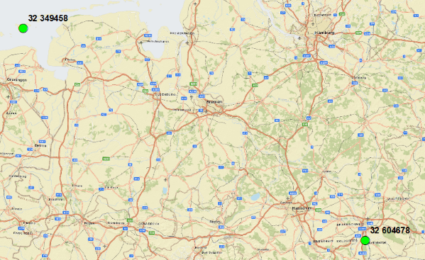
Here are two examples of my coordinate pairs:
| Gewaesser Rechtswert | Gewaesser Rechtswert ohne 32 (easting) | Gewaesser Hochwert in UTM Koordinaten (northing) |
|---|---|---|
| 32 604678 | 604678 | 5781606 |
| 32 349458 | 349458 | 5939876 |
I understand that the coordinates are not in the interval of northing and easting within the error. But i don't have any idea anymore, which coordinate system would fit. I guess that it is simple and i am just doing a stupid mistake. I thought maybe one of you might have an idea?
I would be very happy about any kind of help or hints.
Thanks a lot in advance,
Lena
Solved! Go to Solution.
Accepted Solutions
- Mark as New
- Bookmark
- Subscribe
- Mute
- Subscribe to RSS Feed
- Permalink
'Gewaesser Rechtswert ohne 32 >= 494225.671350 AND
Gewaesser Hochwert in UTM Koordinaten >= 6028859.486114 AND
Gewaesser Rechtswert ohne 32 <= 502301.705257 AND
Gewaesser Hochwert in UTM Koordinaten <= 6036832.306366'.
Remove the spaces in your field names.
- Mark as New
- Bookmark
- Subscribe
- Mute
- Subscribe to RSS Feed
- Permalink
What do you mean...
"If i try e.g. the projected Coordinate System ETRS_1989_UTM_Zone_32N"
The coordinates are either in this coordinate system or not. You need to know what the CRS of the input is...
I would recommend first importing the excel sheet into a gdb first. There maybe some fluff in the spreadsheet which is causing this error.
- Mark as New
- Bookmark
- Subscribe
- Mute
- Subscribe to RSS Feed
- Permalink
'Gewaesser Rechtswert ohne 32 >= 494225.671350 AND
Gewaesser Hochwert in UTM Koordinaten >= 6028859.486114 AND
Gewaesser Rechtswert ohne 32 <= 502301.705257 AND
Gewaesser Hochwert in UTM Koordinaten <= 6036832.306366'.
Remove the spaces in your field names.
- Mark as New
- Bookmark
- Subscribe
- Mute
- Subscribe to RSS Feed
- Permalink
Thank you very much for the answers and the solution guys, that was a big help!!
The error was really the space in the field name. i did not know that so far!
So it made also sence, that your table worked Xander, because you called the columns 'easting' and 'northing' and not as complicated as the original names. Top.
Thanks again and kind regards,
Lena