- Home
- :
- All Communities
- :
- User Groups
- :
- Coordinate Reference Systems
- :
- Questions
- :
- Re: Locate Pixel at Specific Coordinate in US Nati...
- Subscribe to RSS Feed
- Mark Topic as New
- Mark Topic as Read
- Float this Topic for Current User
- Bookmark
- Subscribe
- Mute
- Printer Friendly Page
Locate Pixel at Specific Coordinate in US National Grid
- Mark as New
- Bookmark
- Subscribe
- Mute
- Subscribe to RSS Feed
- Permalink
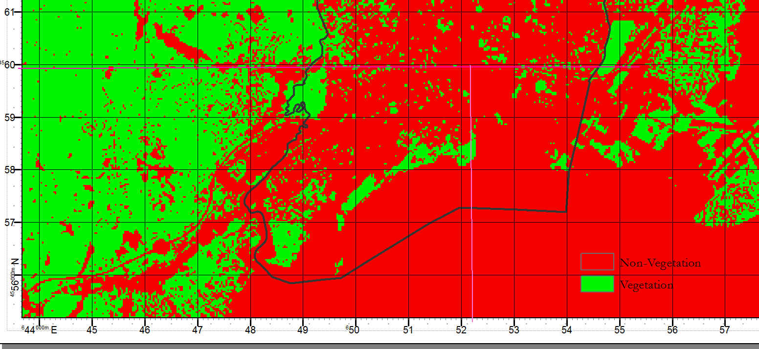
I am trying to locate a specific coordinate within the US National Grid displayed over an NDVI raster.
18TXL5220060030 and 18TXL5157160811 as an example.
I have specified the subdivision ticks to be 10 so I can see 52200 precisely and I can see 60 and can estimate that 30 would be a bit before 61 but I'm just eyeing this information and I'm thinking there must be a more precise method to locate specific coordinates within this mapping software. I'm drawing a line from the tick marks estimated locations to find the intersection but this seems to be a very rudimentary way of doing things. I'm running 10.4
Thankyou for any help.
~Natasha
- Mark as New
- Bookmark
- Subscribe
- Mute
- Subscribe to RSS Feed
- Permalink
If you want to locate specific pixel you can use GO To XY tool in Tools bar

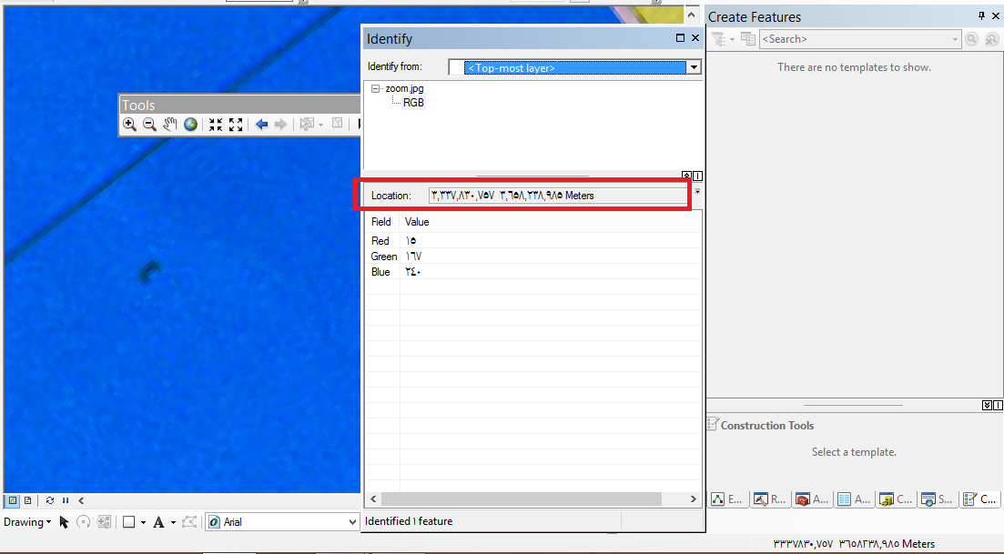
If you want to know the coordinate of any pixel , you can use identify tool

then click on the pixel and you will get this window

that have the coordinates of pixel.
thanks
- Mark as New
- Bookmark
- Subscribe
- Mute
- Subscribe to RSS Feed
- Permalink
Abdullah this was the solution. I very much appreciate you help.
~Natasha
- Mark as New
- Bookmark
- Subscribe
- Mute
- Subscribe to RSS Feed
- Permalink
If you're doing this for more than a few points, you can make a table of your coordinates, make an XY point event layer from the table, and then extract values to points (requires spatial analyst).