- Home
- :
- All Communities
- :
- User Groups
- :
- Coordinate Reference Systems
- :
- Questions
- :
- Re: Comparing the true size and shape of geographi...
- Subscribe to RSS Feed
- Mark Topic as New
- Mark Topic as Read
- Float this Topic for Current User
- Bookmark
- Subscribe
- Mute
- Printer Friendly Page
Comparing the true size and shape of geographically distant features
- Mark as New
- Bookmark
- Subscribe
- Mute
- Subscribe to RSS Feed
- Permalink
Apologies in advance if this is a dumb question or I'm missing something obvious... It's rare I have to leave the confines of the Ordnance Survey National Grid and think about reference systems.
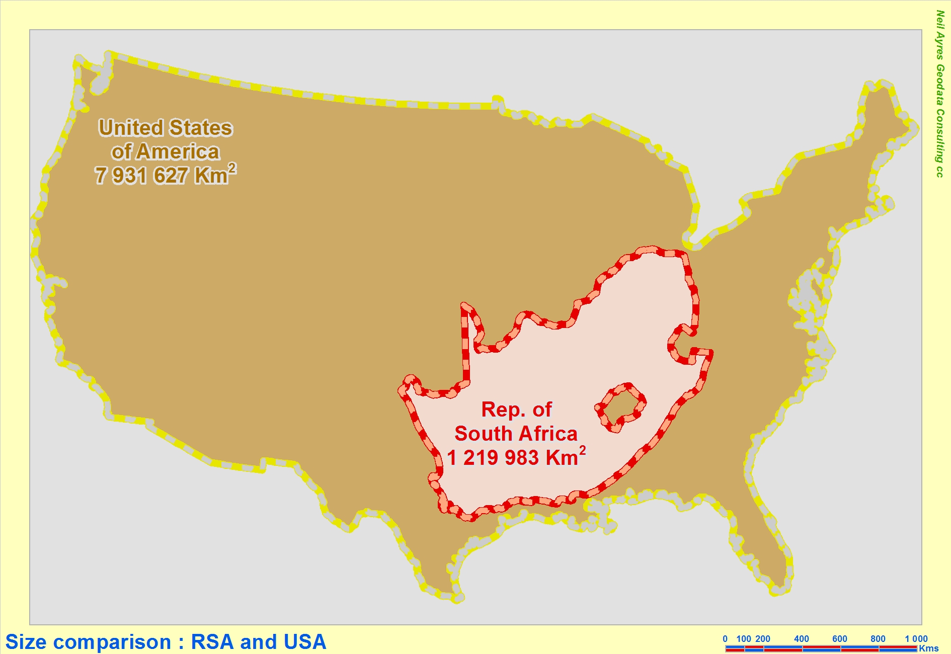
I saw this image on social media and thought it would be fun to experiment with. I obtained shapefiles for Australia and the Mediterranean sea, they used different CRSs so I projected them to a common world one (web mercator to start) and simply dragged the Mediterranean over Australia in edit mode to compare and visualise. This worked fine, but I was concerned that distortion in web mercator would make the comparison invalid.
For the comparison, distance and direction doesn't matter since the features will be moved to an arbitrary location, but shape and area needs to be accurate. Since a projection can't conserve both I toyed with some compromise projections, but most seem to distort either Aus or the Med quite heavily.
I guess this image is closest to what I'm imagining I need, size and shape conserved even if the features are not in their true location. Possibly drawing both using locally suited reference systems, then bringing one into the other's system without actually changing any of the geometry? I'm not sure if that even makes sense.
Perhaps I'm getting too hung up on projections and need to work with a geographic reference system. But I'd still need a way to visualize it accurately.
I've been using ArcMap 10 while messing around with this, but also have access to ArcGIS Pro if needed.
Many thanks in advance!
- Mark as New
- Bookmark
- Subscribe
- Mute
- Subscribe to RSS Feed
- Permalink
web mercator isn't a suitable projection for measures of area
FAQ: Why are my map, distance and area measurements wrong when using WGS 1984 Web Mercator?
... sort of retired...
- Mark as New
- Bookmark
- Subscribe
- Mute
- Subscribe to RSS Feed
- Permalink
If you want to plot 2 geographically separate objects you should use 2 different data frames. Each frame can be projected to a conformal or equal area projection appropriate for that location. Then set the scales the same and overlay each in the layout.
- Mark as New
- Bookmark
- Subscribe
- Mute
- Subscribe to RSS Feed
- Permalink
Thanks for the responses both. After playing around with this a bit more it seems I can clear the projection on one of the shapefiles (so it's set to unknown), then bring it in to the data frame with the other shapefile (which uses the second projection). It isn't on the fly projected so it keeps the same size, shape etc, so I can then compare the 2 features. Feels a bit janky but seems to work for what I want to do.
- Mark as New
- Bookmark
- Subscribe
- Mute
- Subscribe to RSS Feed
- Permalink
You do not need to have one frame in an unknown projection