Smart Campuses in Venezuela
Author: Edgar Díaz
President, Esri Venezuela.
Severe economic and political problems affecting Venezuela have resulted in the country experiencing accelerated technological and educational deterioration as well as frequent bouts of social unrest. At Esri Venezuela, we remain optimistic and expect the country will overcome these difficulties, we expect that when the time for recovery arrives, GIS will play a fundamental role in the rebuilding process.
Young generations of new graduates will be the leaders pushing for the nation’s recovery, therefore at Esri Venezuela we are promoting and assisting in the deployment of Smart Campus Projects to help universities and educational institutions, affected by the country’s economic crisis, to upgrade their facilities. Areas that need upgrading include Security, Transportation, Mobility, Energy. Environment, Management of Educational Areas, and population among others. We believe these Smart Campus projects will have a meaningful impact while helping key personnel at these institutions experience the wide scope that GIS tools provide for problem solving.
In meetings with aauthorities at different national universities, we convinced them that a university campus functions as a small town that shares some of the same problems as the surrounding city. Teaching students how to analyze and solve these problems will give them expertise to participate in the future recovery plans for the country.
Leaders at various universities understood the value of our proposal, leading to the implementation of a program where students attending some of the oldest educational institution in the country must complete a special undergraduate project before obtaining their degree. This served as the starting point for our proposal, the following examples are part of the work completed by students and faculty at some of Venezuela’s top universities.
Smart Campus Project, Universidad Central de
Venezuela.
“La Universidad Central de Venezuela (UCV),” is a symbol of pride for most Venezuelans. It is considered the country’s leading university and the oldest educational institution with more than 298 years of history. The UCV serves a student population of 62,540 individuals and the campus covers 202.53 hectares. It has several facilities throughout the country, but it is headquartered in the city of Caracas. In the year 2000, UNESCO declared the UCV a Cultural and Natural Human World Heritage.
The Smart Campus Project for the UCV began in 2017, sponsored by the Faculty of Geodesy Engineering, where our team proposed to a group of professors and students to collaborate in the creation of a basemap of the university. Esri Venezuela provided the software, tools and methodology, and supported students throughout the Project.
The first task was to collect existing information in all formats (Paper, CAD, and SHP). Flying drones throughout the Campus allowed students to update maps with extremely high precision, providing a lot of new information such as trees, electricity poles, lighting poles, parking spaces, etc.
This first task allowed the group to develop a scale 1:250 basemap of the entire university in both two and three dimensions. With the new information, we developed several apps which will remain as open data and available to support future GIS work by the next class of undergraduates. As a result, today there is a thesis on Campus Mobility with more than 60 layers of transport information (Civil Engineering).
Work has covered areas such as the development of buildings in BIM (Architecture and Engineering), Crime and Crime Prevention (Sociology), Dashboard on Real-Time Problem Care and On Campus Crimes (Political Sciences), Solid Waste and Recycling within campus (Geography), guided tour about Art and history of the UCV (Geography), existing trees, their species and diseases (Biology), Botanical Garden facilities and plants (biology). Moreover, university authorities have taken advantage of all this information to develop a plan for the maintenance of university facilities with a great degree of success.
ESRI Technology supporting creating of the Smart Campus at UC
ArcGIS Online
Survey123
Collector
Operational Dashboard for ArcGIS
Drone2Maps
ArcGIS Pro
ArcGIS Urban
Link Story Maps: https://esriven.maps.arcgis.com/apps/MapJournal/index.html?appid=d3b09792869149b18e5e963e046f5980
Link App 2D: https://esriven.maps.arcgis.com/apps/webappviewer/index.html?id=a5c509538a3d40c7b0bca72abd7deca5
Link App 3D: https://esriven.maps.arcgis.com/apps/3DScene/index.html?appid=55002756ca3a45949a13d90362d0c724
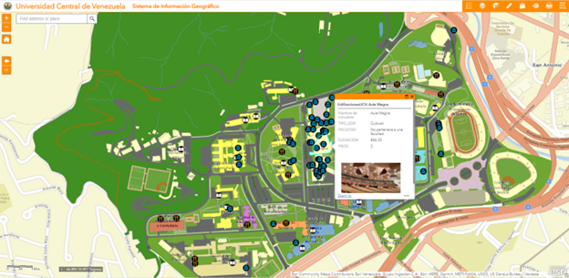
Imagen # 1: 2D View of UCV app.
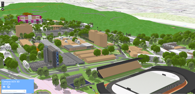
Imagen # 2: 3D View of UCV app.
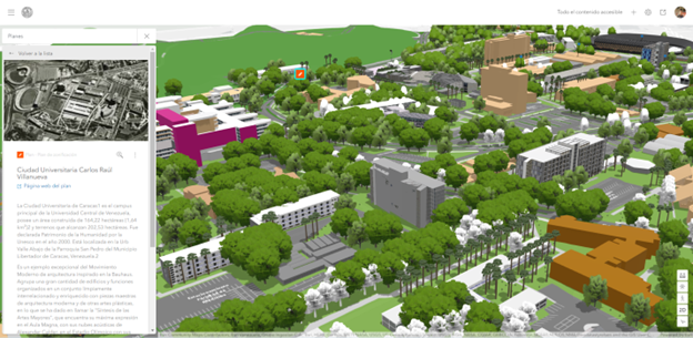
Imagen # 3: Use of ArcGIS Urban at UCV
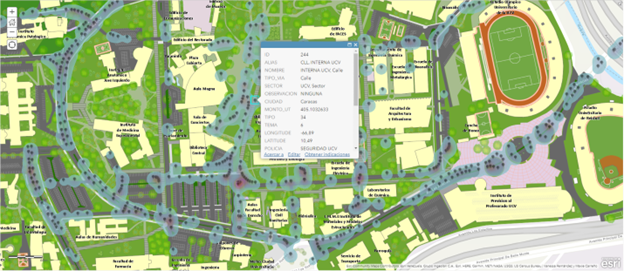
Imagen # 4: View of Crime Analysis inside UCV.
Smart Campus Project: Universidad Simón Bolívar.
“Universidad Simón Bolívar (USB),” is a public university created in 1967. It is one of the most prestigious universities in Venezuela, with a reputation for emphasizing scientific and technological knowledge. It has two locations, one in Sartanejas, Municipality of Baruta and another in the State of Miranda. It occupies 230 hectares and has a population of 15,415 students.
This project featured the same phases as the one completed at the UCV and was conducted by the Geographic Information Systems and Environmental Modeling Lab, part of the Electronic Lab at the USB. The project was sponsored and supported by the School of Urbanism. At USB, the project included internal maps of all building floors and a cadaster for the complete facility.
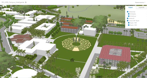
Imagen # 5: 3D View of USB app.
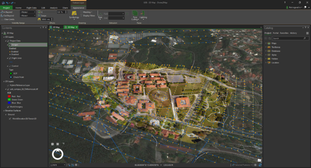
Imagen # 6: USB Drone’s Flight Path, with Drone2Map.
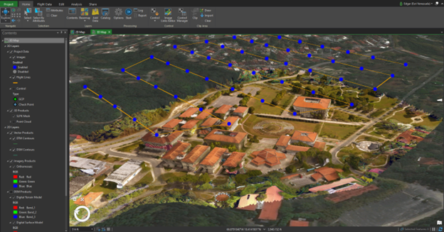
Imagen # 7: USB Campus 3D generation with Drone2Maps.
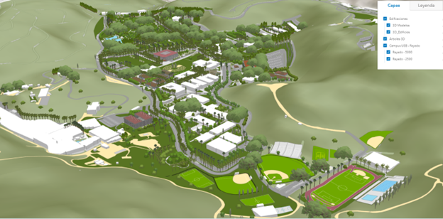
Imagen # 8: USB Campus 3D View.
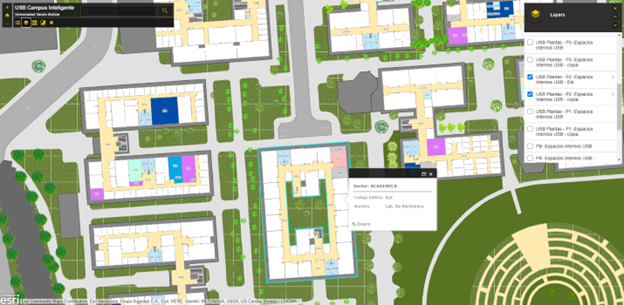
Imagen # 9: 2D View of USB app.
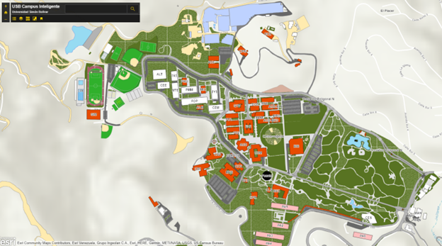
Imagen # 10: 2D Campus View in USB app.
Smart Campus Project: Universidad del Zulia (LUZ)
“La Universidad del Zulia (LUZ),” was founded in 1891 in the City of Maracaibo, State of Zulia. The campus occupies 642,000 hectares and hosts a population of 65,000 students.
This project is currently in its initial phase, the development of a Base Map. With the assistance and implementation of ESRI tools, faculty and students at the School of Geodesy of the Faculty of Engineering are developing a map of the university’s campus with centimeter precision.
ESRI Technology supporting creating of the Smart Campus at LUZ
ArcGIS Online
Survey123
Collector
Operational Dashboard for ArcGIS
Drone2Maps
ArcGIS Pro
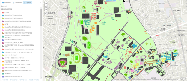
Imagen # 11: 2D View of LUZ.
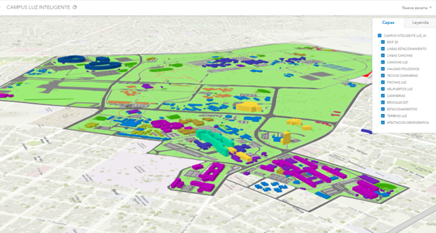
Imagen # 12: 3D View of LUZ
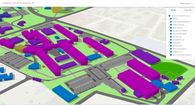
Imagen # 13:3D View of LUZ
Smart Campus Universidad Metropolitana
The Universidad Metropolitana was founded in 1970 and it is located in “Terrazas del Ávila,” in the outskirts of Caracas. The campus occupies 100 hectares and has a population of 5,500 students.
This project is centered around the development of a cartographic inventory to manage university lands. The professional team leading the project consists of engineers from the department of Construction and Sustainable Development. The project is also in its initial stage: the team has collected campus data using drones and is processing data in detail to obtain the Base Maps.
ESRI Technology used
ArcGIS Online
Survey123
Collector
Operational Dashboard for ArcGIS
Drone2Maps
ArcGIS Pro
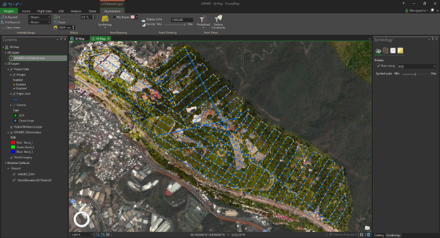
Imagen # 14: Drone’s Flight Path, with Drone2Map: Universidad Metropolitana.
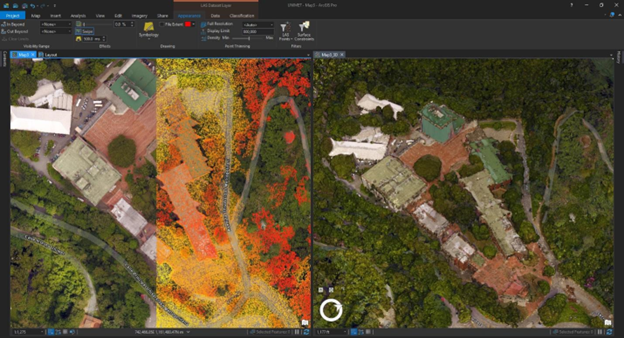
Imagen # 15: Products obtained from Drone’s flight, Drone2maps: Universidad Metropolitana
At Esri Venezuela we will continue supporting Venezuelan universities in developing Smart Campus projects. We believe that regardless of the economic and socio-political challenges facing these institutions and the country on a daily basis, there is a large community of students and young university professors who have the knowledge and skills to use GIS technology or are eager to learn and apply GIS tools in the future for planning the country’s recovery.


