Every 3D Model has a volume. ArcGIS is capable to measure the 3D volume automatically and efficiency. The data will be used in this study case are DEM (Digital Elevation Model) and also its orthomosaic. I will drag the case study of waste piles. So here they are the steps to measure its:
1. Open link Arcnesia Bima -1 - Google Drive to access the waste piles of Cipayung Landfill DEM and its orthomosaic
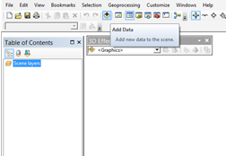
2. Open ArcScene
3. Click add data toolbar
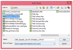
4. Choose DEM of Cipayung Landfill and its orthomosaic to be added as layers
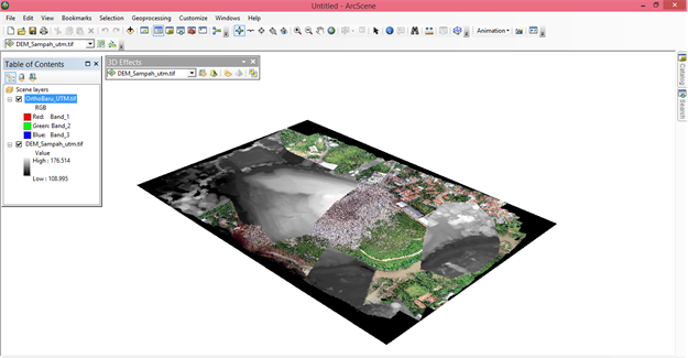
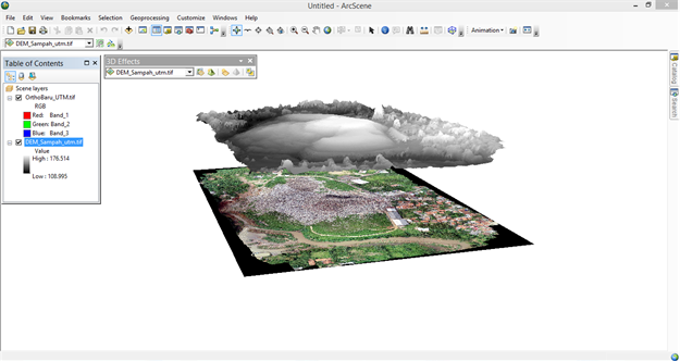
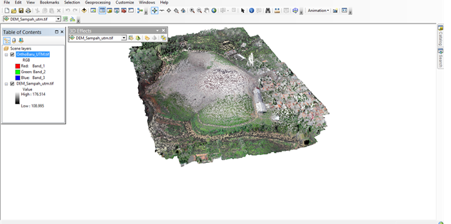
5. Your layers will be appeared like this on map surface
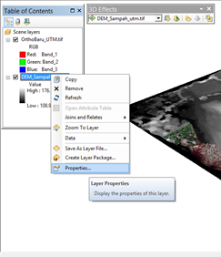
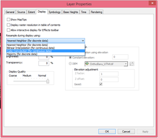
6. Right click on DEM_Sampah_utm.tif then choose properties
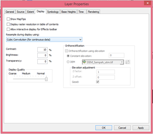
7. At the display tab, please choose cube as the resample during display using
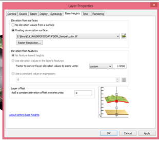
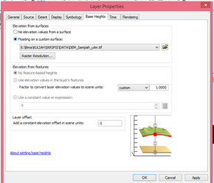
8. On the base height tab, please choose floating on a custom surface with DEM_Sampah_utm.tif data as Elevation from surfaces then click ok
9. Your DEM layer become formed as 3D visualization but not sticked into the orthomosaic layer
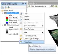
10. If you want to make it stick to orthomosaic data, right click on orthomosaic data then choose properties
11. On base height tab, please choose floating on a custom surface with DEM_Sampah_utm.tif data as Elevation from surfaces
12. On the display tab, please choose cube as the resample during display using then click ok
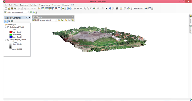
13. Vuala, your layers have been sticked
14. If you wanna visualize the orthomosaic 3D scene only, you may uncheck the DEM_sampah_utm.tif as a layer
15. Now, let's measure the volume
Click search toolbar

16. On search window, type "Surface Volume"
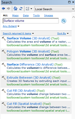
17. Choose Surface Volume (3D Analyst)
18. Choose the DEM on Input Surface window
19, You may choose ABOVE or BELOW as the Reference Plane, but in this case we choose the BELOW to measure its from bottom to top
20. Set the folder that will store the result by txt format
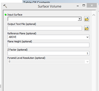
21. Click ok
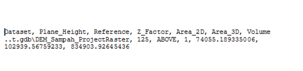
22. You will see the result.
23. The result appeared based on the result sequences. The seuqences are Dataset, Plane_Height, Reference, Z_Factor, Area_2D, Area_3D, Volume and their results are shown based from the begininng of the sequences till end
23. Share your own result by sharing on comment section down below