- Home
- :
- All Communities
- :
- Products
- :
- ArcMap
- :
- ArcMap Questions
- :
- Merging fields
- Subscribe to RSS Feed
- Mark Topic as New
- Mark Topic as Read
- Float this Topic for Current User
- Bookmark
- Subscribe
- Mute
- Printer Friendly Page
Merging fields
- Mark as New
- Bookmark
- Subscribe
- Mute
- Subscribe to RSS Feed
- Permalink
I have a shapefile with different fields which i want to use in a model. The challenge I'm facing is the fields I'm interested in are separated and I'm failing to see how i can bring them under the same column. for instance - I'm interested in Household income - yet there are different ranges from none, 1- 500, 500- 1000 etc and these ranges are presented as separate columns(fields) in the attribute table. Yet when I want t convert to raster- feature/polygon to raster tool I have to select one field which now becomes tricky. I hope it's clear enough and someone can assist.
- Mark as New
- Bookmark
- Subscribe
- Mute
- Subscribe to RSS Feed
- Permalink
Create a new column then use field calculator to populate it from your filled fields.
- Mark as New
- Bookmark
- Subscribe
- Mute
- Subscribe to RSS Feed
- Permalink
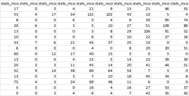
I tried that following this tutorial How To: Concatenate fields in a table in ArcMap but it doesn't work out. What I need is to have 1 field with 1 figure per row/column representing different household income classes. For example, that's part of the table: so instead of having these columns I want them under one column in different rows.
