- Home
- :
- All Communities
- :
- Products
- :
- ArcMap (Retired)
- :
- ArcMap Questions
- :
- Help with Batch Intersect
- Subscribe to RSS Feed
- Mark Topic as New
- Mark Topic as Read
- Float this Topic for Current User
- Bookmark
- Subscribe
- Mute
- Printer Friendly Page
Help with Batch Intersect
- Mark as New
- Bookmark
- Subscribe
- Mute
- Subscribe to RSS Feed
- Permalink
I am trying to run the Intersect tool in Batch mode but it is returning a single feature. I have a set of polygons representing ranges for different land animal species, but some of the polygons cross into the ocean. I want to Intersect them with a World Continents layer to make them conform to land. This works when I do it one by one, but when I try to do a batch process it only returns the last entry in the batch.
Say I setup Batch Intersect with 5 rows in the following order; Horses+Continents, Cats+Continents, Dogs+Continents, Birds+Continent, and Frogs+Continents. In this example it only returns the Intersection of Frogs+Continents.
I am using ArcMap 10.8.1.
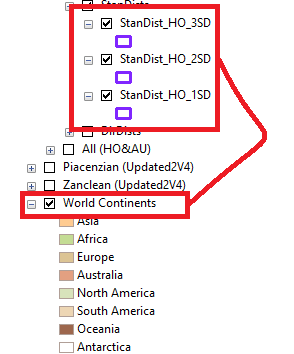
In the attached picture the red box is around the 6 separate polygons I tried to intersect with the 'World Continents' in the blue box. The yellow box is the output. Any help would be greatly appreciated!
- Mark as New
- Bookmark
- Subscribe
- Mute
- Subscribe to RSS Feed
- Permalink
Are you providing different output names ? A screenshot of the Batch Processing parameters would help.
Else, For output filename (inside a Geodatabase), type Continent_%Name%
Think Location
- Mark as New
- Bookmark
- Subscribe
- Mute
- Subscribe to RSS Feed
- Permalink
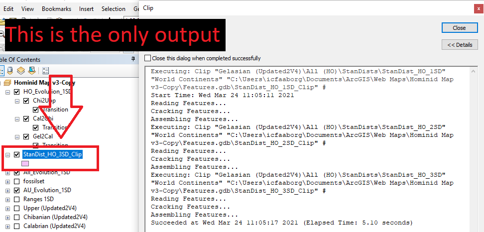
Thank you for sharing the screenshot. I think all the outputs are generated perfectly. Only the last one gets added to the map.
Please navigate to the path ...\Features.gdb (from Catalog or Add Data button) and check if all the output feature classes are present. Add the Feature classes to the map and verify.
Think Location
- Mark as New
- Bookmark
- Subscribe
- Mute
- Subscribe to RSS Feed
- Permalink
Strange, may be a bug in the batch tool. Also you might be best just using Clip Clip—Help | ArcGIS for Desktop if you're not concerned about appending the continent's attributes.
As a side note, your standard distance looks very circular for a world-sized area. I think you may have a projection issue with your data.
- Mark as New
- Bookmark
- Subscribe
- Mute
- Subscribe to RSS Feed
- Permalink
Thank you for your response! I will be using the clip tool now, it seems to be faster. I checked the projections and they are consistent. All of the layers are currently set to WGS_1984_Web_Mercator_Auxiliary_Sphere for PCS and GCS_WGS_1984 for GCS. Is the Standard Distance tool supposed to output non-circular shapes?
- Mark as New
- Bookmark
- Subscribe
- Mute
- Subscribe to RSS Feed
- Permalink
I guess what I was trying to say is that Standard Distance very likely isn't a geodesic method, and considering that scale is not consistent across that projection, and the size of the area you're looking at, you would have to take the standard distances with a big pinch of salt.