- Home
- :
- All Communities
- :
- Products
- :
- ArcGIS Web AppBuilder
- :
- ArcGIS Web AppBuilder Questions
- :
- Re: Situation Awareness Widget - Use feature layer...
- Subscribe to RSS Feed
- Mark Topic as New
- Mark Topic as Read
- Float this Topic for Current User
- Bookmark
- Subscribe
- Mute
- Printer Friendly Page
Situation Awareness Widget - Use feature layer as incident
- Mark as New
- Bookmark
- Subscribe
- Mute
- Subscribe to RSS Feed
- Permalink
Is it possible to leverage a layer in the situation awareness widget to represent the incident. For example, I want to use the forecasted hurricane locations as my incident to find nearby locations that might be impacted. Right now, I can only locate the incident manually.
- Mark as New
- Bookmark
- Subscribe
- Mute
- Subscribe to RSS Feed
- Permalink
Hi ! Thanks for your question ---
Yes, this is possible through the feature's pop up. From the forecasted location point on the map, click the ellipses (...) to expand the Feature Action list. From here, click "Set Location" to use that feature's geometry as the input for the Situation Awareness widget.
Here's a screenshot of what that looks like --
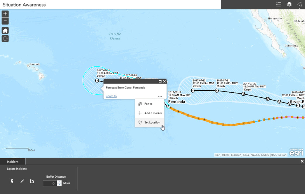
Note that the Set Location feature action is available whether the Situation Awareness widget is open or not, so it can be used in various points of your workflow.
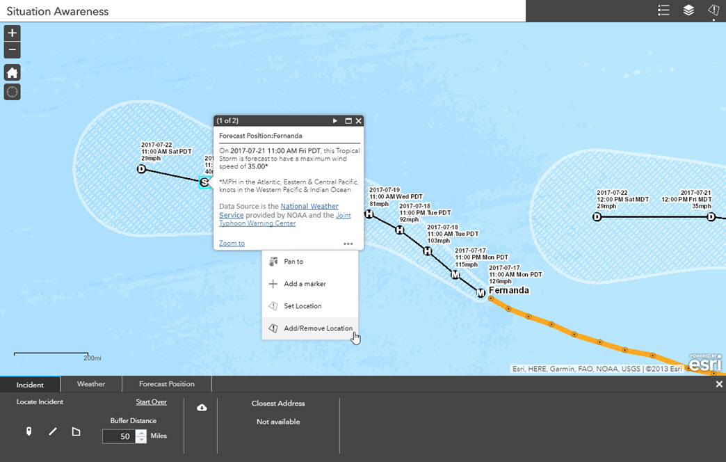
If you'd like to use multiple forecasted locations, you can do this with the Add/Remove location action. Once an initial location is defined, this additional feature action becomes available --
Let me know if this address your question --
jess
- Mark as New
- Bookmark
- Subscribe
- Mute
- Subscribe to RSS Feed
- Permalink
Jess,
Thanks that does answer my question. It also could let me select it as in input into some of my GP tool widgets which is a nice benefit as well. If I select multi features using that option, it appears as though the list of locations within the polygon/buffer is provided by it does not differentiate which incident(s) it is impacted by. Is that correct?
TODD HENRY
SR. TECHNICAL MANAGER, REAL ESTATE MARKET RESEARCH
345 Court Street l Coraopolis, PA 15108
[email protected]<mailto:[email protected]> l o: 724-260-5545 l m: 412-522-3269
- Mark as New
- Bookmark
- Subscribe
- Mute
- Subscribe to RSS Feed
- Permalink
Hi Todd -- That's correct. If you add multiple locations into your incident, the widget does not differentiate the analysis results between the incidents.
Depending on what your needs are, you could run the widget multiple times and then download lists or reports from the widget summarizing the information for each location.