- Home
- :
- All Communities
- :
- Products
- :
- ArcGIS Web AppBuilder
- :
- ArcGIS Web AppBuilder Questions
- :
- Re: Increase zoom level (aerial imagery)
- Subscribe to RSS Feed
- Mark Topic as New
- Mark Topic as Read
- Float this Topic for Current User
- Bookmark
- Subscribe
- Mute
- Printer Friendly Page
- Mark as New
- Bookmark
- Subscribe
- Mute
- Subscribe to RSS Feed
- Permalink
I have an aerial imagery layer with high in zoom levels. Adding it to the web app builder, the in-zoom levels are restricted due to base map in-zoom levels. Is there a way to circumvent this and make use of the high resolution aerial imagery to its maximum?
Solved! Go to Solution.
Accepted Solutions
- Mark as New
- Bookmark
- Subscribe
- Mute
- Subscribe to RSS Feed
- Permalink
 Hi Sravanthi Murali,
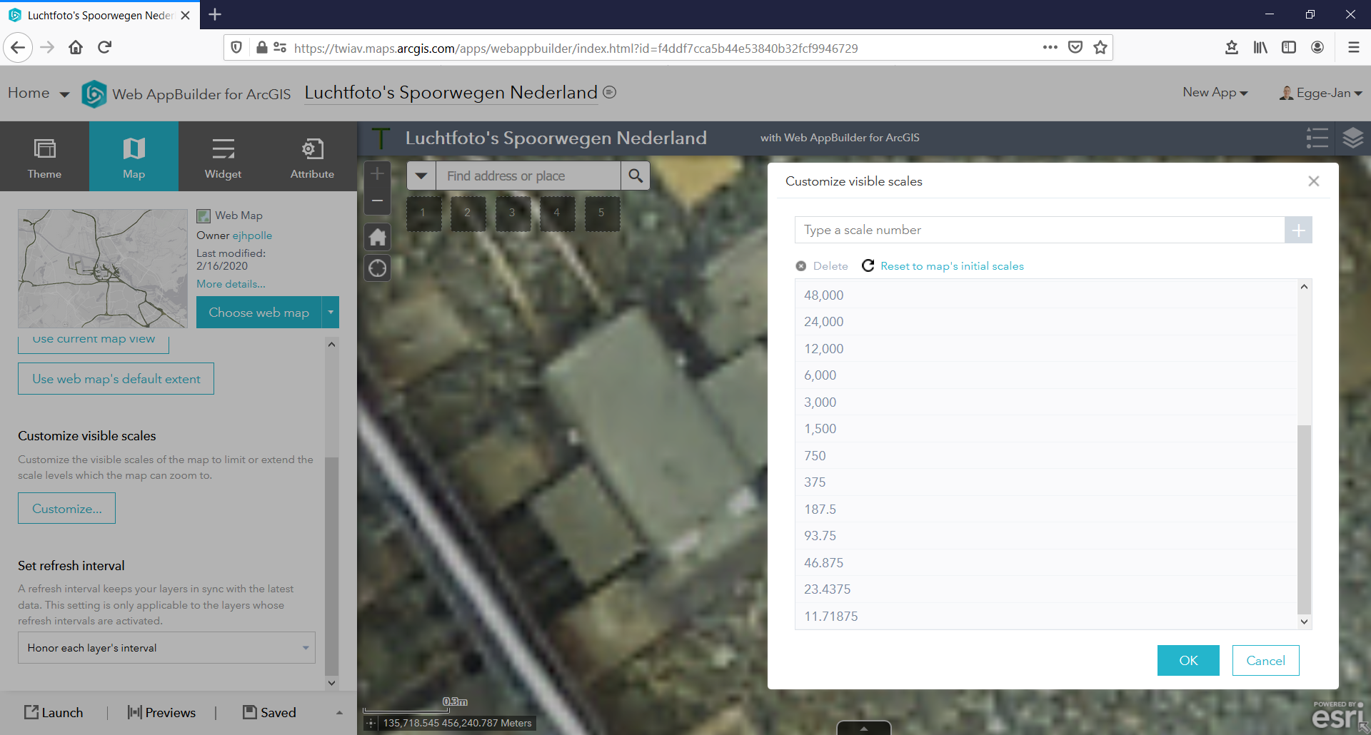
Apparently the basemap determines the visible range of a map. Most basemaps offered by Esri Nederland, for example the light gray canvas in RD, offer the levels 0 (1:12,288,000) to 16 (1:187.5). This means that you can not zoom in beyond 1:188, which for these detailed aerial pictures (and for other cases) definitely is not enough...
You might set the aerial photo as the basemap - this will allow you to zoom in further.
But in your use case, it might be a better option to Customize visible scales in the Web Mapping Application instead. As Robert Scheitlin, GISP indicates above, in the Web AppBuilder for ArcGIS go to the Map tab and add additional levels - see screen capture above.
I have added the levels 93.75, 46.875, 23.4375 and 11.71875. And this allows me to zoom in to railway sleeper ('dwarsligger') level.
Hope these answers do help to solve your issue. Which one do you pick as the correct one? 🙂
Cheers,
Egge-Jan
- Mark as New
- Bookmark
- Subscribe
- Mute
- Subscribe to RSS Feed
- Permalink
On the map tab you can click a button for levels of display (LODs). There you can add additional levels.
- Mark as New
- Bookmark
- Subscribe
- Mute
- Subscribe to RSS Feed
- Permalink
Hi Sravanthi Murali,
Apparently the basemap determines the visible range of a map. Most basemaps offered by Esri Nederland, for example the light gray canvas in RD, offer the levels 0 (1:12,288,000) to 16 (1:187.5). This means that you can not zoom in beyond 1:188, which for these detailed aerial pictures (and for other cases) definitely is not enough...
You might set the aerial photo as the basemap - this will allow you to zoom in further.
But in your use case, it might be a better option to Customize visible scales in the Web Mapping Application instead. As Robert Scheitlin, GISP indicates above, in the Web AppBuilder for ArcGIS go to the Map tab and add additional levels - see screen capture above.
I have added the levels 93.75, 46.875, 23.4375 and 11.71875. And this allows me to zoom in to railway sleeper ('dwarsligger') level.
Hope these answers do help to solve your issue. Which one do you pick as the correct one? 🙂
Cheers,
Egge-Jan
- Mark as New
- Bookmark
- Subscribe
- Mute
- Subscribe to RSS Feed
- Permalink
Hi Egge-Jan Pollé,
Thank you very much for the detailed answer! I just tried this out and it works like a charm 
Sravanthi