- Home
- :
- All Communities
- :
- Products
- :
- ArcGIS Web AppBuilder
- :
- ArcGIS Web AppBuilder Questions
- :
- Incident Analysis - input for distance doesn't wor...
- Subscribe to RSS Feed
- Mark Topic as New
- Mark Topic as Read
- Float this Topic for Current User
- Bookmark
- Subscribe
- Mute
- Printer Friendly Page
Incident Analysis - input for distance doesn't work?
- Mark as New
- Bookmark
- Subscribe
- Mute
- Subscribe to RSS Feed
- Permalink
I am trying to configure the Incident Analysis widget. When you use the slider on the buffer distance, it works. IIf you use what looks like an input field to enter a distance, this doesn't work.
This seems like a bug, but I haven't found a note of this yet. This is the online version.
Solved! Go to Solution.
Accepted Solutions
- Mark as New
- Bookmark
- Subscribe
- Mute
- Subscribe to RSS Feed
- Permalink
Tracy Schloss it is indeed an ESRI bug.
I know what you mean. You enter distance, then click the Point or other geometry. I think that will instinctively be the workflow of many users. You instinctively as a user focus on the length, enter it, then select Point or other drawing tool, to place it on the map for the buffer. Yet, it draws what the slider was. The slider stays stuck. The fix is below.
It is a bug in both WAB 1.2 and 1.3.
The fix is here in my thread.
insert on Line 481 (insert under the following line.... this.own(on(this.horizontalSlider, "change", lang.hitch(this...., this._sliderChange)));
-----
this.own(on(this.sliderValue, "change", lang.hitch(this, this._updateSliderValue)));
-----
geonet.esri.com/message/583971
Important Note for WAB 1.2 users: do not use this widget in 1.2 of the Builder. It measures incorrectly. At least in coastal Georgia, it under-measures distance. This was against known lengths of features that are actually part of the Esri topo basemap, that I tested it on. I confirmed with other measure tools and other vector data. Support reproduced it, but stated they will not patch Builder 1.2 widgets. The only solution is to migrate your site to 1.3.
- Mark as New
- Bookmark
- Subscribe
- Mute
- Subscribe to RSS Feed
- Permalink
Hi Tracy,
Have you tried reproducing this in other web maps? I was able to get this working successfully.
- Mark as New
- Bookmark
- Subscribe
- Mute
- Subscribe to RSS Feed
- Permalink
It must have needed lunch. I tried several times this AM and no matter what distance I entered, it always drew the distance the same as the original size. Now it seems to be working. Weird. I'm going to keep an eye on it, definitely.
- Mark as New
- Bookmark
- Subscribe
- Mute
- Subscribe to RSS Feed
- Permalink
Or, maybe someone partied too hard during last nights Superbowl 
- Mark as New
- Bookmark
- Subscribe
- Mute
- Subscribe to RSS Feed
- Permalink
Nothing that interesting. Must be Monday.
- Mark as New
- Bookmark
- Subscribe
- Mute
- Subscribe to RSS Feed
- Permalink
Tracy Schloss it is indeed an ESRI bug.
I know what you mean. You enter distance, then click the Point or other geometry. I think that will instinctively be the workflow of many users. You instinctively as a user focus on the length, enter it, then select Point or other drawing tool, to place it on the map for the buffer. Yet, it draws what the slider was. The slider stays stuck. The fix is below.
It is a bug in both WAB 1.2 and 1.3.
The fix is here in my thread.
insert on Line 481 (insert under the following line.... this.own(on(this.horizontalSlider, "change", lang.hitch(this...., this._sliderChange)));
-----
this.own(on(this.sliderValue, "change", lang.hitch(this, this._updateSliderValue)));
-----
geonet.esri.com/message/583971
Important Note for WAB 1.2 users: do not use this widget in 1.2 of the Builder. It measures incorrectly. At least in coastal Georgia, it under-measures distance. This was against known lengths of features that are actually part of the Esri topo basemap, that I tested it on. I confirmed with other measure tools and other vector data. Support reproduced it, but stated they will not patch Builder 1.2 widgets. The only solution is to migrate your site to 1.3.
- Mark as New
- Bookmark
- Subscribe
- Mute
- Subscribe to RSS Feed
- Permalink
I agree that it should work in whatever order the user tries it. I must have instinctively been doing it one way originally and changed it up a little when I was paying more attention.
It's always frustrating to hear of a bug that exists through multiple versions.
- Mark as New
- Bookmark
- Subscribe
- Mute
- Subscribe to RSS Feed
- Permalink
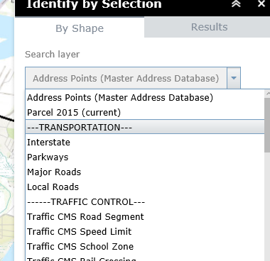
Tracy Schloss I have a "fix". If you just need it to draw a visual buffer, don't use this tool. Use Robert's eSearch. In Search by Shape, be sure the list of layers to search includes a "dummy layer" that is empty. I had plenty to choose from, because since I had over a hundred layers in the list I needed to create "separators". I direct our users to select Transportation then draw a graphic with the Buffer Graphic selected. This in effect simply "draws" a graphic. Almost as intuitive as the Esri widget. And, the bonus of not cluttering the toolbar with another tool, at least from our view.