- Home
- :
- All Communities
- :
- Products
- :
- ArcGIS Web AppBuilder
- :
- ArcGIS Web AppBuilder Questions
- :
- Re: Inability to sort in query widget when using m...
- Subscribe to RSS Feed
- Mark Topic as New
- Mark Topic as Read
- Float this Topic for Current User
- Bookmark
- Subscribe
- Mute
- Printer Friendly Page
Inability to sort in query widget when using map image layer
- Mark as New
- Bookmark
- Subscribe
- Mute
- Subscribe to RSS Feed
- Permalink
I've regularly used the query function in the Web Appbuilder and sorted my results by different fields as required. Recently I've had a very large dataset, which I couldn't load directly, and instead had to share as a web map layer from Pro. Although I can set up a query to run on this layer, the option to 'Sort' is greyed out. I assume this is something to do with it not being a standard feature layer, but wonder what I can do, as not being able to sort my results is very annoying.
- Mark as New
- Bookmark
- Subscribe
- Mute
- Subscribe to RSS Feed
- Permalink
Not too sure, I'd probably investigate by also publishing as a Feature Service (tick Feature Access as a capability on publishing, or tick it on in the ArcGIS Sever map image service properties). Or add a new feature by URL specifying the Map Service URL, making it then referenced as a feature service.
- Mark as New
- Bookmark
- Subscribe
- Mute
- Subscribe to RSS Feed
- Permalink
Thanks David. I'll give it a try. It was the first time I'd done a share from Pro, as I've never had issues with adding layers direct before.
- Mark as New
- Bookmark
- Subscribe
- Mute
- Subscribe to RSS Feed
- Permalink
Hi David,
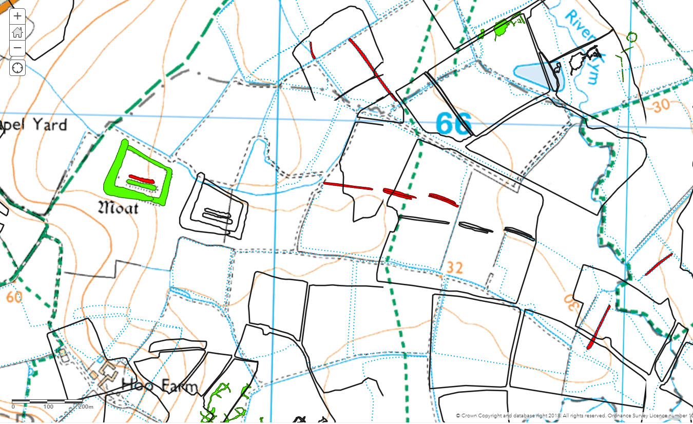
I tried that, and it does indeed allow me to sort 😀, but now I've got a different problem. Although it's exactly the same layer as I exported/shared as a 'map image', for some reason this comes in at the wrong location, offset c200m ☹️. I can't think of any reason why this should be, and I've tried saving it as a different layer and then importing, and again it's offset. The original data appears using symbology; the newly shared as a black outline.
Any thoughts anyone?
- Mark as New
- Bookmark
- Subscribe
- Mute
- Subscribe to RSS Feed
- Permalink
Not far from Huntingdon where I used to live.
What are you viewing this in, Pro or WAB? So the map image service displays in the right place but the feature service does not? How did you publish the feature layer in the end?
Certainly looks like a projection issue, something like the wrong transformation of WGS84 to BNG being applied (e.g. the 1 parameter one instead of the 7 or 9).
- Mark as New
- Bookmark
- Subscribe
- Mute
- Subscribe to RSS Feed
- Permalink
Hi David,
That was very well spotted! You must know the area well.
Actually, I'm viewing it in Portal; this is the web map, where I'd normally do the symbology, configure the pop-ups etc, but since it's in the wrong place I'm a bit stumped. It's not clear in Pro where, if anywhere, you configure things like projections, and since it appears to be in the same location as the original (i.e. the right place) in Pro, it must be happening between Pro and Portal.
- Mark as New
- Bookmark
- Subscribe
- Mute
- Subscribe to RSS Feed
- Permalink
Just saw it was ordnance survey mapping and did some detective work because I'm sad.
What is the layer? Is it something you've digitized? Looks like a projection issue - what are the coordinate systems of the data and your portal basemap? Everything in BNG?
previous questions - So the map image service displays in the right place but the feature service does not? How did you publish the feature layer in the end?
if there's a difference between the map service and the feature service display, that sounds very funky - if so perhaps try a new mapmap to test in.
If you can walk through the steps to get where you are now it might give more insight.
- Mark as New
- Bookmark
- Subscribe
- Mute
- Subscribe to RSS Feed
- Permalink
The layer relates to the historic environment and yes, it has been digitized, from aerial photos etc.
I've had both OSGB and WGS84 versions of the data, which appear in the same location in Pro. I'm not certain, but I think the Portal web map is WGS84 by default.
I tried starting with a new blank map and imported the 'map image' and the 'feature' separately; they came in as with my existing map, 'map image', correct; 'feature layer', offset.
In terms of steps, I created the layer in ArcMap, but then because I had to combine a number of layers, I had to move to Pro as ArcMap couldn't cope. I carried out the 'merge' in pro to create the combined layer. It was this layer that I shared first as a 'map image', at which point I couldn't sort the resulting query, and then as a 'feature', which comes in offset. I can't see how changing the form in which the data is shared should affect its projection.
Does that help?
- Mark as New
- Bookmark
- Subscribe
- Mute
- Subscribe to RSS Feed
- Permalink
so you published it as a feature service from Pro?
the projection of the portal basemap defines any projections/transformations needed, do you have your own basemap or are you just using an AGOL one?
all your data you are publishing is in BNG?