- Home
- :
- All Communities
- :
- Products
- :
- ArcGIS Web AppBuilder
- :
- ArcGIS Web AppBuilder Questions
- :
- Hiding Scale-specific Layers in Layer List?
- Subscribe to RSS Feed
- Mark Topic as New
- Mark Topic as Read
- Float this Topic for Current User
- Bookmark
- Subscribe
- Mute
- Printer Friendly Page
Hiding Scale-specific Layers in Layer List?
- Mark as New
- Bookmark
- Subscribe
- Mute
- Subscribe to RSS Feed
- Permalink
Is it possible to hide scale-specific Layers from users within the Layer List Widget? For instance, I'm using ESRI's Diversity Index map in my WAB Mapping Application, and currently, this is what users see when expanding the Index's layer in the Layer List:
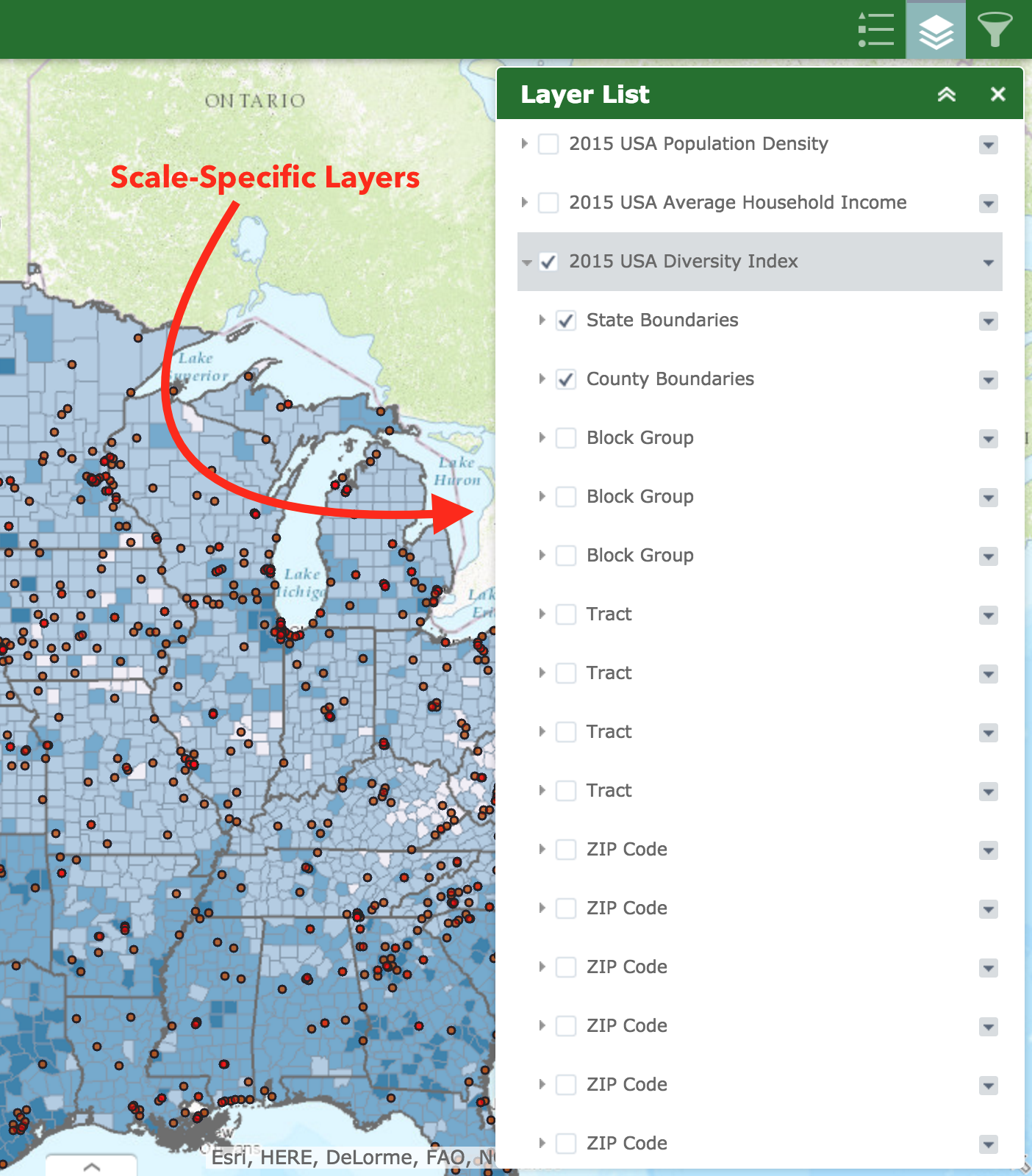
Is it possible to consolidate, or even hide these repetitive layers - i.e. Block Group, Tract, etc? I realize each layer is critical for the proper scaling of the Diversity Index Map Layer. However, allowing users to see this level of detail seems like it will just cause confusion. Any potential solution to this?
- Mark as New
- Bookmark
- Subscribe
- Mute
- Subscribe to RSS Feed
- Permalink
Jason,
look at this thread where I provide code to gray out scale dependent layers. You can modify the code to instead set the style to display none for those layers out of scale range.