- Home
- :
- All Communities
- :
- Products
- :
- ArcGIS Urban
- :
- ArcGIS Urban Questions
- :
- Re: Apply Building Type - buildings underground
- Subscribe to RSS Feed
- Mark Topic as New
- Mark Topic as Read
- Float this Topic for Current User
- Bookmark
- Subscribe
- Mute
- Printer Friendly Page
Apply Building Type - buildings underground
- Mark as New
- Bookmark
- Subscribe
- Mute
- Subscribe to RSS Feed
- Permalink
Hi there,
I have noticed that sometimes when using Apply Building Type, the buildings are appearing underground or partially underground but they appear to be populating the building regulation window correctly. The buildings are drawing on the surface if I use Edit -> Draw Building and are correctly populating the building regulation window.
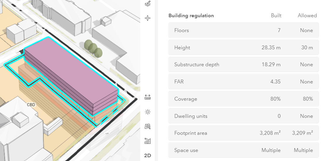
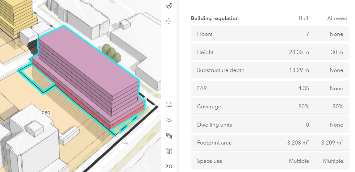
I checked on a parcel that with a scenario that was created before the last update and added a new scenario (Scenario 1 - Apply Building Type.png versus New scenario - Apply Building Type.png) as an equal comparison.
This appears to be happening in both Land Use Plans and Zoning Plans. I also encountered this in a different Urban model.
I am wondering if there is a height setting in one of my 3D Base Layers that needs to be adjusted since the most recent Urban update?
I should mention that I am not using a local DTM for the ground elevation in either of these areas shown in the images. Both areas were left as the default World Elevation for the ground elevation surface when extruding existing buildings. Should I re-upload my base layers with the local DTM elevation layer for these areas?
Thanks in advance!
- Mark as New
- Bookmark
- Subscribe
- Mute
- Subscribe to RSS Feed
- Permalink
Hi @lbedard ,
Thanks for your question and for sharing your experience with the community.
Some follow-up questions to better understand the issue that you are experiencing:
- Do you currently have a custom elevation layer configured on your Urban Model?
- Did you have a custom elevation layer configured on your Urban Model when the building in scenario 1 was generated?
- When you create a new scenario 2 based on Scenario 1, go to Zoning mode and then click "Reapply all building types": will the building(s) be positioned like in "Scenario 1" or rather like in the "New Scenario"?
Right now, Urban behaves as follows when working with custom elevation layers:
- Applying a building type within the extent of a custom elevation layer: the parcel's vertex with the minimal height determines the z-value at which the building is positioned. The z-value is taken from the custom elevation layer.
- Applying a building type outside of the extent of a custom elevation layer: the building is placed at a height of 0.
- Drawing a custom space within the extent of a custom elevation layer: the z-value at the position where you start drawing determines the height at which the building space is positioned. The z-value is taken from the custom elevation layer.
- Drawing a custom space outside of the extent of a custom elevation layer: the z-value at the position where you start drawing determines the height at which the building space is positioned. The z-value is taken from the default World Elevation service.
We will investigate if and how the user experience can be improved when working with building types outside the extent of a custom elevation layer.
Thanks.
Dominik
- Mark as New
- Bookmark
- Subscribe
- Mute
- Subscribe to RSS Feed
- Permalink
Hi Dominik,
Thanks for your reply.
For your follow-up questions, my answers are as follows:
- I do currently have a custom elevation layer configured in the Urban model
- I did have the same custom elevation layer configured when scenario 1 was created
- When I created a new scenario based on scenario 1, and reapplied building types, the buildings were positioned like "New Scenario"
Thanks for the clarification and thank you for looking into this.
- Mark as New
- Bookmark
- Subscribe
- Mute
- Subscribe to RSS Feed
- Permalink
Hi @lbedard ,
Thanks for answering my follow-up questions. Unfortunately, due to technical limitations, buildings are placed at a height of 0 when applying a building type to a parcel that is outside of the custom elevation layer's extent. We will investigate ways to improve the user experience in such cases in a future version of Urban and will keep you posted.
In the meantime, I'd recommend removing the custom elevation layer when applying a building type on a parcel that is outside of the custom elevation layer's extent.
Sorry for any caused inconvenience and thanks for your understanding.