Turn on suggestions
Auto-suggest helps you quickly narrow down your search results by suggesting possible matches as you type.
Cancel
- Home
- :
- All Communities
- :
- Products
- :
- ArcGIS Survey123
- :
- ArcGIS Survey123 Questions
- :
- Integrating Survey123 with Collector for ArcGIS
Options
- Subscribe to RSS Feed
- Mark Topic as New
- Mark Topic as Read
- Float this Topic for Current User
- Bookmark
- Subscribe
- Mute
- Printer Friendly Page
Integrating Survey123 with Collector for ArcGIS
Subscribe
735
1
06-11-2018 04:00 PM
06-11-2018
04:00 PM
- Mark as New
- Bookmark
- Subscribe
- Mute
- Subscribe to RSS Feed
- Permalink
Hello,
I would like to add just for visualization the fs. of a Survey into a webmap used offline by Collector for ArcGIS. Any idea on how to do this?
Simple adding, disable editing, creating a non-editable view of the Survey123 feature service....none of these options let me download the Collector map for offline use.....
1 Reply
06-18-2018
01:23 AM
- Mark as New
- Bookmark
- Subscribe
- Mute
- Subscribe to RSS Feed
- Permalink
Hi Roxana,
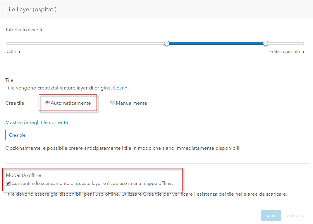
maybe creating Tile layer from FLHof your survey...setting "automatic creation" and "offline mode" and then put this into basemap.

Cheers
Stefano