- Home
- :
- All Communities
- :
- Products
- :
- ArcGIS Survey123
- :
- ArcGIS Survey123 Questions
- :
- Geopoint Height and Display
- Subscribe to RSS Feed
- Mark Topic as New
- Mark Topic as Read
- Float this Topic for Current User
- Bookmark
- Subscribe
- Mute
- Printer Friendly Page
Geopoint Height and Display
- Mark as New
- Bookmark
- Subscribe
- Mute
- Subscribe to RSS Feed
- Permalink
I am experiencing an issue that i can't seem to figure out. I have created a survey using the theme-grid style. On this survey is a geopoint and further down the form is another geopoint in a repeat. Here is how the first geopoint displays in my survey:
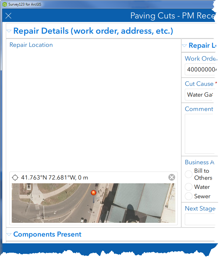
There is a lot of empty space so I set the height of the question to height=20 in the body::esri:style column. This is the result:
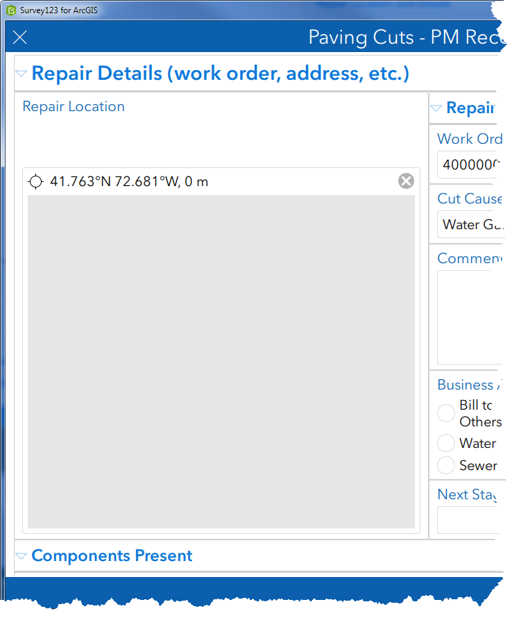
I can't see the map. I get a gray box that appears to be the height that I set. If I click on the map and the click a new location, the map appears in my survey.
Further down in my survey, I have another geopoint in a repeat. The geopoint location is set based on the location in the first geopoint question. In the XLSForm, the geopoint question is configured exactly the same but displays the map:

Why does the first geopoint question not display correctly with a height set but the second does? Thanks.
- Mark as New
- Bookmark
- Subscribe
- Mute
- Subscribe to RSS Feed
- Permalink
Hi Jim,
What version of survey123 app are you using?
Are you able to see the map correctly in Connect as well?
- Mark as New
- Bookmark
- Subscribe
- Mute
- Subscribe to RSS Feed
- Permalink
Hi Shwu-jing!
I am using 3.7.60. The issue is the same in Connect.
Thanks.
- Mark as New
- Bookmark
- Subscribe
- Mute
- Subscribe to RSS Feed
- Permalink
Hi Jim,
I tested your form with field app 3.7.57 and Connect 3.7.60 and I have no problem to see the first map:
Both builds are 64-bit on Windows 10.
What is your OS configuration?
I'd suggest to contact Esri Tech Support to troubleshoot this further as I can't seem to reproduce your issue here.

Thanks,