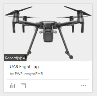
UAS Flight Log
- Subscribe to RSS Feed
- Mark as New
- Mark as Read
- Bookmark
- Subscribe
- Printer Friendly Page
UAS Flight Log
Using Survey123 to perform UAS preflight checklists and track UAS flight projects
By: Josh Shelton, GIS Manager, Pend Oreille County, Washington
Eric Roth, County Surveyor, Pend Oreille County, Washington
Sometimes the most elegant solutions are the simplest. This was the thinking behind using Survey123 to transform what was a pen and paper menial task into a more efficient, portable and user-friendly digital workflow.
In this article, we will discuss our motivations to use Survey123 at Pend Oreille County to support UAS (Unmanned Aerial Aircraft) operations. We will also share details on our implementation, approach to engage with stakeholders and lessons learned.
Understanding the need and benefits of using a UAS in Pend Oreille County
Pend Oreille County, Washington is a scenic rural county in the northeastern corner of Washington state nestled against the state of Idaho and Canada. Pend Oreille County encompasses approximately 1500 square miles of lush coniferous forest and is divided by the Pend Oreille River, a major tributary of the Columbia River.
Pend Oreille County utilizes UAS primarily for gravel pit & stockpile quantity calculations. The benefit here is that our crews spend a third less time collecting data than it would take utilizing conventional survey methods. We also use UAS for roadway pre-design topography maps, bridge inspections, flood tracking, and land slide tracking. By using UAS for these situations, our personnel can operate the equipment from a remote location keeping them safe and out of harm’s way.
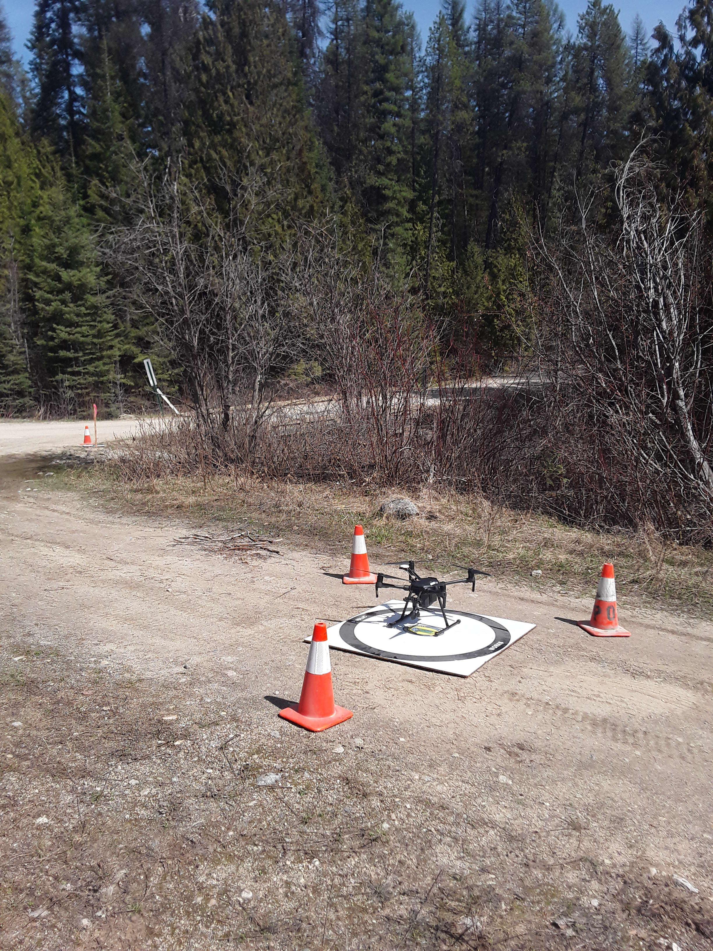
UAS launch site prior to flight
Eric Roth, Pend Oreille County
Unlocking the potential of Survey123 – Empowering our Users
Being a rural county and an organization with less than 200 employees, at the Pend Oreille County GIS group we are constantly trying to think outside the box when it comes to improving workflows while maintaining our need to be fiscally responsible for our constituents.
In an effort to better facilitate collaboration and information sharing, the Pend Oreille County GIS staff formed an internal GIS user group in 2009. This group discusses new technologies, showcases new projects and shares ideas empowering our users to improve the way they work with GIS.
This is exactly what happened when the GIS Department showcased Survey123 to the group for the first time. We discussed the power and simplicity of Survey123 and showcased how easily smart forms can be created without the need for advanced GIS or developer skills. When our county surveyor saw the technology he immediately began thinking of ways he could leverage Survey123 to improve his own workflows. This ultimately led to the creation of the UAS Flight Log.
FAA regulations mandate that all UAS (Unmanned Aerial System) pilots perform and document a thorough preflight check on their equipment and surroundings. UAS flight logs must also be documented.
Commonly, preflight checks and flight logs are manually recorded on paper. Completing these paper forms is cumbersome and can lead to errors and even data loss. There are several reasons why Survey123 smart forms are a natural replacement for obsolete paper forms:
- Survey123 runs on the same mobile devices that everyone already has. There is no need for an additional piece of paper when the form can be completed on your own mobile phone or tablet.
- Survey123 smart forms streamline data capture, allowing UAS pilots to focus in areas of the preflight check and flight log that require more attention.
- Certain critical information such as location, times and photos are particularly easy to capture with Survey123 in a systematic and accurate way. That is the opposite of what happens with traditional paper forms.
- Survey123 forms can be easily synced with our ArcGIS organization. This reduces chances for data loss, eliminates transcription errors, and facilitates immediate access to this information for visualization, reporting and sharing.
The nuts and bolts of our survey design
The survey was developed entirely using the Survey123 web designer at survey123.arcgis.com. The basic premise was to take the preflight checklists already being performed and recreate these in the survey. The added benefit here is that one could integrate post-flight observations as well as log our flight location and record the event with photos. The survey design is split into 4 logical sections:
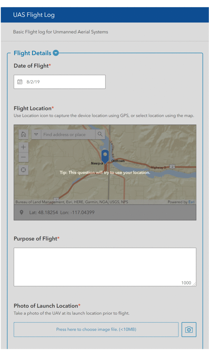
Form Summary
- Flight Details – Here we record the following:
- Date of capture – This auto populates further simplifying the process
- Location – Uses device GPS to provide location or the user can select from the map.
- Purpose of flight – Comment field allowing for a customized description
- Photo of the UAS at the launch location – This helps to prove project location and UAS used, as well as the condition of the launch location
- Weather conditions – Comment field for customized descriptions
- Name of RPIC (Remote Pilot in Command) – Comment field for customized entry
- UAS pilot name, if different than the RPIC – Comment field for customized entry
- VO (Visual Observer(s)) names, if applicable – Comment field for customized entry
- UAS Details – Here we record the Make and Model of the UAS.
- UAS Manufacturer – prepopulated dropdown containing the manufacturer of the UAS being used
- UAS Model – prepopulated dropdown containing the model of UAS being used
- Pre-Flight Check List – This is a simple check list where the following items are “checked off” as they are inspected:
- Batteries charged and secure?
- Aircraft Hardware OK?
- Equipment & Gear OK?
- Remote Control OK?
- Propellers OK & Secured to UAS?
- Software & Firmware Versions Up to Date?
- Remote Control is Powered ON?
- UAS is Powered ON?
- UAS Compass is Calibrated?
- Camera is ON & Calibrated?
- UAS GPS is Functioning?
- Flight Control App is Running & Connected to UAS?
- Pre-Flight Notes – Here any ancillary information can be noted
- Post-flight details – here we record flight start/stop times and note any post-flight observations
- Begin Flight – record the time the flight began
- End Flight – record the time the flight ended
- Post-Flight Notes – Records any additional observations
For those of you interested in seeing what we've done, here is the XLSForm.
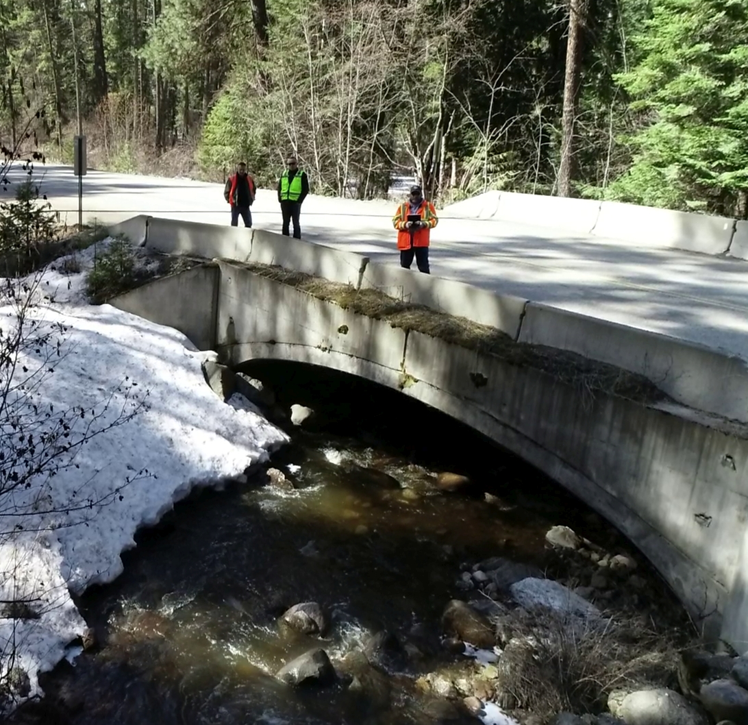
Using UAS for road and bridge inspection
Eric Roth, Pend Oreille County
Lessons Learned and next steps
From a GIS management perspective, the ability for our non-GIS personnel to develop and put into production their own data collection tools has been essential to success. Inspiring and empowering county personnel to implement GIS technology for their own needs has allowed GIS personnel to focus efforts on other tasks which help our organization improve the information, tools, and services we provide and utilize. It’s been said that necessity drives innovation and in this case the need to simplify a simple redundant workflow is proof that there is room for improvement in the seemingly most simplistic of tasks.
The use of Survey123 for UAS operations validated major benefits.
- Ease of use – The intuitive design of the Survey123 mobile app facilitates rapid, efficient data capture with minimum training.
- Flexibility – Using Survey123 web designer, smart forms can easily and timely be modified to match new requirements.
- Reliability – Paper forms can easily be damaged or misplaced and handwritten notes are often illegible or difficult to decipher. Survey123 form data is directly stored in ArcGIS as soon as the mobile device as network connectivity. Using ArcGIS Online provides us with security and peace of mind that the data will be there should the need arise where we need to go back and review prior projects.
- Portability – The Survey123 app is supported on a wide range of devices and platforms allowing us to easily make use of existing devices such as smartphones, tablets, etc.
- Offline capability – Our operating areas are rugged and remote. Reliable network access is not always available making offline collection a necessity.
- Longevity – Since the records are stored digitally within our ArcGIS Online organization and can be manually archived, we can guarantee access to the data into the future increasing the value and return on our investment.
Not only were we able to achieve our goals but we’ve helped reduce the time it takes to prepare and perform a flight. We can now get up to date imagery of our public works projects, use the imagery in conjunction with Drone2Map to calculate volumes of sand and gravel piles before road projects and in preparation of sanding roads in the winter. We’ve also helped to improve the safety of our employees by using the UAS to perform inspections on bridges that are often difficult and unsafe to survey manually. This critical return on our investment has helped to solidify the sustainable use of UAS technologies in our everyday workflows. Talks are currently underway to expand the use of UAS technologies to other departments in the hopes that it will add further improvements to our workflow processes.
Josh Shelton is the GIS Manager for Pend Oreille County in Washington state. Josh has been doing GIS and supporting the county for over 11 years. Pend Oreille County GIS supports all county departments and strives to help empower people to use GIS technologies to better themselves, the organization and the communities in which we live. Josh loves the outdoors and has an enthusiasm for technology, it’s this passion and drive which enables him to continually push the boundaries and think outside the box providing technologies and solutions to county personnel and their constituents.
Eric Roth is the County Surveyor for Pend Oreille County. Eric has been a licensed surveyor in Washington state for over 15 years and has been working for Pend Oreille County for the last 3 years. His love of surveying and technology led him to create the first UAS program in the county. Since the program’s inception, Eric has been working on ways to make the program more efficient, safe and cost effective.
You must be a registered user to add a comment. If you've already registered, sign in. Otherwise, register and sign in.