- Home
- :
- All Communities
- :
- Products
- :
- ArcGIS Spatial Analyst
- :
- ArcGIS Spatial Analyst Questions
- :
- Two different results for viewshed analysis?
- Subscribe to RSS Feed
- Mark Topic as New
- Mark Topic as Read
- Float this Topic for Current User
- Bookmark
- Subscribe
- Mute
- Printer Friendly Page
Two different results for viewshed analysis?
- Mark as New
- Bookmark
- Subscribe
- Mute
- Subscribe to RSS Feed
- Permalink
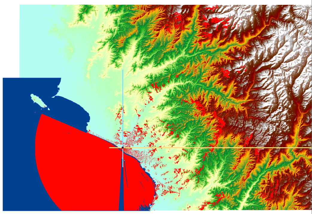
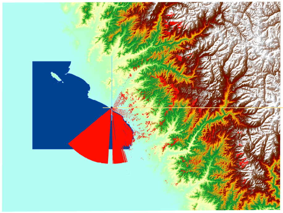
I think there might be a problem with a DEM I'm using to ran a viewshed analysis of a coastal area (88mt above sea level).
I've ran the tool twice, analysing the same area except the second analysis covers up a larger area. My results on the second analysis are really confusing: the west, north-west quadrant is either skipped or deemed not visible. I think this is incorrect because: a) I've been to the site, b) on the previous analysis, the area is indeed visible. I set up an observer at 16mt above the ground and only then I'm getting the area visible again.
Any ideas on what could be wrong, and how could I fix this? I'm attaching images of my first two results. For the two analyses I ran, I clipped the same source DEM.
Thanks
- Mark as New
- Bookmark
- Subscribe
- Mute
- Subscribe to RSS Feed
- Permalink
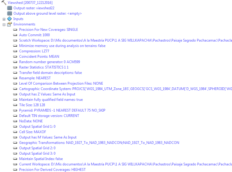
what analysis properties were set in both?
(check the Environments tab in the tools or the Results output after the tool is run)
- Mark as New
- Bookmark
- Subscribe
- Mute
- Subscribe to RSS Feed
- Permalink
These are the properties for the second analysis (incorrect one).

and for the first analysis (correct one):
- Mark as New
- Bookmark
- Subscribe
- Mute
- Subscribe to RSS Feed
- Permalink
one plus sign off... the 'inputs' of the two will actually give you the tool specific environment settings.