- Home
- :
- All Communities
- :
- Products
- :
- ArcGIS Spatial Analyst
- :
- ArcGIS Spatial Analyst Questions
- :
- Re: Spatial Analyst Output Problem
- Subscribe to RSS Feed
- Mark Topic as New
- Mark Topic as Read
- Float this Topic for Current User
- Bookmark
- Subscribe
- Mute
- Printer Friendly Page
Spatial Analyst Output Problem
- Mark as New
- Bookmark
- Subscribe
- Mute
- Subscribe to RSS Feed
- Permalink
Hello,
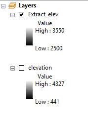
I am having problems using numerous spatial analyst tools. When I try to extract by attributes or reclassify a raster file, the output keeps coming out blank. There are no error pop-ups, just an empty output. I included pictures of how the window looks like. The output range of the extracted file is suppose to be between 2500 to 3550, instead the output range is 0.
Thanks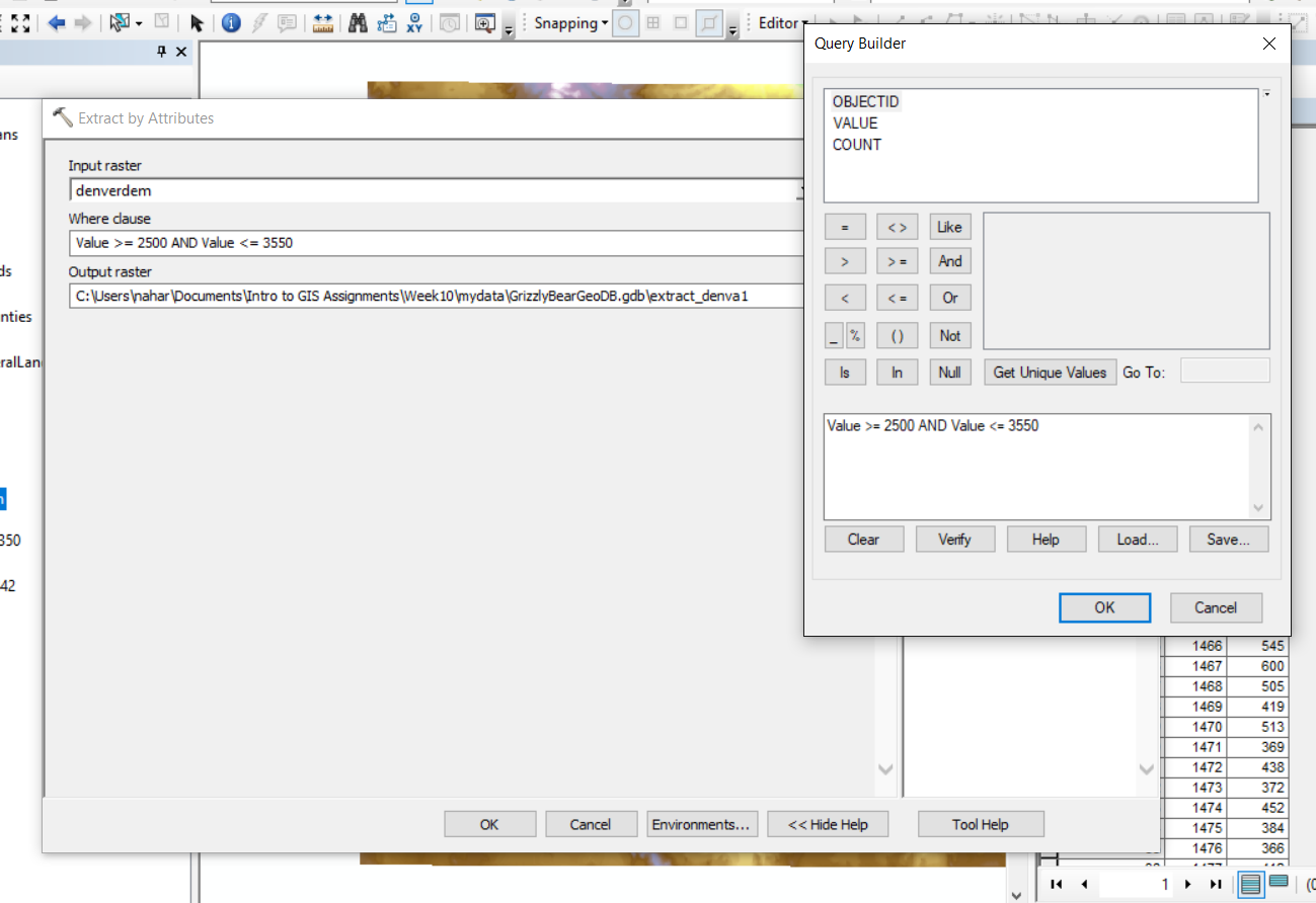
- Mark as New
- Bookmark
- Subscribe
- Mute
- Subscribe to RSS Feed
- Permalink
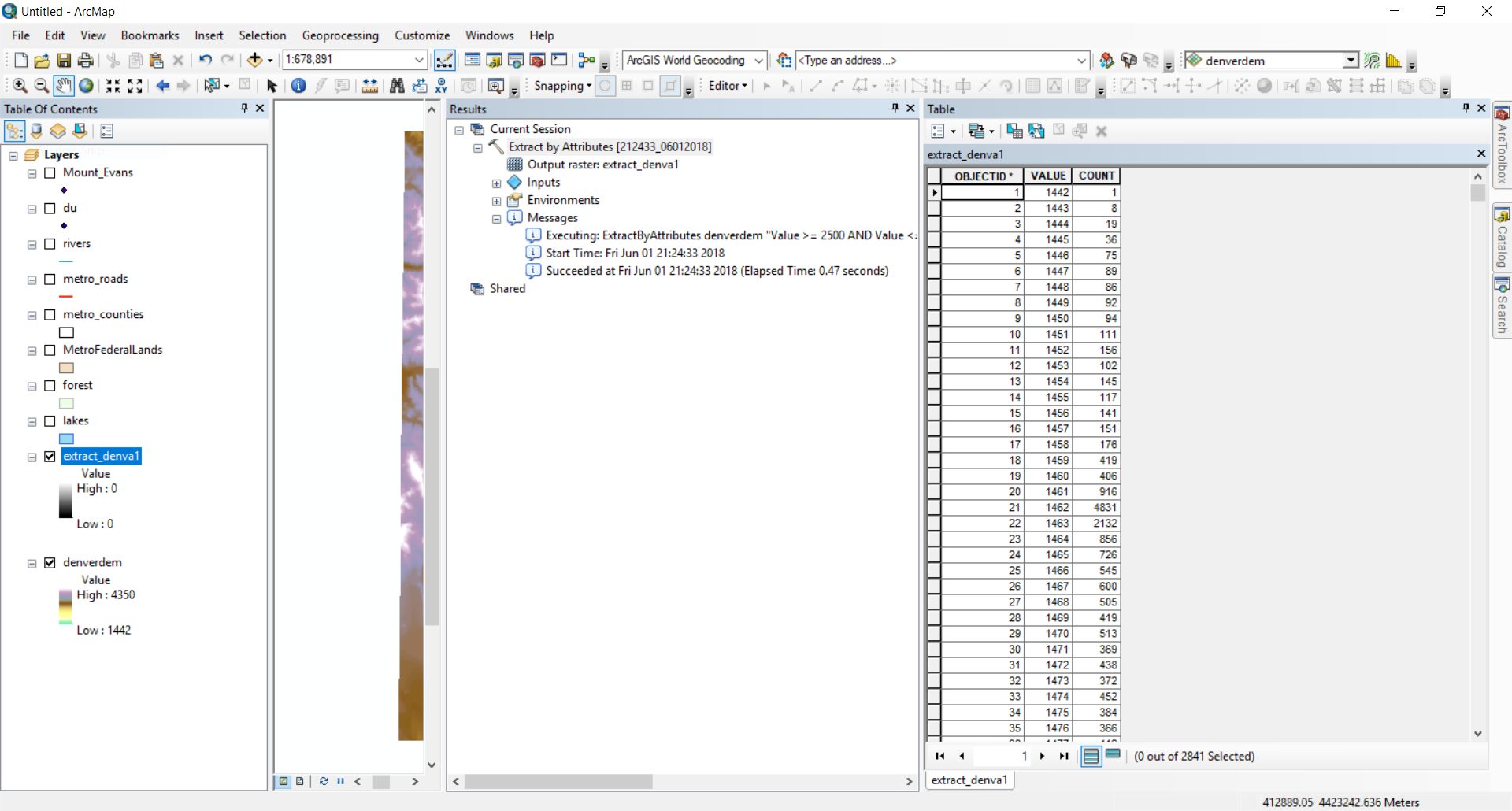
When I look at your second screenshot, I notice that the attribute table does reflect the correct values. The raster in the table of contents is showing the range 0 to 0 erroneously and probably need to have its statistics build explicitly. Try using: Build Pyramids And Statistics—Help | ArcGIS Desktop
- Mark as New
- Bookmark
- Subscribe
- Mute
- Subscribe to RSS Feed
- Permalink
Hi Xander,
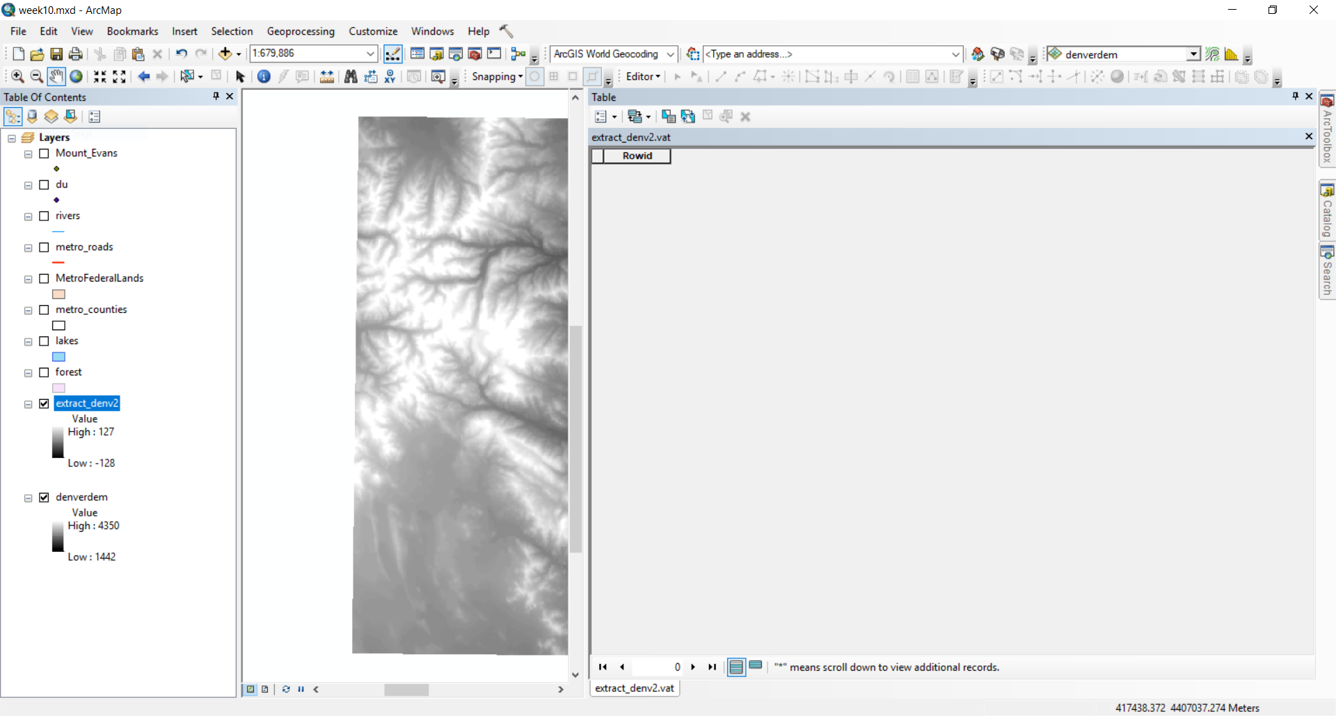
Thank you for replying. I am new to GIS, so I hope I can be clear. Based on the above picture, the values aren't correct because the values isn't within the 2500-3550 range. So I used Build Pyramids And Statistics in Data Management, I inputted the original denverdem raster file into the tool. Then I used the select by attributes, but this time the attribute table was completely empty.
I would appreciate it if you can give step by step direction.
Thank You!
- Mark as New
- Bookmark
- Subscribe
- Mute
- Subscribe to RSS Feed
- Permalink
If you want the elevations between that range, use the Con tool
Con( (Raster("elev") > 2500 ) & ( Raster("elev") < 4500), "elev", 0)This portion
(Raster("elev") > 2500 ) & ( Raster("elev") < 4500)
will return a boolean, hence you need to use & instead of AND (if I remember correctly)
The rest of the Con statement basically says if the expression is True, then return the value in the "elev" grid otherwise, 0
- Mark as New
- Bookmark
- Subscribe
- Mute
- Subscribe to RSS Feed
- Permalink
Hi Dan,
This is the con window.
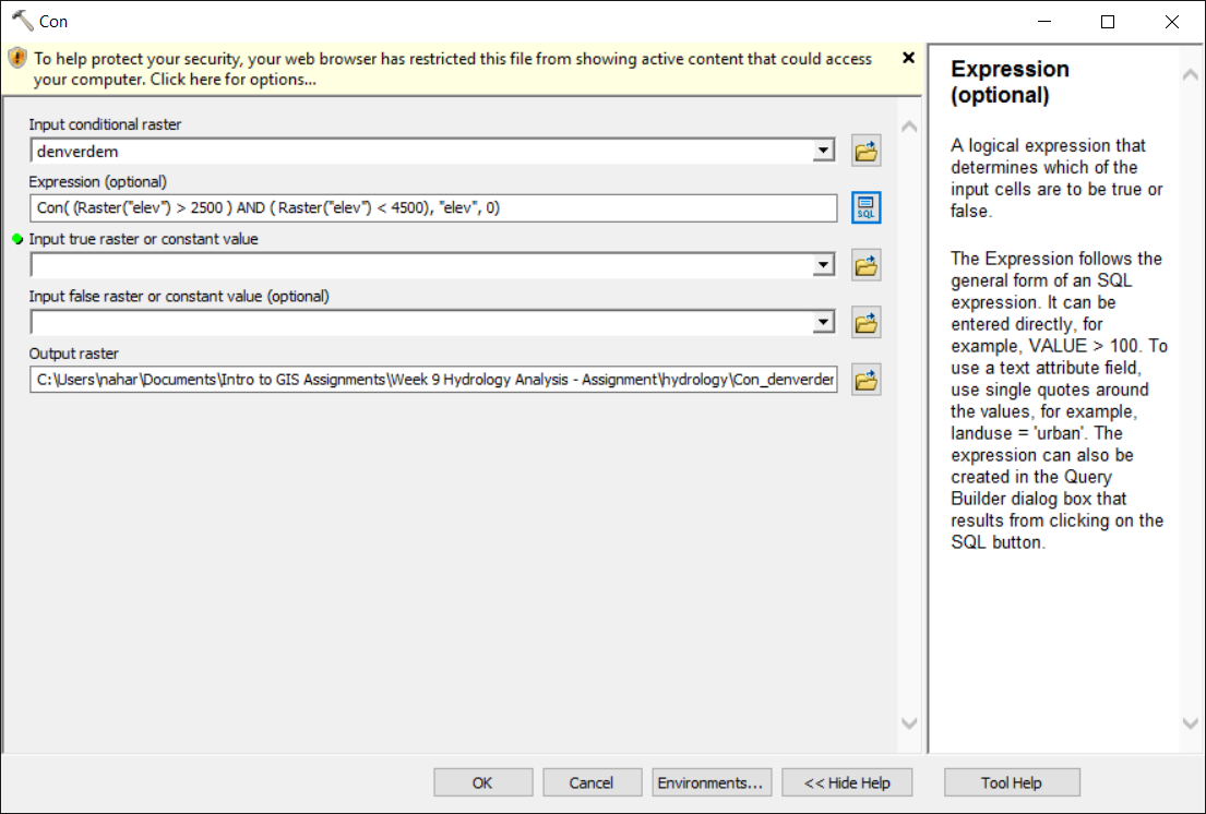
Using & doesn't work, when I try to verify the query. Would I put the same raster for both the input conditional raster and input true raster?
Thank you for responding!
- Mark as New
- Bookmark
- Subscribe
- Mute
- Subscribe to RSS Feed
- Permalink
You don't put the expression I gave you in the Con tool.
put it in the Raster calculator... and you have to substitute my example grid name for your grid's name
Also... don't work in folders with spaces, especially if you are producing esri grids. (ie rasters without a file extension)
- Mark as New
- Bookmark
- Subscribe
- Mute
- Subscribe to RSS Feed
- Permalink
Hi Sadia,
May I know what version of ArcMap are you using? I tried to repro using my own data in latest version of ArcMap, with the same expression as you did, but it works to me. Or maybe it is data specific.

I will appreciate if you can report your problem to our Technique Support with your detail repro steps, information and data (if possible). So that we can log it and investigate.
Thanks,
Wei
- Mark as New
- Bookmark
- Subscribe
- Mute
- Subscribe to RSS Feed
- Permalink
Thanks!
What is Technique Support?
Sent from my iPhone
- Mark as New
- Bookmark
- Subscribe
- Mute
- Subscribe to RSS Feed
- Permalink
Technical Support https://support.esri.com/en/
- Mark as New
- Bookmark
- Subscribe
- Mute
- Subscribe to RSS Feed
- Permalink
And you also have such problem using Reclassify tool in this data? Can you also show how you did?