- Home
- :
- All Communities
- :
- Products
- :
- ArcGIS Spatial Analyst
- :
- ArcGIS Spatial Analyst Questions
- :
- Re: Issue selecting area upstream in watershed too...
- Subscribe to RSS Feed
- Mark Topic as New
- Mark Topic as Read
- Float this Topic for Current User
- Bookmark
- Subscribe
- Mute
- Printer Friendly Page
Issue selecting area upstream in watershed tool of arcmap
- Mark as New
- Bookmark
- Subscribe
- Mute
- Subscribe to RSS Feed
- Permalink
Hello! I am trying to calculate the watershed at several locations using the watershed tool of ArcMap. When I am doing it, I get the watershed cut at all the points, and not all the watershed upstream. I set the processing extent and the snap raster to the flow direction raster in the watershed tool, but this does not solve the problem.
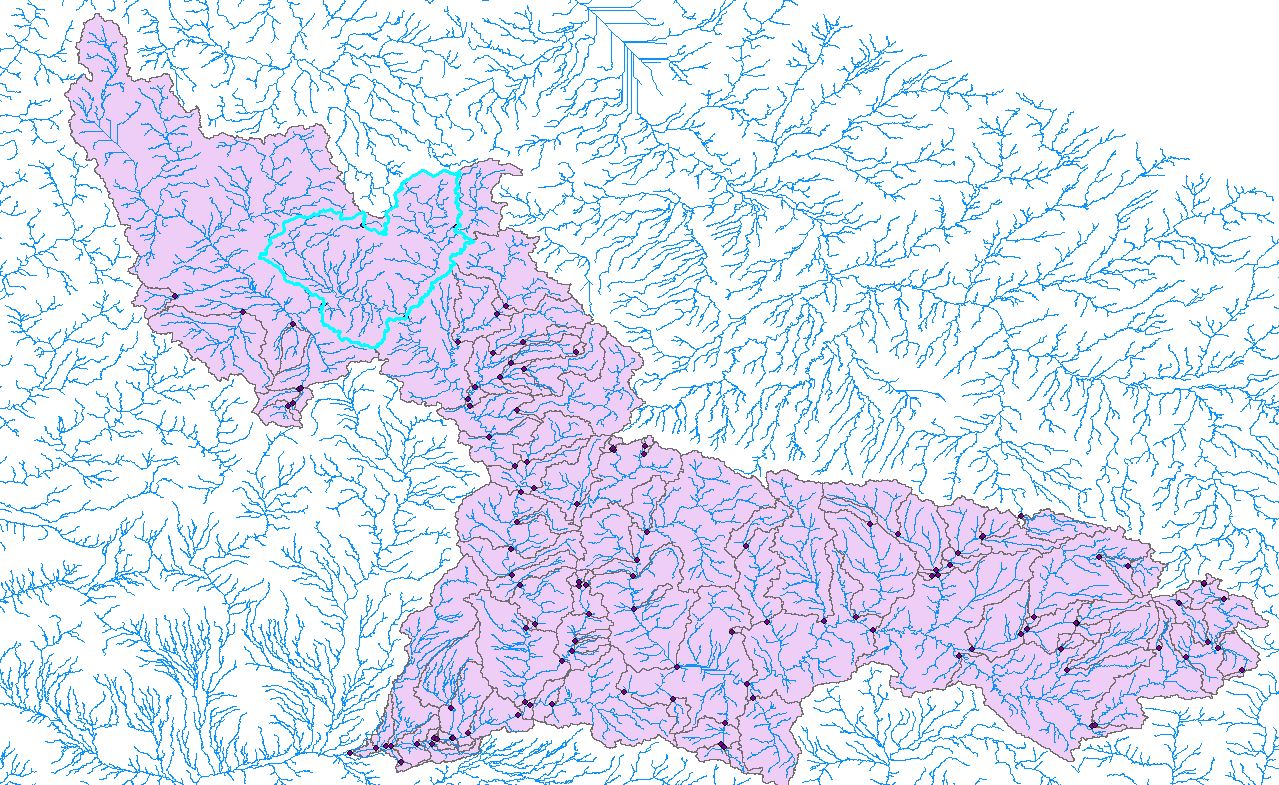
As you can see in the image below, the watershed for that particular station gets cut when finding the next station and does not consider the area upstream.
Any idea how to solve this issue?
Solved! Go to Solution.
Accepted Solutions
- Mark as New
- Bookmark
- Subscribe
- Mute
- Subscribe to RSS Feed
- Permalink
Hi SAV,
Thank you for reaching out! Please correct me if I am wrong: It seems that by cut you mean that for each point, the output watershed is only the contributing area between an upstream point and the point in question. In addition, your expected output is a delineated watershed at each of your points which considers all the upstream area given the extent of your flow direction input.
If my interpretation of your problem and expected output is correct, what you need to do is to run the Watershed tool for each of your points individually. You have several options to do this: 1) Select each point one by one from the attribute table and run the tool, 2) ModelBuilder, 3) use ArcPy.
You might also want to take a look at additional workflows and tools in ArcHydro Tools for more advanced capabilities.
Please let us know if this solved your problem or if you have any more questions.