- Home
- :
- All Communities
- :
- Products
- :
- ArcGIS Spatial Analyst
- :
- ArcGIS Spatial Analyst Questions
- :
- Re: IDW Interpolation not working
- Subscribe to RSS Feed
- Mark Topic as New
- Mark Topic as Read
- Float this Topic for Current User
- Bookmark
- Subscribe
- Mute
- Printer Friendly Page
IDW Interpolation not working
- Mark as New
- Bookmark
- Subscribe
- Mute
- Subscribe to RSS Feed
- Permalink
I keep getting 000000-12301899 responses when I try to interpolate point data. Tried both IDW and NN interpolation methods. Same error all the time. Tried many times. It is a small data set, 140,000 points with values between 20.00000 and 80.000. The same data set interpolates in QGIS, albiet slowly.
- Mark as New
- Bookmark
- Subscribe
- Mute
- Subscribe to RSS Feed
- Permalink
This is not going to interpolate well using any interpolator.
I suspect you tried the interpolation on the whole dataset at once, with a small cellsize.
Any values that you would have obtained in the large void area between the two subsets would have been spurious in any case.

Your points are spaced quite close together, so if you tried to use a cell size representative of that spacing, it would take forever to produce an interpolated map. Nearest neighbor or even NN wouldn't be useful in the large spaced between the 'lines'.
Here is a closeup of the top left-ish area
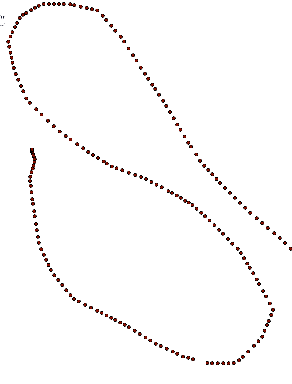
Do you have an end design for using these data?
Perhaps trying to find an existing dem of the area (even if coarser scaled) would provide some context for the points
- Mark as New
- Bookmark
- Subscribe
- Mute
- Subscribe to RSS Feed
- Permalink
Thank you very much Dan.
The data sets consists of 4 merged Electrical Conductivity files obtained with a Geonics EM38 MK 2 unit. I am trying to get them to interpolate the EC 1 m values, I have boundary polyline files around each of the 2 areas that I try to use to limit the interpolation.
I varied the cell size. That seemed to work in QGIS but not in ArcGIS Spatial Analyst.
I can thin the "in line' point values if that is going to let it work. It is physically not possible to get more spatially regular point values. Lots of dense tree growth. Thank you very much for your help. I may eventually get the hang of this new GeoNet thingey esri have come up with.
- Mark as New
- Bookmark
- Subscribe
- Mute
- Subscribe to RSS Feed
- Permalink
Ernest... Do you want values between the points? or in the intervening space.
Don't know what EC 1m values are.
Interpolating along the line can be accomplished. I have toyed with a few calculations for one of the sequences
Clarify if you will.
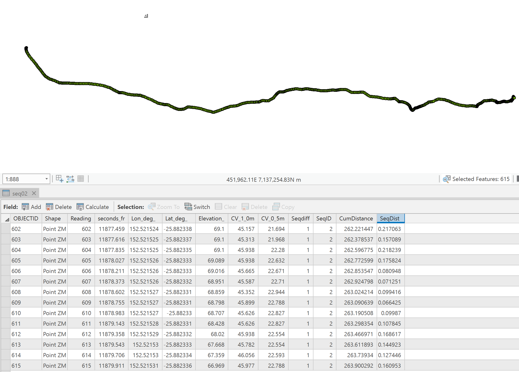
I added and calculated a cumulative distance and sequential distance for one of your sequences (ID's as # 2 in my case. It is the long flat one in the upper grouping).
The distances are quite closely spaced, so are you wanting values at the 1 m distance along the line???
- Mark as New
- Bookmark
- Subscribe
- Mute
- Subscribe to RSS Feed
- Permalink
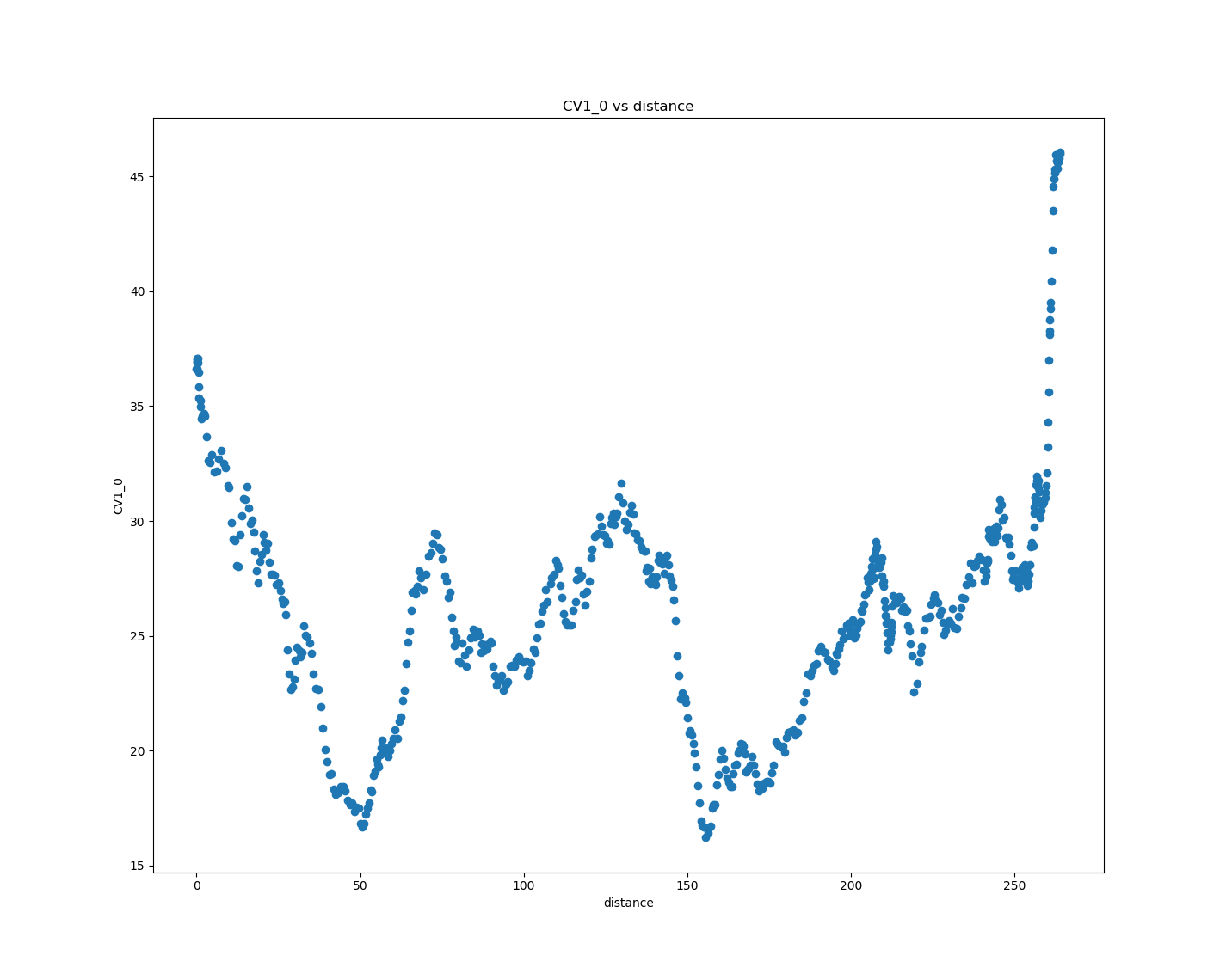
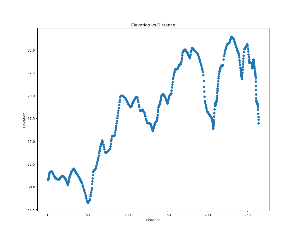
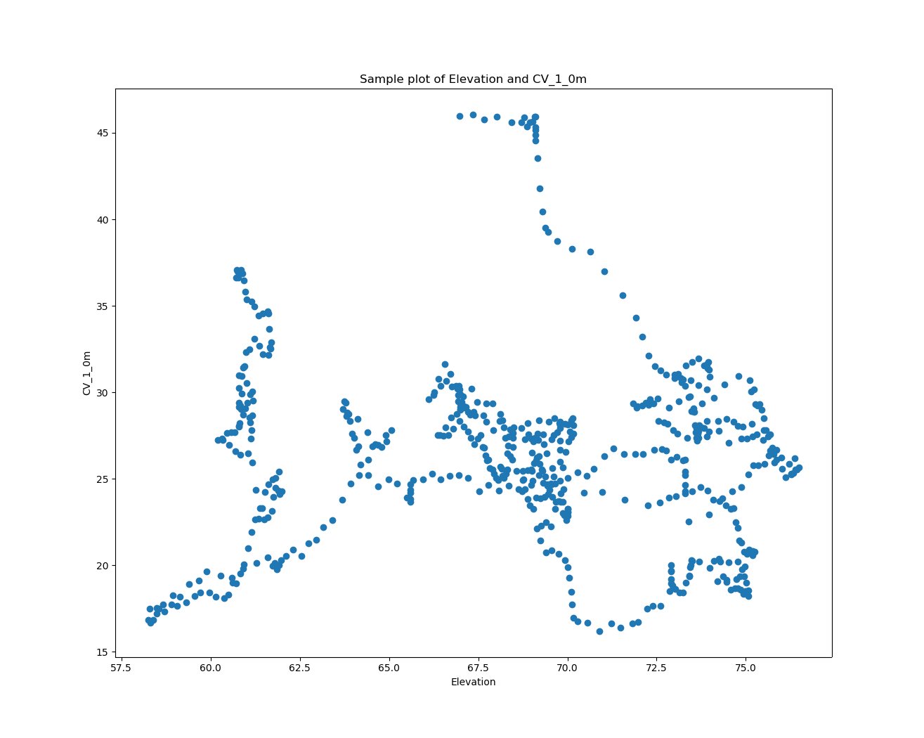
Toying with the data set above … CV_1_0 versus distance along the transect.
- Mark as New
- Bookmark
- Subscribe
- Mute
- Subscribe to RSS Feed
- Permalink
Hello Dan,
Thank you very much for all your help. I didn't get to reply for a few days due to the pressure of other work. I have numbered my responses to help with clarity.
1. The data values are Apparent Electrical Conductivity (ECa) values of the soil to 1 m depth at each point.
2. I use them as a measure of the soils moisture and clay content at each point.
3. Thus, it is desirable to interpolate them across the area they cover and not just along the line that the recording instrument (Geonics EC 35 MK II) travelled.
4. I created 2 polyline shapefiles (around the areas of the point values) to limit the boundaries of the interpolation. Can now attach them when I switched to Advanced Editor. I used them in the ArcGIS IDW Interpolator but they didn't seem to help.
5. I guess I should try specifying different cell sizes to see if that allows it to work.
6. I also tried NN interpolator (used this in the past for somewhat similar data) but it didn't work any better with this data set.
Sincerely,
Ernest
- Mark as New
- Bookmark
- Subscribe
- Mute
- Subscribe to RSS Feed
- Permalink
Looking at the first and 3rd images... interpolating even along the straight line is sketchy at best since . Your points are extremely closely spaced and the spacing between the sample 'lines' is extremely far apart. You might be better off creating a fishnet and summarizing the points within the fishnet and skip interpolation altogether.
- Mark as New
- Bookmark
- Subscribe
- Mute
- Subscribe to RSS Feed
- Permalink
Have a look at Interpolation of Data Collected along Lines
- Mark as New
- Bookmark
- Subscribe
- Mute
- Subscribe to RSS Feed
- Permalink
Thank you Steve,
Was unaware of this article. Its very useful and will try those 2 techniques.
Ernest