- Home
- :
- All Communities
- :
- Products
- :
- ArcGIS Spatial Analyst
- :
- ArcGIS Spatial Analyst Questions
- :
- Re: Extract Polyline Statistics in relation in Ras...
- Subscribe to RSS Feed
- Mark Topic as New
- Mark Topic as Read
- Float this Topic for Current User
- Bookmark
- Subscribe
- Mute
- Printer Friendly Page
Extract Polyline Statistics in relation in Raster
- Mark as New
- Bookmark
- Subscribe
- Mute
- Subscribe to RSS Feed
- Permalink
I am attempting to calculate what distance of a polyline is in a specific raster value. I cannot find a great tool to do this with. One way I believe I could do this is to make a different raster file for each raster value then clip the polylines to that new raster file and measure it. this would split all the roads up and would be very time consuming. Any great ideas?
Context:
I am attempting to identify roads at increased land/mudslide risk post wildfire. The raster values are a raster calculation between NBR and slope. I would like to be able to confidently say something like "FS road ### has 120m of road at high risk for landslide and 540m at moderate risk".
- Mark as New
- Bookmark
- Subscribe
- Mute
- Subscribe to RSS Feed
- Permalink
I think you could quite easily iterate over each polyline (road) and jury-rig the stack profile tool
https://desktop.arcgis.com/en/arcmap/latest/tools/3d-analyst-toolbox/stack-profile.htm
then do some magic on the output table for each road.
- Mark as New
- Bookmark
- Subscribe
- Mute
- Subscribe to RSS Feed
- Permalink
Thank you for the suggestion
Hmm been exploring the stack profile tool now for a little while and cannot get it to produce anything beneficial for my needs.
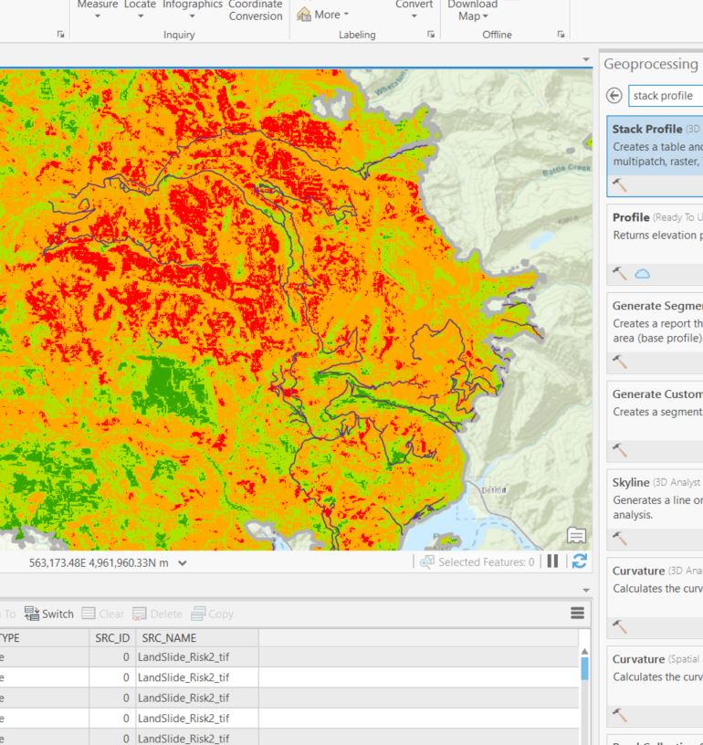
What I need is to be able to identify which of these roads go through red sections, then quantify and identify those locations in red. (see image)
- Mark as New
- Bookmark
- Subscribe
- Mute
- Subscribe to RSS Feed
- Permalink
Seemed to work fine.

- Mark as New
- Bookmark
- Subscribe
- Mute
- Subscribe to RSS Feed
- Permalink
I have almost the same question!
My idea was to create points along the line, extract the values from the raster to the point, and then spatial join the points to segmented portions (regular intervals) of the line.
But I need an average of the raster value around each point (since the roads are already represented in the raster and a value under the point themselves would just return 0).