Hi,
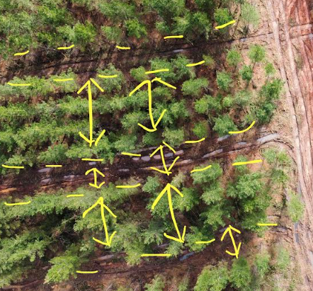
I would like to be able to somehow automate the estimation of the widths of various tree rows in a large area from aerial imagery (see attached photo). Would this be feasible as I would like to apply this over a large area? Even a method which would provide a rough estimate would be useful. I am using ArcMap 10.8.2.
Thanks