Turn on suggestions
Auto-suggest helps you quickly narrow down your search results by suggesting possible matches as you type.
Cancel
- Home
- :
- All Communities
- :
- Products
- :
- ArcGIS Spatial Analyst
- :
- ArcGIS Spatial Analyst Questions
- :
- Re: 3-dimensional distance from multiple points to...
Options
- Subscribe to RSS Feed
- Mark Topic as New
- Mark Topic as Read
- Float this Topic for Current User
- Bookmark
- Subscribe
- Mute
- Printer Friendly Page
3-dimensional distance from multiple points to closest polyline
Subscribe
12125
12
06-21-2013 08:44 AM
06-21-2013
08:44 AM
- Mark as New
- Bookmark
- Subscribe
- Mute
- Subscribe to RSS Feed
- Permalink
I am trying to calculate distance over terrain using the following components:
-point shape values (with x, y, z data)
-polylines (only x, y data)
-DEM from CanadaGeoBase
The polyline was manually created. I will need to extract elevation data from the DEM to every pixel along the poly-line. Without the Z data on the polyline, the distance I calculate will only be 2-dimensional and, therefore, an under-representation of actual distance from point to line as the data is in mountainous terrain.
Does anyone have any suggestions that don't involve map algebra or model building? I was told that there should be a simple tool to use, but I have been unable to find it as of yet.
Thank you in advance!
12 Replies
06-28-2013
11:45 AM
- Mark as New
- Bookmark
- Subscribe
- Mute
- Subscribe to RSS Feed
- Permalink
Very small numbers typically mean your data is using a Geographic C.S and the distance is being described in units of decimal degrees. The tools don't care what projection your map is in. It uses the coordinate system of the data. Check your layer properties to verify what coordinates the data is in. Project your data if necessary. If you project to meters, distances will be in meters. If you project to something in feet, then distances are recorded in feet.
Best,
Eric
Best,
Eric
07-03-2013
08:27 AM
- Mark as New
- Bookmark
- Subscribe
- Mute
- Subscribe to RSS Feed
- Permalink
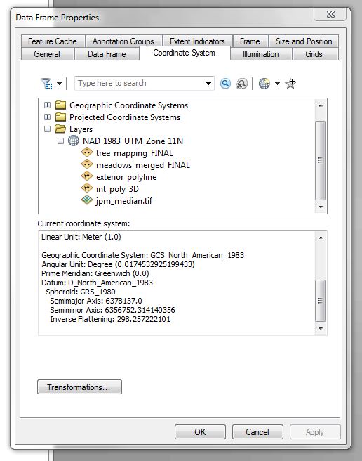
I'm still having the same problems. I've projected all the data into UTM Zone 11 North. The properties all read that the linear distance is in meters. The properties window for the data do, however, still have a GCS listed which I do not know is a problem or not.
I've attached screen shots of all the attribute tables as well as the property windows for the data frame as well as the layers. Some pictures are labeled with 1s and 2s in the file names as all the information could not be screen shot without scrolling.
The "near3" field is the 3D distance that was amended to the attribute tables.
The following are a list of the tools I used:
-To make the points 3D, I used "feature to 3D by attribute" and selected the elev attribute.
-To make the lines 3D, I used "add surface information" using a DEM
-To find 3D distance from point to line, I used the "near 3D" tool
- « Previous
-
- 1
- 2
- Next »
- « Previous
-
- 1
- 2
- Next »