- Home
- :
- All Communities
- :
- Developers
- :
- ArcGIS REST APIs and Services
- :
- ArcGIS REST APIs & Services Ques.
- :
- Re: Rest API returns No Results When Should Inters...
- Subscribe to RSS Feed
- Mark Topic as New
- Mark Topic as Read
- Float this Topic for Current User
- Bookmark
- Subscribe
- Mute
- Printer Friendly Page
Rest API returns No Results When Should Intersect
- Mark as New
- Bookmark
- Subscribe
- Mute
- Subscribe to RSS Feed
- Permalink
I can download statewide NY senate districts using ...
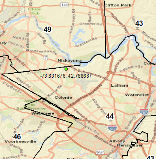
When I query lat/lng against the api... I get zero results.
But when I map the statewide dataset and map the lat/lng I can see I should have an intersect. Can someone tell me why this intersect returns no results when the point falls within zone on the map??? 
- Mark as New
- Bookmark
- Subscribe
- Mute
- Subscribe to RSS Feed
- Permalink
Hi Noah Huntington,
Yeah, got it: you forgot to specify the Input Spatial reference.
The Spatial Reference of the TIGERweb data is 102100 (3857), which is Web Mercator, and the Input Geometry, your point, is in WGS84 (4326). When the input spatial reference differs from the one of the dataset being queried, you have to specify it.
So, with the addition of inSR=4326 your query should (and does) work. The query below returns one polygon with the name "State Senate District 44".
Does this solve your issue?
Cheers,
Egge-Jan