- Home
- :
- All Communities
- :
- Developers
- :
- ArcGIS REST APIs and Services
- :
- ArcGIS REST APIs & Services Ques.
- :
- Multiple Input Geometry for Polygon Query
- Subscribe to RSS Feed
- Mark Topic as New
- Mark Topic as Read
- Float this Topic for Current User
- Bookmark
- Subscribe
- Mute
- Printer Friendly Page
Multiple Input Geometry for Polygon Query
- Mark as New
- Bookmark
- Subscribe
- Mute
- Subscribe to RSS Feed
- Permalink
This is my first stab with the ArcGIS REST API, having just completed the intro course yesterday. I can get a successful return when using a single pair of xy coordinates as Input Geometry as a query to a MapService Polygon layer. My objective is to get the tax district value for a given geocoded address: simple point in polygon. However, I can't seem to find the proper syntax to perform the operation on multiple pairs of xy coordinates. This is how I get a single pair to work:
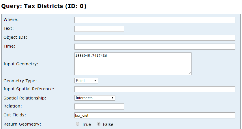
I've truncateded the values for ease of reading; can I input multiple pairs in a query?
- Mark as New
- Bookmark
- Subscribe
- Mute
- Subscribe to RSS Feed
- Permalink
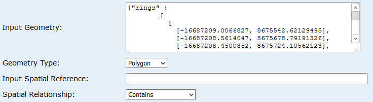
No doubt, you have been experimenting. I've queried using something like this for a polygon:
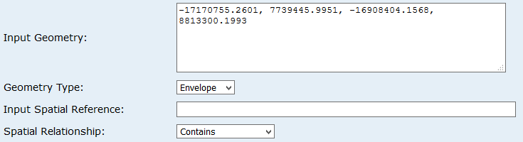
and for an extent (xmin, ymin, xmax, ymax):
For a little documentation see: Query (Feature Service) and esriGeometryType Constants. For me, it's mostly been some experimenting.