- Home
- :
- All Communities
- :
- Developers
- :
- ArcGIS REST APIs and Services
- :
- ArcGIS REST APIs & Services Ques.
- :
- addFeatures or updateFeatures geometry creation is...
- Subscribe to RSS Feed
- Mark Topic as New
- Mark Topic as Read
- Float this Topic for Current User
- Bookmark
- Subscribe
- Mute
- Printer Friendly Page
addFeatures or updateFeatures geometry creation issue
- Mark as New
- Bookmark
- Subscribe
- Mute
- Subscribe to RSS Feed
- Permalink
When updating or creating a feature with JSON thenumber entered for "x" and "y" changes from dec degrees (eg 143.8689302 -35.76106763) to some other format (0.001292349 -0.000321247 in this case). Why does this happen? When I use .CSV file with the same numbers it works correctly.
JSON:
{"geometry":{"x"143.8689302:,"y":-35.76106763,"spatialReference":{"wkid":102100}},"attributes":{"ObjectId":objectId,"Status":"construction_complete","ASSET_ID":assetID,}}
- Mark as New
- Bookmark
- Subscribe
- Mute
- Subscribe to RSS Feed
- Permalink
Hey Matt Creaney,
What is the spatial reference of the web service you are using?
Thanks,
Ben
If this answer was helpful please mark it as helpful. If this answer solved your question please mark it as the answer to help others who have the same question.
- Mark as New
- Bookmark
- Subscribe
- Mute
- Subscribe to RSS Feed
- Permalink
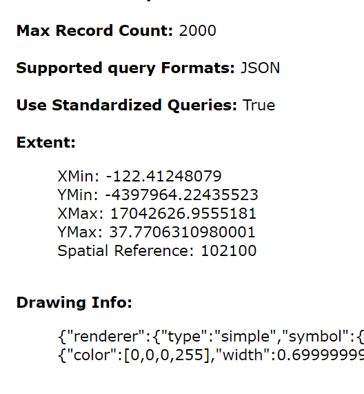
Hi Ben Turrell
Thanks for your reply. The spatial reference shown on the Service URL is 102100