- Home
- :
- All Communities
- :
- Products
- :
- ArcGIS QuickCapture
- :
- ArcGIS QuickCapture Questions
- :
- Record multiple attributes for a single feature
- Subscribe to RSS Feed
- Mark Topic as New
- Mark Topic as Read
- Float this Topic for Current User
- Bookmark
- Subscribe
- Mute
- Printer Friendly Page
Record multiple attributes for a single feature
- Mark as New
- Bookmark
- Subscribe
- Mute
- Subscribe to RSS Feed
- Permalink
This project is similar to my last question. We conduct aerial surveys for different wildlife species, and need to be able to capture multiple attributes for one location (feature) at a time.
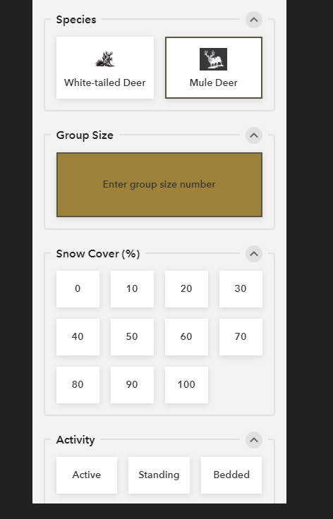
For example, we need to record a group size, ruggedness value, snow cover percentage, visual obstruction percentage, activity value, and species for one single location (record/feature). From what I can determine, Quick Capture is based on feature templates, so there is no way to record all these values for one feature. I would have to create a jumbled mess of feature templates for every combination of possibilities. See the attached picture for an example of how it would ideally work. Instead of each of those groups producing a new record, it would all record to one single record.
Is there a potential workaround for this?
Hopefully this makes sense. I look forward to any clarification.
-Samantha
Solved! Go to Solution.
Accepted Solutions
- Mark as New
- Bookmark
- Subscribe
- Mute
- Subscribe to RSS Feed
- Permalink
Hi Samantha Nichols For an aerial survey, if you want to capture multiple variables for a single observation I would recommend Survey123 for ArcGIS Using the new image-map appearance you can embed within a form a big-button style UX if you like. I will be happy to discuss in more detail. My contact info is [email protected]
- Mark as New
- Bookmark
- Subscribe
- Mute
- Subscribe to RSS Feed
- Permalink
Hi,
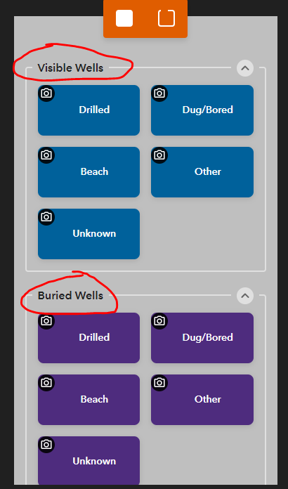
Yes, I had the same issue. Luckily I really only had one other attribute that I needed to populate (WELL_TYPE), so I just created a new group for each subtype. I could see how the more attributes you need to capture, the more of a pain it would be.
But....if you need to capture so many different combinations of attrbutes, with lots of user input, I don't think that is what 'Quick' Capture was designed for. That sounds like more of a Collector type of application.
- Mark as New
- Bookmark
- Subscribe
- Mute
- Subscribe to RSS Feed
- Permalink
Hi Samantha Nichols For an aerial survey, if you want to capture multiple variables for a single observation I would recommend Survey123 for ArcGIS Using the new image-map appearance you can embed within a form a big-button style UX if you like. I will be happy to discuss in more detail. My contact info is [email protected]