- Home
- :
- All Communities
- :
- Developers
- :
- ArcGIS Pro SDK
- :
- ArcGIS Pro SDK Questions
- :
- Finding NearestPoint based on direction
- Subscribe to RSS Feed
- Mark Topic as New
- Mark Topic as Read
- Float this Topic for Current User
- Bookmark
- Subscribe
- Mute
- Printer Friendly Page
Finding NearestPoint based on direction
- Mark as New
- Bookmark
- Subscribe
- Mute
- Subscribe to RSS Feed
- Permalink
Hi,
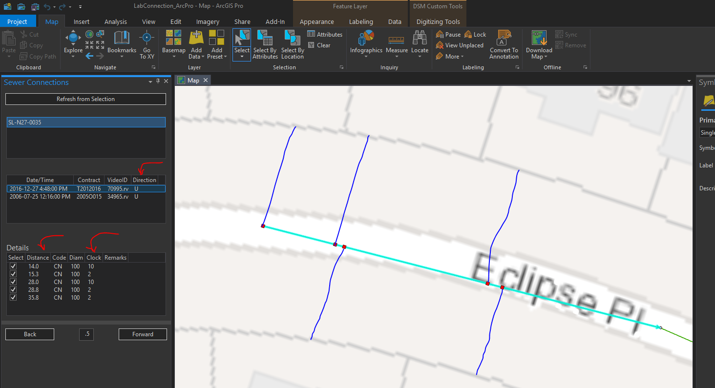
So I'm working on a bit of code to visualize sewer service connection from field CCTV data. In the example below, there should be 5 connection on the selected sewer line. I can add those to the map (red squares...see below) as a MapOverlay without any issues.
I am now stuck at how to determine the nearest point on the Parcel fabric (polygon layer) because I need to now draw a line (see the hand drawn blue lines below) that goes from the connection point (red square) to the nearest point of the parcel fabric, but using the 'Clock' value as a guide for knowing which direction the sewer connection line is going.
Does that make any sense?? I see there is a NearestPoint in the GeometryEngine, but I'm not sure how to select the nearest parcel in a given direction.
- Mark as New
- Bookmark
- Subscribe
- Mute
- Subscribe to RSS Feed
- Permalink
Hi there. Just getting back to this issue after moving on to other things. Just wondering if there might be some new tools in the current SDK that might help with this.
Just looking to find the nearest point on the parcel fabric for each of the red points, so I can draw a line from the red point to the parcel fabric.