- Home
- :
- All Communities
- :
- Products
- :
- ArcGIS Pro
- :
- ArcGIS Pro Questions
- :
- When using a hatch fill over a solid fill, the dra...
- Subscribe to RSS Feed
- Mark Topic as New
- Mark Topic as Read
- Float this Topic for Current User
- Bookmark
- Subscribe
- Mute
- Printer Friendly Page
When using a hatch fill over a solid fill, the drawing behavior is wrong
- Mark as New
- Bookmark
- Subscribe
- Mute
- Subscribe to RSS Feed
- Permalink
This is a bit odd. I have a zoning map that has one of symbols that is a hatched fill on top of a solid fill. ![]()
The trouble is on the map it flips them around and the hatch is under the solid fill:

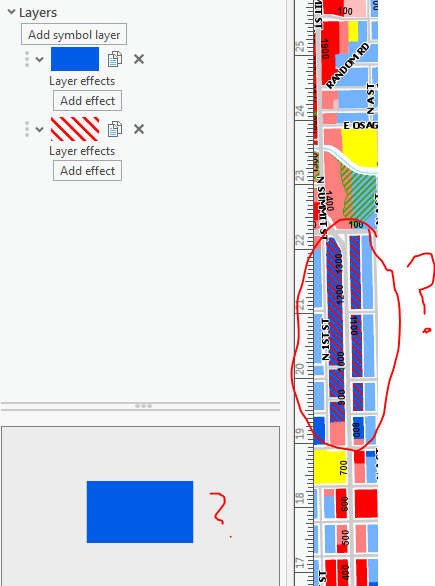
Shown another way:
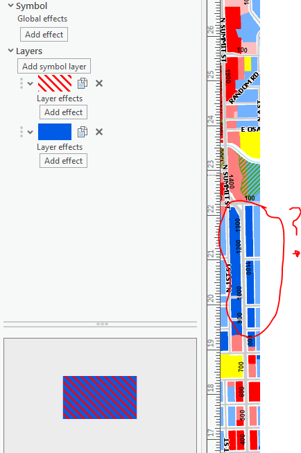
My workaround is to flip the symbols around and it displays on the map layout correctly but the preview is wrong:
This has to be some sort of bug. I'm using 2.2.1
Principal Planner
City of Arkansas City
- Mark as New
- Bookmark
- Subscribe
- Mute
- Subscribe to RSS Feed
- Permalink
It also shows up the opposite way in the legend:

Principal Planner
City of Arkansas City
- Mark as New
- Bookmark
- Subscribe
- Mute
- Subscribe to RSS Feed
- Permalink
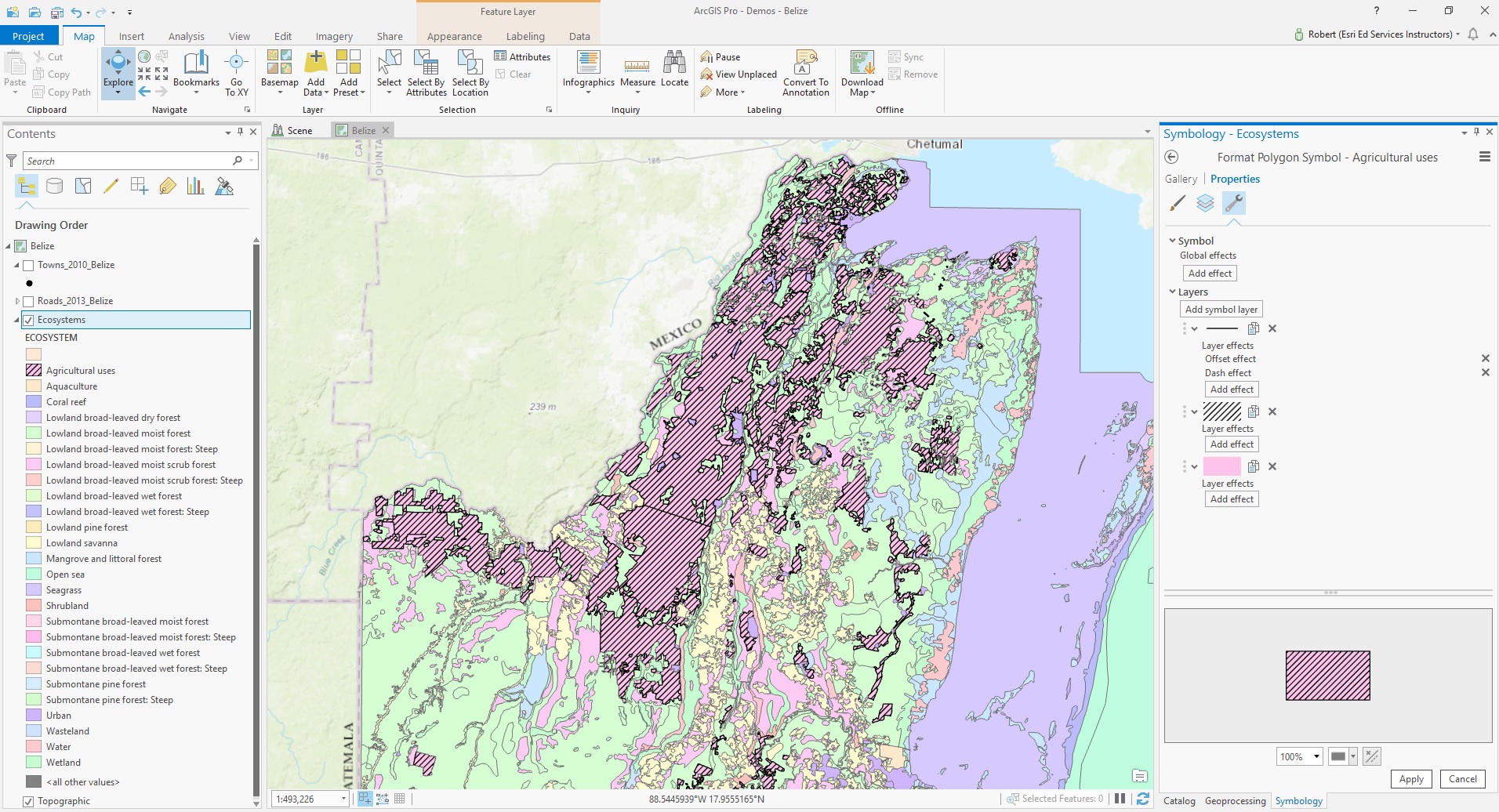
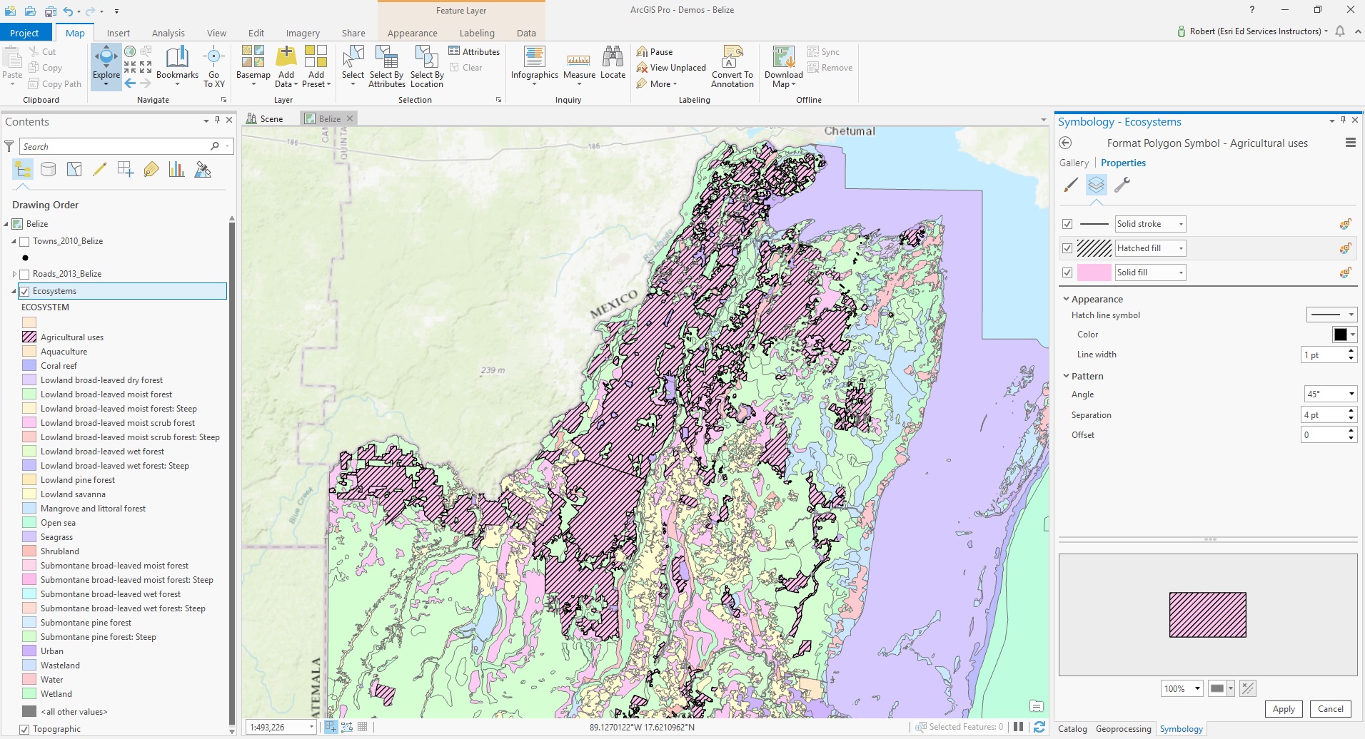
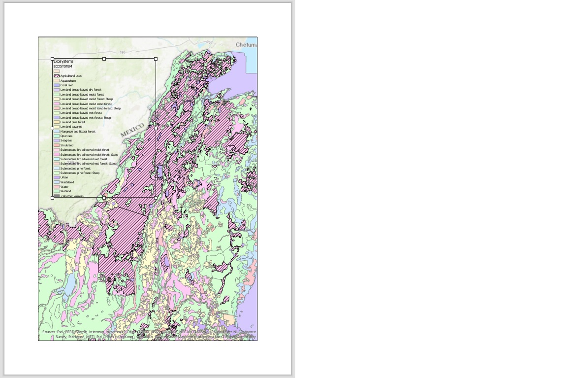
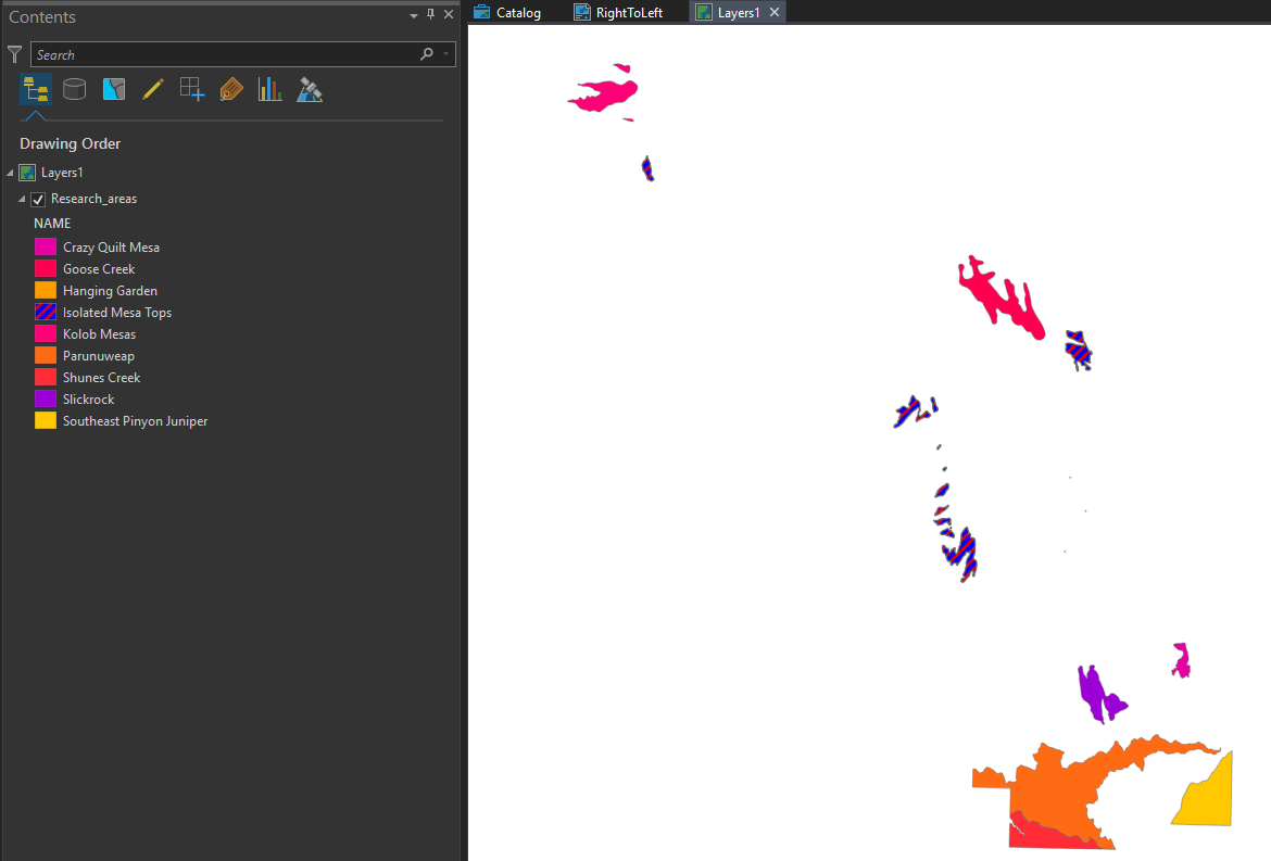
Interesting - I attempted to simulate your workflow using AGP 2.2.1 and had the following results:
- Mark as New
- Bookmark
- Subscribe
- Mute
- Subscribe to RSS Feed
- Permalink
Josh White Sorry that you're seeing this behavior. Like Robert, I don't see it either. Also working in Pro 2.2.1.

Looks like this will require more in depth troubleshooting.
Does this happen in all maps in ArcGIS Pro? In all Projects?
Is the map imported from ArcMap into Pro, or was it created in Pro?
Can you share a map package that demonstrates the issue?
We can start there, and see if we're able to figure something out through the thread - otherwise, it might be advantageous to open a case with technical support.
Cheers
- Mark as New
- Bookmark
- Subscribe
- Mute
- Subscribe to RSS Feed
- Permalink
Does this happen in all maps in ArcGIS Pro? In all Projects?
I tried this in another map and did not experience the same behavior
Is the map imported from ArcMap into Pro, or was it created in Pro?
The map was imported from ArcMap into Pro.
Can you share a map package that demonstrates the issue?
I can if needed, however, on a whim, I removed the hatch symbol from that particular layer and added it again. The behavior returned to normal. I also noticed that the layer has other problems with drawing order (didn't match ArcMap). I have a few symbols that are hatches that overlay the solid fills. The symbol that I found the original problem on was a single symbol. This layer is my zoning districts including overlay districts and it has 21 different symbols associated with it. I have a feeling that because it is so complex, something must have happened during the conversion process from ArcMap into Pro and resulted in this strange drawing behavior.
Principal Planner
City of Arkansas City
- Mark as New
- Bookmark
- Subscribe
- Mute
- Subscribe to RSS Feed
- Permalink
Good info. I'll see if I can find some time to create a quick mxd and test on the imported map. Thanks
- Mark as New
- Bookmark
- Subscribe
- Mute
- Subscribe to RSS Feed
- Permalink
Josh. If you want to continue troubleshooting this, I think it would be best to work through technical support.
Your import log shows a number of errors and warnings so it will be necessary to look into the specifics of symbology on those layers.
I've tried using a hatch overlay like you've described, both on a single symbol as well as unique values from ArcMap. Both work fine and my import notification is:
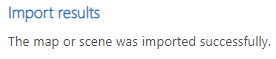

I'm sure we can figure out what is happening, but looks like it may require some in depth troubleshooting.
Cheers
- Mark as New
- Bookmark
- Subscribe
- Mute
- Subscribe to RSS Feed
- Permalink
Honestly, I think its ok for now. I'm confident it had to with the import but things seem to be working now. It's just important to note for those importing from ArcMap, that you should check everything to make sure there were no errors. This being a new system, it works a bit different and there is no good way to have a perfect transition. I actually like the controls for symbology in Pro. Much less windows to work with, that's for sure.
Principal Planner
City of Arkansas City
- Mark as New
- Bookmark
- Subscribe
- Mute
- Subscribe to RSS Feed
- Permalink
Josh:
Did you use any graphics in the data view of your mxd? My org's zoning maps have the hatching in an overlay layer separate from the main layer so I don't see your flipped symbology issue when importing the mxd into Pro. Unfortunately, all of the graphics in the data view get wiped out in the conversion due to no current support of graphics in the data view in Pro for the zoning maps.