Turn on suggestions
Auto-suggest helps you quickly narrow down your search results by suggesting possible matches as you type.
Cancel
- Home
- :
- All Communities
- :
- Products
- :
- ArcGIS Pro
- :
- ArcGIS Pro Questions
- :
- When using a hatch fill over a solid fill, the dra...
Options
- Subscribe to RSS Feed
- Mark Topic as New
- Mark Topic as Read
- Float this Topic for Current User
- Bookmark
- Subscribe
- Mute
- Printer Friendly Page
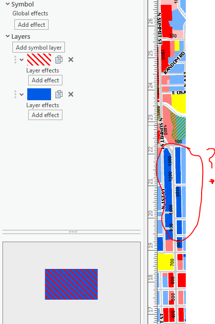
When using a hatch fill over a solid fill, the drawing behavior is wrong
Subscribe
6418
10
08-31-2018 12:51 PM
08-31-2018
12:51 PM
- Mark as New
- Bookmark
- Subscribe
- Mute
- Subscribe to RSS Feed
- Permalink
This is a bit odd. I have a zoning map that has one of symbols that is a hatched fill on top of a solid fill. ![]()
The trouble is on the map it flips them around and the hatch is under the solid fill:

Shown another way:
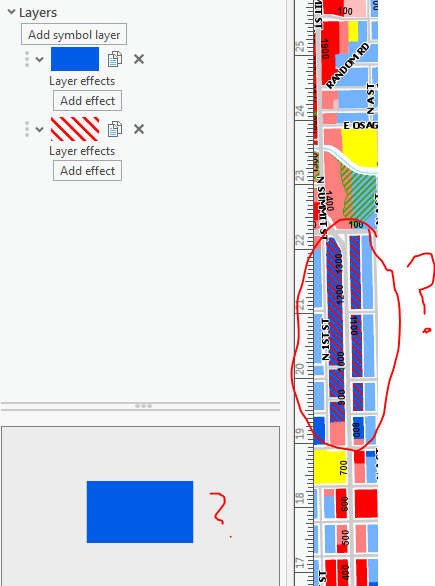
My workaround is to flip the symbols around and it displays on the map layout correctly but the preview is wrong:
This has to be some sort of bug. I'm using 2.2.1
Josh White, AICP
Principal Planner
City of Arkansas City
Principal Planner
City of Arkansas City
10 Replies
09-05-2018
09:54 AM
- Mark as New
- Bookmark
- Subscribe
- Mute
- Subscribe to RSS Feed
- Permalink
I'm not aware of any graphics on the data view. However, when I try to use the select elements tool, it looks like some of my annotation is graphics. Not sure why and it doesn't appear I can delete them. I don't think those would affect other layers' symbology though.
Josh White, AICP
Principal Planner
City of Arkansas City
Principal Planner
City of Arkansas City
- « Previous
-
- 1
- 2
- Next »
- « Previous
-
- 1
- 2
- Next »