- Home
- :
- All Communities
- :
- Products
- :
- ArcGIS Pro
- :
- ArcGIS Pro Questions
- :
- Tabulating Area - how to name values
- Subscribe to RSS Feed
- Mark Topic as New
- Mark Topic as Read
- Float this Topic for Current User
- Bookmark
- Subscribe
- Mute
- Printer Friendly Page
- Mark as New
- Bookmark
- Subscribe
- Mute
- Subscribe to RSS Feed
- Permalink
Hi,
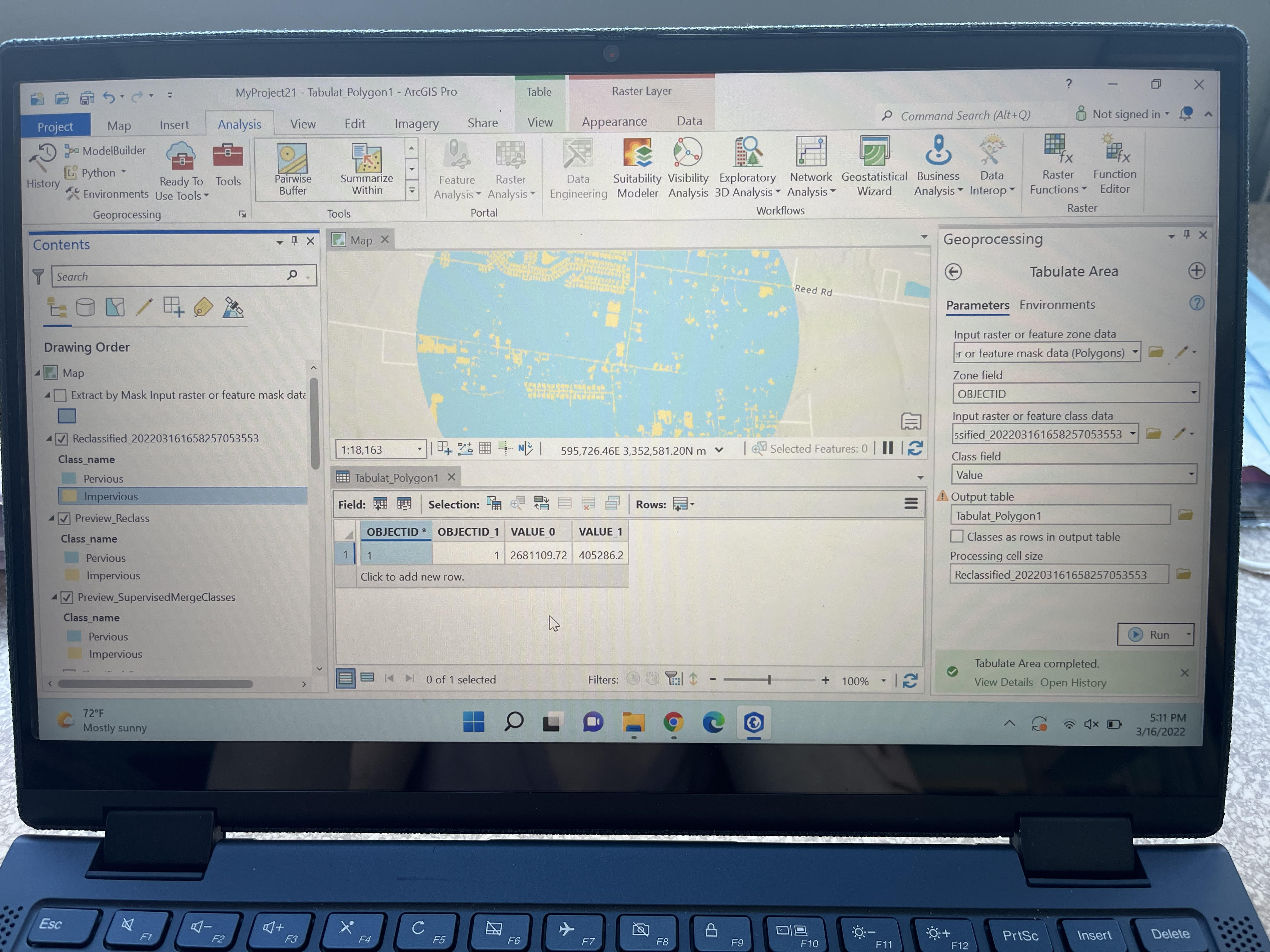
I'm trying to tabulate the area of my image. Do you know how I would get my values to have labels? Like impervious and pervious so I know which value is for which category? Like is Value 0 pervious in the picture I've attached? Thank you in advance!
Solved! Go to Solution.
Accepted Solutions
- Mark as New
- Bookmark
- Subscribe
- Mute
- Subscribe to RSS Feed
- Permalink
If you go into the symbology of the Raster it should have the value next to the description, otherwise click on an blue area (pervious) and the value will be that as shown in the tabulate area tool i.e if it's 0, then VALUE_0 is pervious.