Turn on suggestions
Auto-suggest helps you quickly narrow down your search results by suggesting possible matches as you type.
Cancel
- Home
- :
- All Communities
- :
- Products
- :
- ArcGIS Pro
- :
- ArcGIS Pro Questions
- :
- Re: Symbology doesn't refresh with scale level in ...
Options
- Subscribe to RSS Feed
- Mark Topic as New
- Mark Topic as Read
- Float this Topic for Current User
- Bookmark
- Subscribe
- Mute
- Printer Friendly Page
Symbology doesn't refresh with scale level in ArcGIS Pro
Subscribe
869
2
11-22-2017 11:15 AM
11-22-2017
11:15 AM
- Mark as New
- Bookmark
- Subscribe
- Mute
- Subscribe to RSS Feed
- Permalink
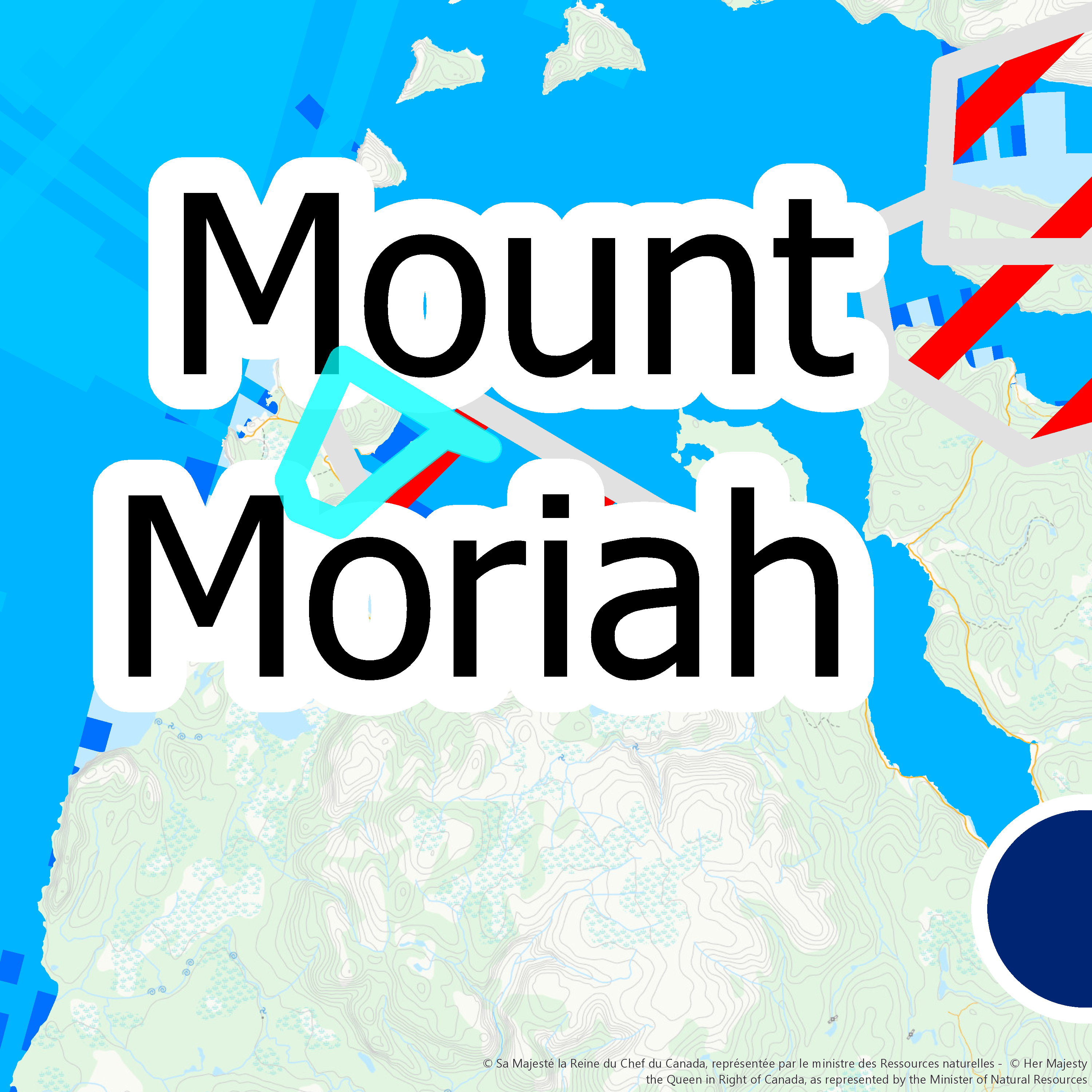
In one of my ArcGIS Pro project, many layers do not adapt their symbology to the zoom level. 
As you can see here, points, polygons and labels are way bigger than what they should be (Scale here is 1:213,020).
For example, the point symbology is supposed to be a 6pt dot with a 0.75pt outline.
Does anyone have an idea on why this happens and how to fix it?
Thanks.
2 Replies
11-22-2017
01:09 PM
- Mark as New
- Bookmark
- Subscribe
- Mute
- Subscribe to RSS Feed
- Permalink
Laura,
Have you given it time to refresh? What kind of layers are these with the symbology issues? Do all layers have these same issues? Which version of ArcGIS Pro are you using?
11-23-2017
06:15 AM
- Mark as New
- Bookmark
- Subscribe
- Mute
- Subscribe to RSS Feed
- Permalink
Adrian,
I did let the map refresh. All layers on this map have this symbology issue. It doesn't seem to be the case on a different map I created in the same project.
I am using ArcGIS Pro 2.0.0