- Home
- :
- All Communities
- :
- Products
- :
- ArcGIS Pro
- :
- ArcGIS Pro Questions
- :
- Reclassifying a Multidimensional Raster in ModelBu...
- Subscribe to RSS Feed
- Mark Topic as New
- Mark Topic as Read
- Float this Topic for Current User
- Bookmark
- Subscribe
- Mute
- Printer Friendly Page
Reclassifying a Multidimensional Raster in ModelBuilder
- Mark as New
- Bookmark
- Subscribe
- Mute
- Subscribe to RSS Feed
- Permalink
I am developing a suitability model for various crops using a NetCDF file that contains precipitation data (PCRP) with three dimensions: latitude, longitude, and time (divided into twelve months). I aim to calculate a suitability model for each month using this data, along with a TIFF file representing soil depth as well as other TIFF files representing other variables.
To make the precipitation layer compatible with the other layers, I:
- Used "Copy Raster" to convert the NetCDF to a CRF file.
- Used "Export Raster" to adjust the cell size, extent and coordinate system to match the TIFF files.
I can reclassify the resulting CRF layer using "Remap," but I want to automate this process using ModelBuilder, where "Remap" is not available. When I attempted to use "Reclassify" to reclassify the CRF, the output was not multidimensional and seemed incorrect.
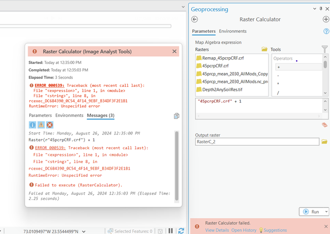
I considered using the raster calculator and some conditional statements to do reclassification, but it returned an error when I tried a test formula to see if the raster calculator would work with a CRF:
despite the example code on (Work with operators in map algebra—ArcGIS Pro | Documentation), under "Multidimensional raster operator rules" suggesting that this should work.
I also tried using "Reclass by Table", but it had the same issues as "Reclassify".
If possible, we would prefer our suitability results to be multidimensional. Any assistance would be appreciated.
