- Home
- :
- All Communities
- :
- Products
- :
- ArcGIS Pro
- :
- ArcGIS Pro Questions
- :
- Raster data layer color change when another layer ...
- Subscribe to RSS Feed
- Mark Topic as New
- Mark Topic as Read
- Float this Topic for Current User
- Bookmark
- Subscribe
- Mute
- Printer Friendly Page
Raster data layer color change when another layer is overlayed
- Mark as New
- Bookmark
- Subscribe
- Mute
- Subscribe to RSS Feed
- Permalink
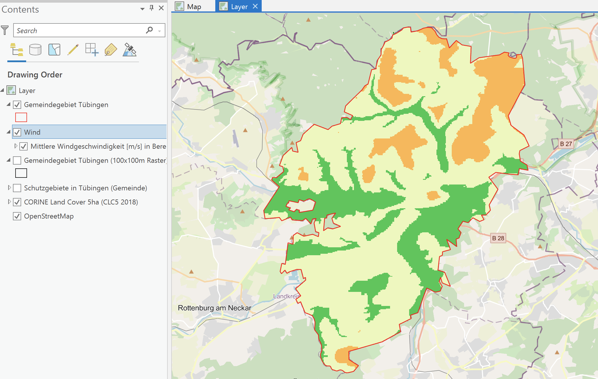
Hey all,
today, I georeferenced a map and so far, so good.
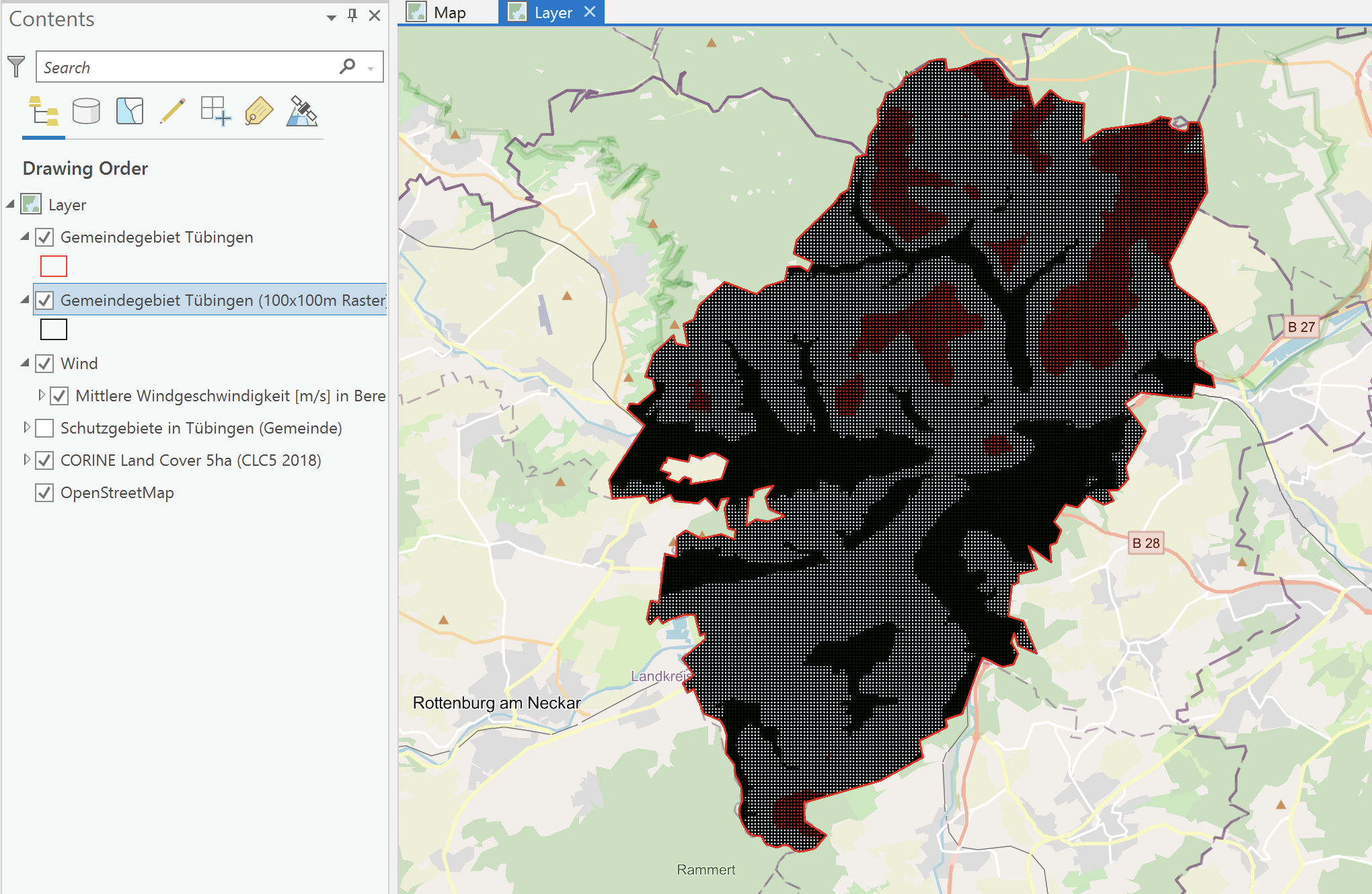
However, when I applied the Grid Index Feature tool to create a grid for the area under investigation, and tried to place it over the georeferenced map in the Contents field, the map changes its colors. Now, unfortunately, I need the original colors as they indicate specific values. (In fact, it changes its colors as soon as I work with any other layer.)
To get the original colors, I always need to place it as the first layer - then ArcGIS changes back to the yellow / orange / green tones.
Please see the screenshots attached, in case I did not express myself clearly enough.
Does anyone know why the georeferenced picture changes its colors / a solution regarding this problem?
Thank you for your help!
- Mark as New
- Bookmark
- Subscribe
- Mute
- Subscribe to RSS Feed
- Permalink
It appears your grid is too fine for the extent of your map and you are getting color mixing along the edges of the lines.
If you zoom in to a smaller area is the effect still there?
... sort of retired...
- Mark as New
- Bookmark
- Subscribe
- Mute
- Subscribe to RSS Feed
- Permalink
Yes, unfortunately the effect is stil there even if I zoom to a smaller area.
I do not think this is a real solution to the problem but: I grouped the Grid-layer together with the wind speed layer under 'Wind' and when I deactivate / activate each layer a few times, they correct colors are shown. To me (as a beginner) it does not really make sense, but anyways, it worked like that. 🙂
Still, if anyone has a solution to the problem please provide the steps! Would be appreciated! Thank you!