- Home
- :
- All Communities
- :
- Products
- :
- ArcGIS Pro
- :
- ArcGIS Pro Questions
- :
- Re: Pixelated hillshade
- Subscribe to RSS Feed
- Mark Topic as New
- Mark Topic as Read
- Float this Topic for Current User
- Bookmark
- Subscribe
- Mute
- Printer Friendly Page
Pixelated hillshade
- Mark as New
- Bookmark
- Subscribe
- Mute
- Subscribe to RSS Feed
- Permalink
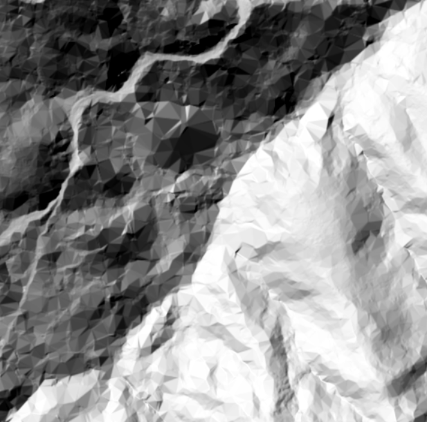
Downloaded USGS DEM and produced a Hillshade using the spatial analysis tool. For some reason, certain areas are turning out very pixelated and other areas are fine. Multidirectional hillshade produced the same result.
- Mark as New
- Bookmark
- Subscribe
- Mute
- Subscribe to RSS Feed
- Permalink
Hi,
A possible solution to this issue could be to adjust the settings of the hillshade tool, such as the azimuth and altitude angles, or changing the Z-factor to adjust the vertical exaggeration. It may also be helpful to check if the input USGS DEM file has any missing or incorrect data that could be causing the pixelation in certain areas. Additionally, using other data sources or sources with higher resolution may also produce better results.
- Mark as New
- Bookmark
- Subscribe
- Mute
- Subscribe to RSS Feed
- Permalink
Another thing I would examine is the coordinate system. Is your DEM in a geographic or projected coordinate system? Best practice is to reproject your raster from geographic to projected before running the GP tool on it.