- Home
- :
- All Communities
- :
- Products
- :
- ArcGIS Pro
- :
- ArcGIS Pro Questions
- :
- Nearest points
- Subscribe to RSS Feed
- Mark Topic as New
- Mark Topic as Read
- Float this Topic for Current User
- Bookmark
- Subscribe
- Mute
- Printer Friendly Page
Nearest points
- Mark as New
- Bookmark
- Subscribe
- Mute
- Subscribe to RSS Feed
- Permalink
Hi all,
I have a basic license for ArcGIS Pro. I want to do the following:
: find the closest point from selected features in one layer to points in another layer.
: create a line between each of the sets of points
: calculate the distance and bearing of each line
I don't have access to the Near tool. Do I have to buy the Advanced version to get access to the Near tool or can you buy individual tools?
Thanks for any help you can provide.
Ron
- Mark as New
- Bookmark
- Subscribe
- Mute
- Subscribe to RSS Feed
- Permalink
I have a Near as Table variant in
Point Tools for Pro it doesn't use Near, it uses NumPy. Give it a whirl.
I also have code to do the rest, I just have to look around for it.
If you have a sample dataset (anonymized of course) with just the geometry and oid field and whatever else needed, I can see what I have that you don't have with the basic license.
- Mark as New
- Bookmark
- Subscribe
- Mute
- Subscribe to RSS Feed
- Permalink
Thanks Ron... something to do this evening 
- Mark as New
- Bookmark
- Subscribe
- Mute
- Subscribe to RSS Feed
- Permalink
Ron, there is something wrong with the shapefile (the merged on)
Could you make a file geodatabase and copy your source files into it and zip and ship the gdb?
It may be corrupt on transfer since I can't do the copy on my end... It shows up fine, but keeps failing to copy
Nevermind, converted them to points array, then back into geodatabase featureclasses.
Onward.
- Mark as New
- Bookmark
- Subscribe
- Mute
- Subscribe to RSS Feed
- Permalink
Look right?

- Mark as New
- Bookmark
- Subscribe
- Mute
- Subscribe to RSS Feed
- Permalink
Yes, that looks right. Sorry for the delay... just got the kids to bed.
- Mark as New
- Bookmark
- Subscribe
- Mute
- Subscribe to RSS Feed
- Permalink
A quick demo for the top left grouping
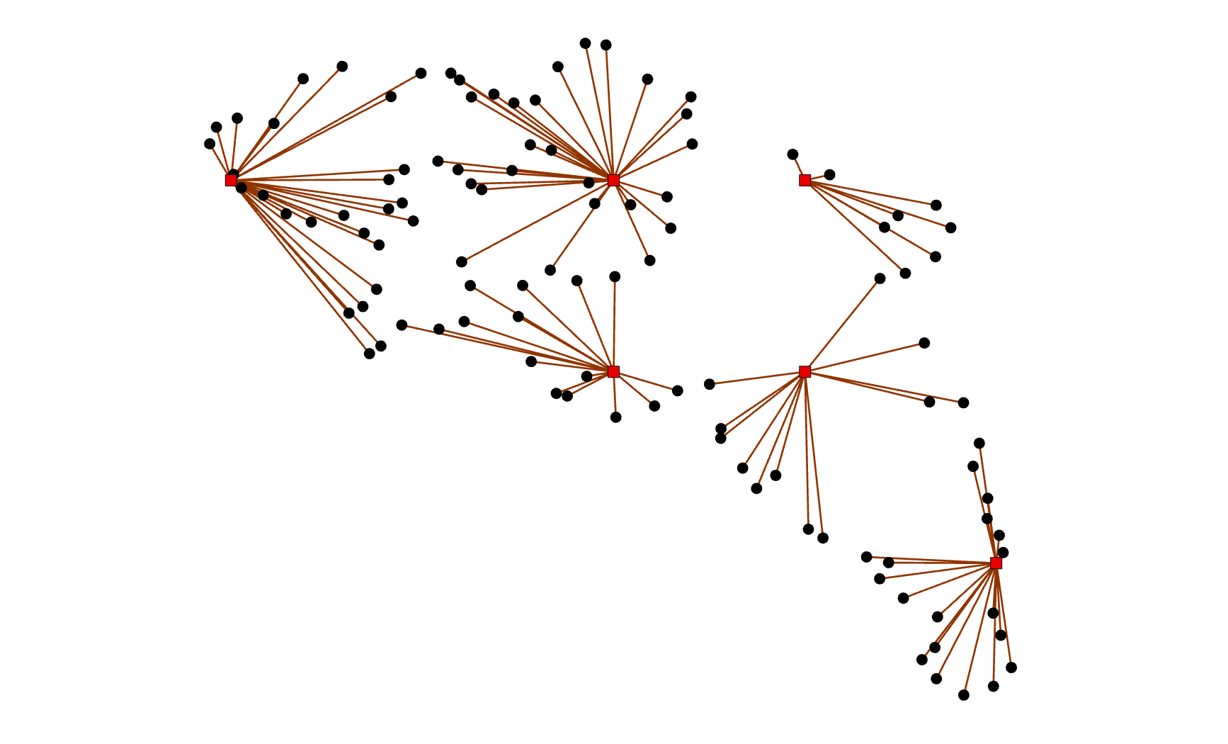
of course with the stuff in the table but you can get an idea
- Mark as New
- Bookmark
- Subscribe
- Mute
- Subscribe to RSS Feed
- Permalink
Dont' know if you are still interested, but before I roll out the final copy, everything check out.
- Mark as New
- Bookmark
- Subscribe
- Mute
- Subscribe to RSS Feed
- Permalink
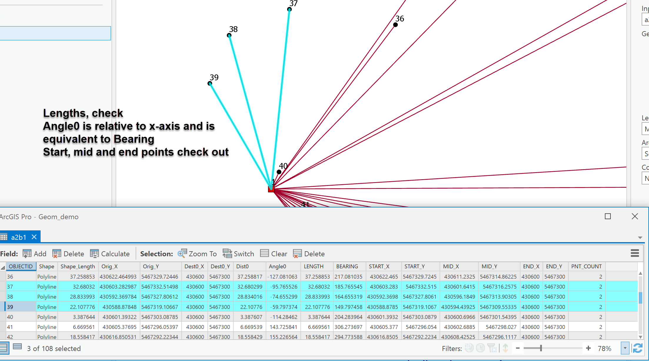
Point Tools for Pro updated 2018-05-09

Closest between layers
- returns the origin, destination coordinates, the distance and angle to the closest and connects them with a polyline.
Closest within layer
- You get to choose how many up to 5 connections and polylines are produced
Closest within table
- A table variant with all the bumph of where and what and how far. You can use this as an event layer to generate all your own points and/or connections.