- Home
- :
- All Communities
- :
- Products
- :
- ArcGIS Pro
- :
- ArcGIS Pro Questions
- :
- Re: Make a multipart polygon of touching polygons,...
- Subscribe to RSS Feed
- Mark Topic as New
- Mark Topic as Read
- Float this Topic for Current User
- Bookmark
- Printer Friendly Page
Make a multipart polygon of touching polygons, not merge


- Mark as New
- Bookmark
- Subscribe to RSS Feed
- Permalink
This may not be possible. But, how do you take adjoining polygons, merge them together, but still keep the diving lines (in case you want to dissolve or explode it later)?
This is what I have:
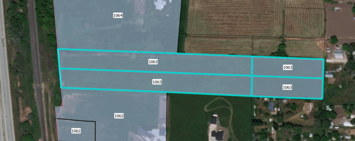
Those selected ones are four separate polygons. I want to make them into a multipart feature without losing the middle lines. Is this possible?
ArcGIS Pro 2.4.1 (or any version, doesn't matter)
Solved! Go to Solution.
Accepted Solutions


- Mark as New
- Bookmark
- Subscribe to RSS Feed
- Permalink
Adrian, dissolve with shared boundaries will remove the boundary.
- You could use a very small negative buffer for the shapes, then dissolve creating a multipart polygon.
- You could also just create a polyline representation of the shapes (sans attributes) to use to split the dissolved polygons should you need to have them as singlepart again.
- Finally, storage is cheap.... just create singlepart and multipart versions of the files
- Mark as New
- Bookmark
- Subscribe to RSS Feed
- Permalink
Adrian, dissolve with shared boundaries will remove the boundary.
- You could use a very small negative buffer for the shapes, then dissolve creating a multipart polygon.
- You could also just create a polyline representation of the shapes (sans attributes) to use to split the dissolved polygons should you need to have them as singlepart again.
- Finally, storage is cheap.... just create singlepart and multipart versions of the files
- Mark as New
- Bookmark
- Subscribe to RSS Feed
- Permalink
Dan, thanks for the reply. What you're saying is that no, there is not a native way to do this, but here are some alternative workarounds. I appreciate the assistance but I wished these solutions worked for what we're looking for!
- Mark as New
- Bookmark
- Subscribe to RSS Feed
- Permalink
 and I await the day that a null point doesn't return (0, 0)

- Mark as New
- Bookmark
- Subscribe to RSS Feed
- Permalink
The workarounds suggested don't work for us either. We need the inner splits otherwise the data does not display correctly in 3D (see example below - instead of a linear slope following the red line, we get a stairstep). I think the Esri solution for this might be multipatch features, but that leads to other problems that are also difficult to impossible for us to overcome. I agree with Adrian, I wished the workarounds worked for us, but they do not. We would have to store 900,000 singlepart features vs. having 124 multipart features that all share the same attributes. The data is so complex that it takes too long to draw, the public would be clicking and scrolling, clicking and scrolling, clicking and scrolling, back button, start over, click, click, click. Even on my fast, "exceeds computing requirements" computer.

