- Home
- :
- All Communities
- :
- Products
- :
- ArcGIS Pro
- :
- ArcGIS Pro Questions
- :
- Re: How to open a ERDAS 7.5 GIS Raster
- Subscribe to RSS Feed
- Mark Topic as New
- Mark Topic as Read
- Float this Topic for Current User
- Bookmark
- Subscribe
- Mute
- Printer Friendly Page
How to open a ERDAS 7.5 GIS Raster
- Mark as New
- Bookmark
- Subscribe
- Mute
- Subscribe to RSS Feed
- Permalink
I have 8 Raster files with the .GIS extension. In my research, I found that it is a ERDAS 7.5 GIS type. How do I open this file in ArcMap or ArcGIS Pro?
- Mark as New
- Bookmark
- Subscribe
- Mute
- Subscribe to RSS Feed
- Permalink
Raster file formats—ArcGIS Pro | ArcGIS Desktop
erdas *.gis is a supported raster type using the Spatial Analyst Extension... do you have it?
- Mark as New
- Bookmark
- Subscribe
- Mute
- Subscribe to RSS Feed
- Permalink
Yes. In Spatial Analyst what tool should I use? Can this file open in ArcGIS Pro? I tried using the Raster to other Format but that causes an error. Thanks!
- Mark as New
- Bookmark
- Subscribe
- Mute
- Subscribe to RSS Feed
- Permalink
have you tried just using the Add data tool from the ribbon when a Map is active?
If it doesn't read it natively, then you will have to provide the error message, I don't have any *.gis files to test
- Mark as New
- Bookmark
- Subscribe
- Mute
- Subscribe to RSS Feed
- Permalink
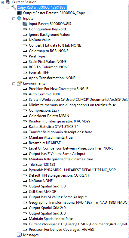
I just gave the Raster export another try and the tool ran without error but the file did not save in the folder indicated. I tired converting to a TIFF and also tried IMAGE but neither output save in the workspace.