- Home
- :
- All Communities
- :
- Products
- :
- ArcGIS Pro
- :
- ArcGIS Pro Questions
- :
- How to display 3D point depth data in ArcGIS Pro?
- Subscribe to RSS Feed
- Mark Topic as New
- Mark Topic as Read
- Float this Topic for Current User
- Bookmark
- Subscribe
- Mute
- Printer Friendly Page
How to display 3D point depth data in ArcGIS Pro?
- Mark as New
- Bookmark
- Subscribe
- Mute
- Subscribe to RSS Feed
- Permalink
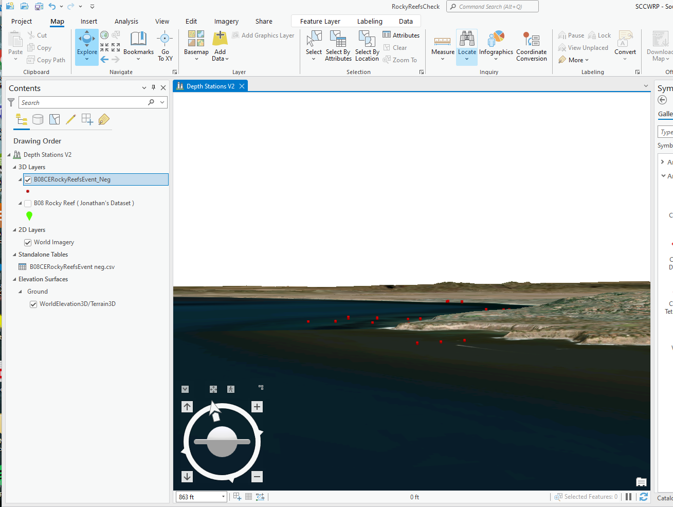
Hello all, I am working with ocean collection data (latitude, longitude, depth) and I want to show the depth of each recorded sample but I can´t display it in ArcGIS Pro correctly. I created a new local scene, went to the feature layer's properties to the Elevation tab and set the "Features are: Relative to the Ground." But yet, the points still appear above sea level. I cannot seem to locate the "Navigate Underground" button anywhere. Attached is an image of how my data looks in the local Scene of ArcPro. Any help is greatly appreciated!
Solved! Go to Solution.
Accepted Solutions
- Mark as New
- Bookmark
- Subscribe
- Mute
- Subscribe to RSS Feed
- Permalink
Hi Mina. I notice your dataset has a _neg suffix - are the values in the table negative? If so, you could set the layer to draw features 'at an absolute height' and then specify the depth field. (or if positive, could set an expression to subtract the positive value from zero - so no need to change the table) The second step is to allow below-ground-navigation, which is a bit hidden. Select the 'ground' layer, which should reveal an Elevation Surface Appearance context menu at the top - navigate underground is a check box there.
- Mark as New
- Bookmark
- Subscribe
- Mute
- Subscribe to RSS Feed
- Permalink
Hi John,
Yes, correct - I had made the depth units negative as they were originally positive. Your advice did the trick. Thanks a ton!
- Mark as New
- Bookmark
- Subscribe
- Mute
- Subscribe to RSS Feed
- Permalink
My student seems to have done all of these things and while we are able to model the depth below ground, when you look at the model in transect, the depths are all off by the approximately our elevation. For instance, the first pond is about 2.9 meters deep, but it shows as 950 meters deep and our elevation is about 947 meters. I am sure this is something so obvious, but I am not thinking of it.
Also I am sorry I do not have a screen shot. I do not have that part of the project handy, but can get it, if you need it.
- Mark as New
- Bookmark
- Subscribe
- Mute
- Subscribe to RSS Feed
- Permalink
Hi Dawn. Whereas Mina was extruding downward to an absolute depth below 'zero' or sea level, it sounds like you might want to extrude downward from a much higher ground level given by an elevation surface. If your pond depth is in a field for example, change the extrusion type to "Base Height", and set the Field to your pond depth field. If the values in there are positive (eg "2.9"), you will just need to subtract from zero to go down instead of up:

- Mark as New
- Bookmark
- Subscribe
- Mute
- Subscribe to RSS Feed
- Permalink